A journal of our trip to New Zealand in 2008
(Last update: 05 March 2008)


Prologue
nzmap.jpg
North and South Island of New Zealand.

2008_0101_nz.jpg
Avon River in Christchurch.

It's been an interesting challenge to prepare for this trip. The mountaineering hut system of New Zealand is not like that which we experienced in the European Alps. NZ huts have water, cooking stoves, and gas but we must bring our own cook kits and sleeping bags. We will also prepare our own meals. In comparison, the Alpine huts we visited in the European Alps all had bunks with blankets and the hut staff prepared all the meals. This means, of course, we will need to carry much more gear than we did on previous trips. And that's the problem -- the pack will only hold so much gear. Thus, the challenge trying to decide what to take and what to leave behind.

In preparation for this trip we made many advance plans and reservations but also have many unstructured days so that we may do whatever pleases us. We will be attempting to climb Mt. Aspiring during our first week. After a few days of general sightseeing, we will walk on the Milford Track during our second week. We also plan on doing some kayaking but have not made any firm plans on when and where.

Small as it may seem to some of us, New Zealand is much too large to visit in just a few weeks. Wisely, we've restricted ourselves to visiting just the South Island and then only parts of it.


29 December 2007
2008_0102_nz.jpg
Bridge of Remembrance: A memorial acknowledging Canterbury's contribution to World War I.

2008_0105_nz.jpg
Anglican Church, City Centre, Christchurch.

Finally, after months of planning and preparation, it's time to go. It's been a busy and stressful period getting ready for this trip. Now it's time to enjoy ourselves.

Kendric drops us off at the airport shuttle in downtown Flagstaff. The shuttle is a three hour drive that will take us to the airport in Phoenix. Once in Phoenix, we wait a few more hours for our flight to San Francisco. We arrive in San Francisco and we wait a few more hours for our flight to Auckland, NZ. It's already been a long day and we haven't even left the country!

The overseas flight is on an Air New Zealand B-777 and this is a very nice airliner! Comfortable seats, large movie selection, pretty good food, and a pleasant crew. But nothing can make a 13-hour flight fun. We did manage to get a few hours of sleep.

And, of course, there is another wait before we fly the final leg from Auckland to Christchurch.


31 December 2007
2008_0114_nz.jpg
Christchurch Art Centre, formerly Canterbury College.

2008_0121_nz.jpg
Fountain in the Botanical Gardens, Christchurch. In the background in Christchurch Art Centre.

There is no 30th as this day is lost when we cross the International Date Line.

Finally, we have arrived! Through Passport Control and on to Inspection. We must have our tent and boots and other camping gear inspected for dirt and debris. NZ is very careful to keep out unwanted seeds, plants, and insects. There are none of these unwanted pests in our gear because we carefully cleaned them prior to this trip.

There were four carry-on baggage inspections (PHX, SFO, AUK, and CHC) and I tried to have my film hand inspected each time. Everyone was very accomodating except in AUK where they refused to do so.

Once at our hotel (Thomas's Hotel) in downtown Christchurch, we take a short nap then get up to walk around the City Centre and eat lunch. We discovered that restaurants are...um...pricey. We walk around Cathedral Square, then the Art Centre, and finally the Botanical Gardens. The walk in the gardens is pleasant and greatly appreciated after our many long hours spent in airports and aircraft.

The next problem of the day is dinner. There is no grocery store nearby—it's a fair walk from the hotel — and many restaurants are closed or having fancy parties this evening. It's New Years Eve, after all. We'll figure out something.

Oh, yes. Tom and Renee aren't here because their United Air Lines flight from SFO-SYD-CHC was cancelled. They will arrive tomorrow.


01 January 2008
2008_0128_nz.jpg
Christchurch Art Gallery (exterior).

2008_0130_nz.jpg
Christchurch Art Gallery (interior).

Happy New Year! There was quite a party at the pub across the street with three bands and many people. And the city had a large celebration with fireworks in the City Centre. But we missed it all because we were exhausted and had retired early. Nonetheless, the boom of the fireworks awakened me and I was able to watch them from our room.

Morning rolled around and we got up to have a breakfast of bagels and cream cheese. Our next task was to find a coffee shop. But just about everything was closed—it's New Years Day morning, after all!

Finally we found a Starbucks. Inside, a group of holiday revelers struck up a conversation with us. Something about our accent made us obvious travelers. All of them worked in the restaurant industry and they invited us to visit the restaurants where they worked while we are in Christchurch. With coffee and baked goods in hand, we returned to wait for Tom and Renee. They arrived shortly after we returned to the hotel but without baggage! Oh, no!

After settling into their room, the four of us walked to the Botanical Gardens and to the Canterbury Museum. Because we had not completely explored these yesterday, Susan and I were able to view previously unseen exhibits and gardens.

Our next stop was to find and visit a grocery store where we began the task of purchasing food items for our mountaineering trip.

Later that afternoon, Susan and I visited the Christchurch Art Gallery —a short two blocks away from our hotel. The building architecture is at least as interesting as the exhibits.

It's the end of our second day in Christchurch and we have seen much of the City Centre and visited gardens, galleries, and museums. Our choice of a downtown hotel has proven to be a good one.


02 January 2008
2008_0136_nz.jpg
Diamond Lake track near Wanaka.

2008_0137_nz.jpg
Lake Wanaka.

Tom and Renee's bags finally arrived—but not at the same time. No matter. We picked up the rental car that Tom had reserved but it was higher priced than what he had previously negotiated. "Sorry—don't have any of the others available now." And we continued our food shopping for our mountaineering challenge.

The drive from Christchurch to Wanaka took us about five hours and traversed some very pretty country. Lots of sheep, of course. The road was rarely straight and was often narrow and it made for a challenging drive. Tom did all the driving and did a good job of driving on the left hand side of the road.

Our accomodations at the Purple Cow Backpackers hostel in Wanaka are quite nice. Ensuite setup, four beds, kitchen, and interesting neighbors. We talked with Greg and Jack, two Aussie climbers that had just finished Mt. Aspiring. We gleaned many useful bits of information that will help us over the next few days. And Jack sold me his copy of the Mount Aspiring region climbing guide at a nicely reduced price!


03 January 2008
2008_0000_nz.jpg
Sunrise over the Southern Alps.

2008_0201_nz.jpg
This is the way to Mt. Aspiring National Park.

2008_0205_nz.jpg
Matukituki River Valley. Mt. Aspiring (not visible) is at the far end of the valley and to the right.

The weather proved to be a problem today. A cold front moving across NZ brought light showers and strong winds. The Aspiring Helicopter pilots declined to fly under these conditions.

We did an afternoon hike along the Diamond Lake track. This was a nice trail and steep in some sections—and windy at the top of the hill. But the view across the hills and Lake Wanaka was worth it. Afterwards, Tom decided to do some 4-wheeling with our sedan and we explored some dirt roads in the area.

We returned to Wanaka to find lodging and to eat. We were successful with the latter; less so with the former. We finally ended up at a Holiday Park campground. The campground charges by the person rather than by the tent site so it gets a bit expensive at NZ$15/person. And it's close quarters and noisy in the tent area. There is a boisterous group across from us that is partying and drinking and loud. But they all pass out early and everything works out just fine.


04 January 2008
2008_0206_nz.jpg
Loading our gear on the heli. Pilot Alex with Tom and Susan.

2008_0211_nz.jpg
Mt. Aspiring West Face, NW Ridge and SW Ridge, with Bonar Glacier in the foreground.

2008_0212_nz.jpg
Colin Todd Hut and NW ridge of Mt. Aspiring.

I awakened during the night to a sky full of stars. I was initially unable to recognize any constellations, in part, because I could only view a small portion of the sky. But the main reason is that these are southern hemisphere constellations. It's exciting to see new stars and constellations in the sky that are unfamiliar.

We left the campground early for the heli office but they weren't going to fly until noon. So we drove on down the road into Mt. Aspiring National Park to the Raspberry Flat car park and waited. The heli finally arrived but we were second in line for the shuttle up to Bevan Col and the Bonar Glacier. Then, finally, we were in the air and quickly overflying the route that we will walk out in a few days. Shortly, we were at Bevan Col, the drop-off point.

Packs shouldered, we started down the snow field and onto the glacier. The sun was hot and the snow had softened making for slow travel. About an hour later we arrived to an overbooked Colin Todd Hut. There are no bunks available and we didn't bring sleeping pads or bivvy sacks for sleeping outside. And we had incorrect information about the alpine huts having cook stoves. There are none and we didn't bring one. This is not a good situation.

Then things improve. A group returning from the summit decides to heli out today. They give us their four bunk spots. (Well, 3 1/2, actually) and they loaned us a stove. Another climber has donated us a bottle of fuel (so he doesn't have to carry it out!). Thanks! We're okay again. But we made some serious mistakes on what is and isn't available in the huts.

To avoid the crowd we eat an early dinner and finish before 6 p.m. Climbers continue to arrive from the summit and it's busy inside the hut. Because the hut is overbooked, there are a large number of groups trying to cook dinner and, eventually, the heat from all those stoves results in an overheated hut. Time to open some windows!


05 January 2008
2008_0218_nz.jpg
Sunrise near the top of the Bonar Glacier on the NW Ridge.

2008_0221_nz.jpg
Traversing the Gendarmes on the NW Ridge.

2008_0224_nz.jpg
Finishing the summit snow dome.

2008_0226_nz.jpg
Susan and David on the summit.

2008_0229_nz.jpg
Setting up our anchor and belay for the descent.

2008_0232_nz.jpg
Tom on the NW Ridge. Another group takes a break below us.

Summit day on Mt. Aspiring! We're up at 3:30 a.m. and climbing shortly after 4:30 a.m. The initial climb was up the Bonar Glacier with firm snow conditions. We transitioned to rock, back to snow, more rock, etc., all day long. This required that we put on crampons, take off crampons, put on crampons, again and again.

We were the last group to start the climb today. This actually worked to our advantage since we were not completely familiar with the route. We simply followed the crampon tracks on the snow or watched which route they took while traversing through the rocks.

The summit was reached at 11 a.m. A few pictures were taken on the summit and then we're on our way down. The final push to the summit was on very firm and steep snow requiring some front-pointing on the ascent and some belay and ropework on the descent. As we reached the lower sections and moved onto the Bonar Glacier, our pace slowed because the warm sun had softened the surface and we were trudging through deep and slushy snow. The sun also was intense enough that we all were sunburned despite the constant application of sunscreen. We arrived at the hut at 5 p.m. It has been a very challenging but ultimately rewarding 12-hour day for us.

Near the hut are a few tarns. Some of them are shallow and have only slow flow of water through them. This has allowed the water to be warm enough to splash around in. We take advantage of these wading pools to rinse the sweat and salt from our bodies. Refreshed, we relax on the warm rocks as the sun settles in the west.

Tomorrow we depart via Bonar Glacier and Bevan Col back to the car park. The upper portion of the col is technical and is rated Grade 10 (5.2 Yosemite Decimal System). It will require some rappels (abseils), followed by a very long walk through the Matukituki valley .


06 January 2008
2008_0235_nz.jpg
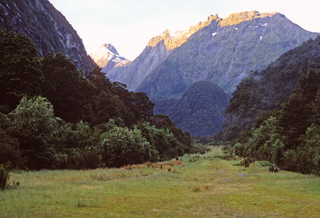
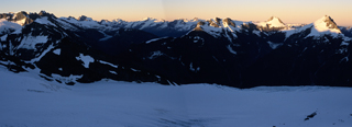
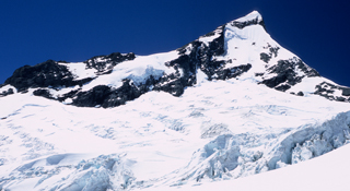
Mt. Aspiring and the NW Ridge at sunset.
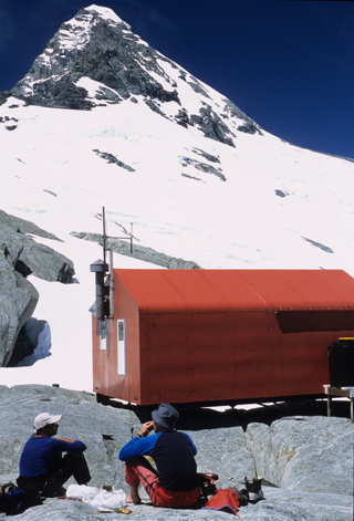
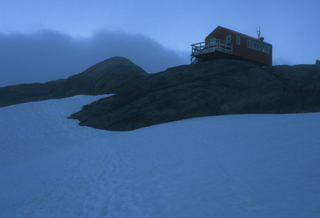
2008_0302_nz.jpgColin Todd hut and early morning fog.

2008_0304_nz.jpg
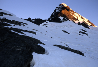
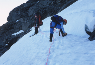
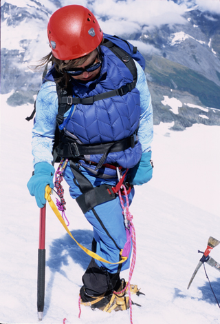
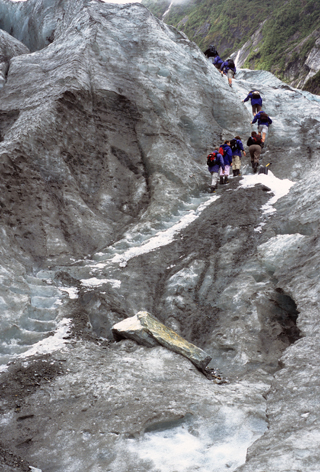
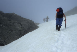
Climbing towards Bevan Col in the early morning fog.

2008_0308_nz.jpg
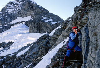
Descent from Bevan Col. Fog has given way to bright sunshine.

2008_0311_nz.jpg
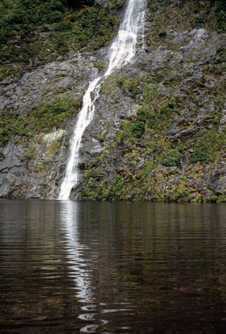
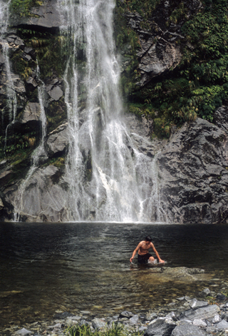
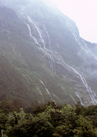
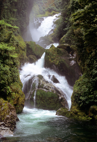
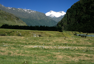
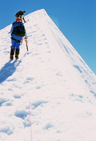
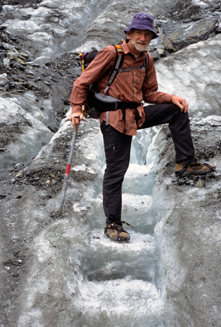
Below the waterfull crux and above the head of Matukituki River Valley. The climbing is over but there remains a very long downhill walk from here.

2008_0314_nz.jpg
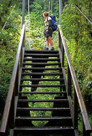
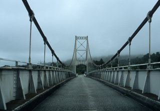
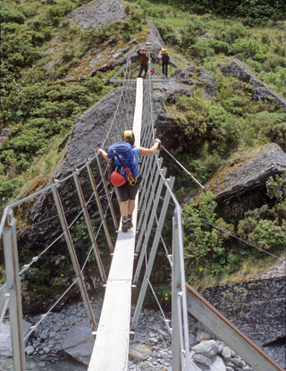
The first of many "swing bridges." This one has a capacity of one person at a time.

It was an epic day! We left the hut at 6:30 a.m. and travelled across the Bonar Glacier. The snow was firm and the footing was good. At Bevan Col, we put on crampons for the descent on the snowfields. It was cool, windy, and foggy. And the foggy conditions resulted in some very interesting photographs of the group moving across the snow. Eventually we ran out of snow and travelled on rock carefully finding our way down the cairned track.

Then we hit the crux at the waterfall and gorge. We scouted the area extensively and eliminated all possible routes but one. That must be the way. Roping up, we single belayed Tom across the roaring stream, then double belayed Susan and Rene, followed by a single belay for David. Carefully traversing and downclimbing the rock slabs, we found the rappel anchors. With only a short rope, we had to do a single-rope rappel/abseil. Two pitches later and we were out of the gorge—which we nicknamed "Bevanschlucht." And that was the easy part!

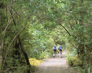
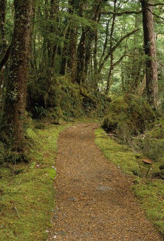
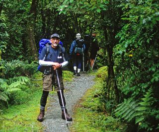
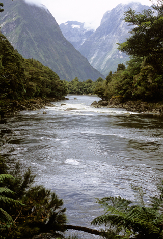
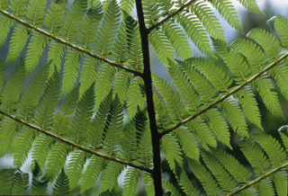
The rest of the day we travelled on faint to good to excellent tracks, crossed numerous swing bridges, traversed ancient beech forests, ducked under an ice cave, crossed uncountable small streams, and walked endlessly. Finally we arrived at the car park. More than fifteen hours after leaving Colin Todd hut we were done. It was 10 p.m. and twilight was rapidly fading.

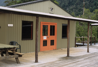
Although we could have stayed at the Aspiring Hut (a Department of Conservation, DOC, hut)—about a two hour walk upvalley from the car park—we had chosen to keep moving. Because we were so tired and sore, we had decided to drive out of the park and to stay in Wanaka so we could attend to our overworked bodies. Additionally, the weather was changing and rain would start overnight. At least part of the road from the car park to the main road forded streams and we were concerned that rain would result in these fords being too deep to cross with our sedan.

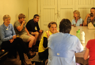
On the previous day, two climbers (Mark and Karl) had hiked up the Bevan Col route in one day to the Colin Todd hut. Their plan was to climb Mt. Aspiring the next day and then walk out the same day. We know that they were successful because they PASSED US on the way out! These two fellows were incredibly strong and fast. Most impressive.

(I found some videos on YouTube that document another groups' adventures on Mt. Aspiring. Their Day 1 , Day2, and Day3 are very similar to ours.)


07 January 2008
2008_0323_nz.jpg
The DOC Visitors Centre in Haast. And, yes, it's raining. Again.

2008_0327_nz.jpg
Ferns in the Hapuku Estuary south of Haast.

2008_0330_nz.jpg
Jackson Bay -- southernmost community on the west coast.

We have a couple of free days before we need to be at our next destination so we decided to drive to the west coast and explore that region. I got my first chance to drive on the left side of the road. It required attentiveness but otherwise it wasn't too bad.

Driving across Haast Pass and the Divide was fun because it was raining and all the creeks and rivers were running full. Our first stop was the Blue Pools. Unfortunately, high water from the heavy rain had silted the pools. The walk to the pools, however, was very interesting because of the flora.

We arrived in Haast on the west coast and stopped at the DOC Visitor Centre. Given the ongoing heavy rain, we agreed that camping was not a good choice so we needed to find lodging.

After getting a room at the Wilderness Backpackers hostel, we drove down to Jackson Bay, the southernmost community on New Zealand's west coast. Along the way were communities with many of the houses for sale. It's apparent that these communities are no longer economically viable. Our visit to the beach at Jackson Bay was brief because of the sand flies. Very annoying little pests. Their bite hurts and then they itch for days.

Tom prepared a small feast for dinner. By the time we finished eating and began our cleanup it was past 10 p.m. The owner was unhappy because he had asked us to be finished by 10 p.m. so that our cleanup noise would not disturb guests in rooms adjacent to the kitchen. He had good reason to be annoyed with us.


08 January 2008
2008_0234_nz.jpg
A kea, or mountain parrot.

2008_0332_nz.jpg
West coast beach and fog.

2008_0334_nz.jpg
Fox Glacier.

Susan and I ate breakfast at the nearby cafe while Tom and Renee made breakfast in the hostel kitchen. Susan tried a meat pie and I had my typical coffee and pancakes. But these were much better than typical pancakes.

It was still misty when we left to drive up the coast. The cloud-draped hills were very picturesque. Suddenly, we broke out of the fog and it was sunny and everything was intensely bright green. What an incredibly lush landscape! A stop along the beach rewarded us with many polished pieces of quartz. After selecting a few to keep we moved on to Fox Glacier. The plan was to play on the ice with crampons, ice axes, and rope but the terminus of the glacier was too unstable with constant rock falls and we abandoned that goal.

Our final stop of the day was Franz Josef where we visitied the DOC Visitor Centre and then grabbed a tent site at the local Holiday Park. The campground had a pleasant grassy area for tents. There were also hot showers and a very nice kitchen area. As before, the campground charged by the person—this time it was $17/person.

After dinner we went into town for ice cream and to window shop. But we did more than window shop because we found things worth buying. We also watched numerous groups taking evening helicopter rides up to the Franz Josef glacier. I'm beginning to think that the helicopter is the national bird of New Zealand.

Of the many climbers we met at Colin Todd Hut, two stand out: Karl and Mark. As previously described, these two hiked in through Bevan Col in one day then climbed Mt. Aspiring and hiked back out on the second day. And they passed us doing so. So it was nice to run into Mark again in Franz Josef and chat for a few minutes.


09 January 2008
2008_0405_nz.jpg
Guided tour group ascending the Franz Josef Glacier.

2008_0406_nz.jpg
Tom on the Franz Josef Glacier.

Although it was clear with stars last night, we awoke to fog and mist this morning. Because the days are long and the threat of afternoon thunderstorms is nearly nil, it's all too easy to get a late start each day. Add the fog and mist and we finally got away around 10 a.m.

Tom and I tramped up onto the Franz Josef glacier and did some ice play with ropes, ice screws, belays, and double-axe climbing. Along the way, we ran into Karl and got a chance to chat with him. Both Mark and Karl are guides for Franz Josef Glacier Tours and lead groups up onto the ice.

Later, Tom headed up the glacier to his overnight at the DOC hut and I headed down. Then up, over, down, around, up, down as I tried to find the track back down. I finally found the faint track and descended uneventfully back to the car to meet Susan and Renee. Then it's off to a bakery for coffee and a treat.

Renee, Susan, and I decided to eat out at Priya Indian Restaurant. Very good and, of course, not inexpensive.

Late that night we were surprised to hear Tom. He had made it to the hut but because DOC employees were doing maintenance work, he was unable to stay there. It would have been useful if that information had been conveyed to us at the Visitor Centre.


10 January 2008
2008_0412_nz.jpg
West coast beach north of Haast.

2008_0333_nz.jpg
One of the ubiquitious one-lane bridges. Signs on either end indicate which direction shall "Give Way."

Although dawn broke clear, there was a heavy dew and it took awhile before we were able to dry out the tents and break camp. We stopped briefly in town and looked at the ice climbing wall. We've all seen rock climbing walls before but this was new to us.

The drive back to Wanaka was uneventful and we arrived late afternoon. After securing a room at the Purple Cow Backpacker, we made our way to nearby Lake Wanaka for an afternoon swim. The water was cool but pleasant.

While at the Purple Cow, we ran into Rachel and Justin. We had met them earlier on Mt. Aspiring and we shared the summit with them and their climbing guide. On the way down Rachel had injured her knee slogging through the wet and heavy snow requiring a helicopter ride out instead of the two day hike via the French Ridge hut. It turns out her injury was minor and with some rest should heal well. It was fun to chat with them and talk about our experiences on the climb.


11 January 2008
2008_0730_nz.jpg
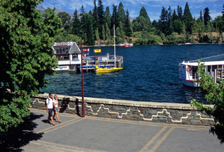
View of the waterfront in Queenstown from our hotel room.

2008_0736_nz.jpg
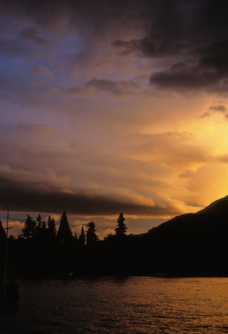
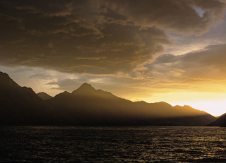
Sunset over Lake Wakatipu in Queenstown.

2008_0726_nz.jpg
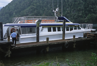
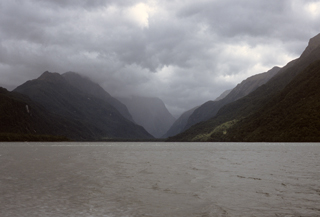
This is the bus that will transport us to Te Anau and the Milford Track.

A few quick errands and we are on our way to Queenstown. We took the scenic route which is very steep with hairpin turns. There's no time for sightseeing while carefully driving this road! At the bottom of the hill we take a recommended side trip into the small town of Arrowtown. The main street has many interesting shops but we are most fascinated by the photography studio of Craig Potton. His photographs of New Zealand are stunning and we buy some photo cards of Mt. Aspiring.

We're staying at Thomas's Hotel on the waterfront in Queenstown. It's old but clean and it's also centrally located in the heart of Queenstown. Susan and I attend our Milford Track pre-trip meeting with Ultimate Hikes, then do some last minute shopping for the walk. After dinner, we walk along the lakefront before watching the sun slide lower in the sky.


12 January 2008
2008_0422_nz.jpg
Our transportation from Te Anau Downs to the beginning of the Milford Track.

2008_0421_nz.jpg
Lake Te Anau under leaden skies. Will we see the sun over the next four days?

2008_0423_nz.jpg
Mile 1 of the Milford Track. Only 32 more to go.

2008_0424_nz.jpg
Glade House—our first nights lodging.

Oh, my! Queenstown parties on Friday nights! And probably on other nights, too. The noise from drinkers and revelers went all night long and finally ended at 6 a.m. Is that when the bars close?

We will be doing a 5-day 4-night guided walk of the Milford Track with Ultimate Hikes along with many other walkers. We are Tour Group 73.

Susan and I board the coach with our group and depart at 9:30 a.m. There is a lunch stop in Te Anau where we cross paths with the outgoing group. They all have smiles and we conclude that they have thoroughly enjoyed their walk on the Milford Track. Next is a one hour boat trip up Lake Te Anau to the boat ramp at the north end of the lake then, finally, we're on the trail for a short walk to our first lodge: Glade House.

The weather is deteriorating with clouds giving way to drizzle, then to rain. I wonder if we will see much sun or scenery over the next few days?

The lodge is quite large and easily accomodates the fifty trampers plus four guides as well as the lodge staff. There is afternoon tea and cookies, the bar opens at 5 p.m. (but the drinks are expensive), and dinner is served at 6 p.m. It is an excellent meal for everyone—except the vegetarian main dish is a bit bland. The lodge has hot showers, flush toilets, and we can easily hand wash our clothes and dry them overnight. Very nice accomodations, indeed!


13 January 2008
2008_0429_nz.jpg
Clinton Hut -- the first nights lodging for the "independent" walkers.

2008_0430_nz.jpg
Lush greenery of the beech forest along a well-maintained trail.

2008_0434_nz.jpg
One of the many waterfalls along the Track.

2008_0435_nz.jpg
The swimming hole. A few went swimming; many more did not.

2008_0437_nz.jpg
Pompolona Lodge - second nights lodging for guided walkers.

We awaken to clouds and drizzle. After a hearty breakfast we start up the track at around 8:30 a.m. The track follows the Clinton River, then the West Clinton River, through lush rain forest. Everything is green and vibrant. The track is well maintained and wide. Drizzle gives way to light rain and, later, to heavy showers. There are waterfalls everywhere and the volume of water increases as more rain falls. It's an amazing sight and photographs cannot do it justice.

There are two sets of walkers that start on the Milford Track each day with up to 40 independent walkers and up to 50 guided walkers. Each group has their own set of huts and lodges and they are spaced such that each group rarely encounters the other. This minimizes the amount of congestion on the track and you can easily walk alone for long stretches.

There is a swimming hole along the way and many in our group take the plunge including Susan. The water is cold, the sky grey, and it's raining, so I chose not to swim.

Tom and Renee started the track today and Renee will spend her first night at Clinton Hut. Tom, on the other hand, plans to run the Milford Track from end to end in one long day. He catches us near Mile 10 at the swimming hole and we walk the next mile together—then he's on his way again. We'll have to wait a few days to hear how his running adventure turns out.

We arrive at Pompolona Lodge around 2 p.m., quickly shower, and then do some laundry. The lodges have facilities for hand washing and there is a drying room. Very thoughtful and very necessary.

The rain increases during the afternoon and evening. The waterfalls are becoming waterfulls and are amazing. It's difficult to photograph because of the grey misty skies but that doesn't stop me from trying.

This lodge is often visited by the kea, a mountain parrot. These birds will take your gear and play with it if left where they can get it. So it's important to keep everything inside where they cannot get it.


14 January 2008
2008_0507_nz.jpg
Rain, rain, and more rain. The waterfalls continue to grow in volume during the day.

2008_0508_nz.jpg
The streams rise as the rain continues but well-built bridges get us across.

2008_0517_nz.jpg
Side trail to Sutherland Falls—the highest falls in New Zealand.

2008_0513_nz.jpg
Waterfalls everywhere. When will the rain stop?

2008_0516_nz.jpg
Quinton Lodge.

2008_0523_nz.jpg
The rain stops and the clouds break and we get a view of the valley and mountains.

Rain, rain, rain, and then it rained some more. It rains all evening and much of the night. The volume of water cascading down the cliffs grows. Waterfalls are everywhere.

A kea, or mountain parrot, attempted to get into our room last night but quick action by Susan kept the bird outside. Given a chance, the mountain parrot will wreak havoc on your gear.

The rain slackened in the morning and hopes ran high that the storm was ending. I was able to take a few photographs during this segment of the walk. But the rain increased and I finally had to put the camera away to keep it dry. Others were forced to do the same but at least one photographer had brought a waterproof case. Must be locals.

We started the long uphill to Mackinnon Pass. Upward and our view down the Clinton Valley became grand. Upward still and the winds increased. Upward more and we were in the clouds and there was no longer any view. We didn't stop at the Mackinnon memorial because was raining and blowing with gale force winds. Still we climbed with rain and sleet now stinging our faces and the wind blowing us off our feet.

Finally, the Pass Shelter came into view and we took refuge inside to eat our lunch along with the other walkers. And then it was back into the storm to begin the descent. Water everywhere. Waterfalls cascading and crashing around us. Water filling the trail. Water crossings with treacherous footing. We finally descend out of the wind but the rain continues.

The trail becomes a stream; the streams become rivers; and the rivers are Awesome! Streams of water converge becoming roaring torrents with spray jetting outward. Stunning! And impossible to capture the experience on film. The camera remained safely packed away and dry.

Finally we reach Quinton Lodge where we begin the task of drying our gear.

"Be the waterfall." (Ginger Smith, USA).

It rained and rained and rained
The average fall was well maintained
And when the tracks were simple bogs,
it started raining cats & dogs
After a drought of half an hour
We had a most refreshing shower,
And then most curious thing of all,
A gently rain began to fall!
Next day but one was fairly dry
Save for one deluge from the sky
Which wetted the party to the skin
And then, at last, the rain set in.

Anonymous


15 January 2008
2008_0530_nz.jpg
David on Day 4. Yes, it's still raining.

2008_0601_nz.jpg
Mid-morning tea break at the "Boat House" on the Milford Track.

2008_0607_nz.jpg
As the river crossings get bigger so do the bridges.

2008_0615_nz.jpg
Just another waterfall...

2008_0628_nz.jpg
Somewhere downstream is Milford Sound.

2008_0624_nz.jpg
A fern, of course.

2008_0631_nz.jpg
Mile 33.5. We're done. And the rain finally stopped.

During the night I step outside to see brilliant stars in the sky. Hopes rise again that the storm is over. But dawn arrives with clouds and drizzle.

The water in the small streams and on the trail has diminished overnight but the rivers continue to roar with incredible volumes of water. It has little impact on us because the trail is "dry" and there are foot bridges over the side streams and swing bridges over the rivers. The waterfalls are running full and are still impressive.

Today is mostly downhill on a good track but there are many miles before we are done. The group remains clustered in a few small packs and it is easy to get good photographs of walkers on the trail today. Such a difference from yesterday. But still the rain falls, albeit lightly.

At the end of the trail we take our photograph with the end-of-trail sign that is adorned with many pairs of boots that didn't quite make it. As we board the boat we are all happy to finish this amazing walk.

(Here are some YouTube videos from a previous group on the Milford Track: Part 1; Part 2; Part 3.)


16 January 2008
2008_0633_nz.jpg
A few of our group on the boat ride from Sandfly Point to Milford Sound and Mitre Lodge.

2008_0703_nz.jpg
Mitre Peak and Milford Sound.

2008_0708_nz.jpg
View of Milford Sound from our cruise boat.

2008_0719_nz.jpg
Just another waterfall...except that our cruise boat Captain made an exceptionally close pass to the falls!

2008_0737_nz.jpg
Beautiful sunset in Queenstown. Buildup of wave clouds is a good indicator it will be raining soon. It did.

Finally, a blue sky and sunny day. Today is our cruise on Milford Sound and it is a glorious day. The photographic opportunities abound and we all take advantage of the situation. The cruise takes us to the mouth of the fjord and into the Tasman Sea. We see seals and porpoises—and other boats, kayaks, planes, and helicopters.

The bus ride from the Milford Sound harbour to the Homer Tunnel climbs steadily with many switchbacks until, finally, we cross the NZ Divide and begin our descent. It's a long drive from here back to Queenstown and we pass the time watching the changing scenery.

Back in Queenstown, we check into our hotel then walk around town window and menu shopping. We buy a replacement ice axe cover for my axe. I lost it on the descent from Bevan Col into the Matukituki valley.

After dinner, the group meets at Pog Mahones Irish Pub for a few beers before saying our goodbyes and going our own ways. I wonder if we'll see any of these wonderful people again?

We wander down the waterfront to watch a street entertainer and I'm surprised that I recognize him. He used to do this show years ago on the Pearl Street Mall in Boulder, Colorado!


17 January 2008
2008_0804_nz.jpg
We bought enough fruit here to last...well...at least a day or two!

2008_0812_nz.jpg
The rain has ended and the beach beckons.

2008_0814_nz.jpg
The kitchen area of our cottage at McFarmers Backpacker.

2008_0824_nz.jpg
Pilots Beach where the Blue Penguins wander ashore each night.

Rain started to fall during the evening and continued through the night and into the morning before ending. Just another rainy day in New Zealand.

Tom and Renee arrived at the hotel a little after 10 a.m. to pick us up. We all tell each other our stories of the past few days. Tom's adventures while running the Milford Track are the most interesting because of all the rain and water he encountered on the trail.

We head towards the east coast and Dunedin then out to the Otago Peninsula. We find a beautiful cottage to stay in at McFarmers Backpacker. It's an ensuite with a spectacular view of the bay. We were able to get this cottage because of a last minute cancellation and we got it at a reduced price as well. Nice!

In the evening we drove to Pilots Beach to watch the Blue Penguins come ashore. They leave the sea and return to their nests each evening as it becomes dark. It's hard to see them clearly, of course, in the low light but easy enough to see them waddle by. Fascinating!


18 January 2008
2008_0828_nz.jpg
A sea lion waddles ashore...

2008_0829_nz.jpg
...and poses for me.

2008_0832_nz.jpg
Papanui Inlet on the Otago Peninsula.

2008_0902_nz.jpg
City Centre, Dunedin. Statue of Robert Burns.

2008_0903_nz.jpg
Dunedin train station (exterior)...

2008_0908_nz.jpg
...Dunedin train station (interior).

Once again we drove out on the Otaga Peninsula to view the wildlife. The Royal Albatross tour was expensive and would require waiting half a day to get on a tour. Instead, we spent our time watching birds and sea lions. Then it's off to Allans Beach, a nice sandy beach between two rocky points. More sea lions were observed here and it was entertaining to watch them waddle up the beach and find a warm spot on a rock to sleep.

Off we go to visit Dunedin, a city with a strong Scottish heritage. Traffic wasn't too bad and it wasn't much trouble to find City Centre—just follow the signs. Our first stop was the tour at the Cadbury Chocolate factory. This turned out to be only mildly interesting but they did give us a lot of chocolate. Then we checked out the architecture of the buildings and visited the Anglican church in City Centre. Finally, we did a quick tour of the Dunedin Public Art Gallery. Of particular interest was a sculpture exhibition called "Of Hi-Fi and Sci-Fi." On the road again in the evening and we make a few stops along the coast. Of great interest were the Moeraki Boulders. They looked like dinosaur eggs sitting on the beach in the sand. And a few had hatched!

Finally, in twilight, we found the DOC campground near Glencoe. Directions were vague, roads unmarked, but we were successful. It's a nice grassy area with a small shelter, running water, and a picnic table. And it's free. There are two other groups there when we arrive and one is playing loud music. Interestingly enough, after we arrive, they change the music to bluegrass/old-timey and I find the music enjoyable. Soon enough, they turn it off and we all fall asleep.


19 January 2008
2008_0911_nz.jpg
Moeraki Boulders.

2008_0914_nz.jpg
Moeraki Boulders.

2008_0915_nz.jpg
Moeraki Boulders.

2008_0923_nz.jpg
Penguin crossing in Oamaru!

2008_0927_nz.jpg
Aigantighe Art Gallery in Timaru.

After breakfast we walked down to the creek for a morning swim. The water was cool and the swim was short but invigorating and delightful.

We stopped at Oamaru to check out more penguin colonies. Since these are Blue Penguins, we would not see any until dusk. We did see a sign for penguins crossing the road. Novel!

Next stop was Timaru for the Aigantighe Art Gallery (very nice!) and the aviary (run down; not nice!).

Our camping spot for the night is a DOC campground to the northwest of the town of Geraldine. There is a pleasant stream near the campground and the water is cool but comfortable and we take a late afternoon swim.

The sky is clear for the first time in a few days and this may be our last chance to stargaze and view the southern sky and constellations.


20 January 2008
2008_0934_nz.jpg
Overlooking Akaroa on the Banks Peninsula.

2008_0936_nz.jpg
Rails to Trails on the Banks Peninsula.

I awoke twice during the night to view the stars. The moon had not set for the first viewing and the night sky was muted. The second time the moon had set, the sky was dark, and the stars were brilliant. Besides familiar constellations and stars such as Orion, Gemini, and Sirius, there were southern sky objects including the Southern Cross, the Coal Sack Nebula, and the Magellanic Clouds . Beautiful! Because it was so dark and the stars so bright, the starlight even cast faint but discernible shadows.

There was also a heavy dew and we spent part of the morning drying tents. On the way back to the highway we stopped in Geraldine at the bakery and the cheesery. Great food! Good coffee! Excellent cheese!

We drove out to the Banks Peninsula but did not have enough time to drive to the end of the road at Akaroa nor to do any of the walks in the area. Instead we visited the spit of land on the south side of the peninsula where semi-precious stones can be found. But, alas, not by me.

There is an excellent trail for walking and biking on the Otago Peninsula. The Otago Centrail Rail is an old railroad line that has been been converted into a trail.

Finally, we're back in Christchurch where we settle into our rooms at Thomas's Hotel to pack for our return trip home tomorrow. Then we have a big dinner at DUX deLUXE (Seafood and Vegetarian) restaurant for a final celebratory meal.


21 January 2008
2008_0937_nz.jpg
Thomas's Hotel in Christchurch. We spent time here at the beginning and end of our trip.

It's travel day and it will be a long one. Taxi from downtown to Christchurch airport followed by a quick flight to Auckland. Again, it is cloudy and we see nothing of the land below us. From Auckland to San Francisco is a long overnight flight. And it's raining in San Francisco causing numerous flight delays. Although we leave SFO late, we still arrive in PHX with plenty of time to catch our airport shuttle ride back to Flagstaff.

Because we crossed the International Date line on the return trip, we got back the day we lost on our flight to New Zealand. Lucky us! We got to have two days that were 21 January!


Epilogue
2008_0306_nz.jpg
Mt. Aspiring National Park.

2008_0503_nz.jpg
It's a rain forest, after all. Raining again.

2008_0833_nz.jpg
Where would you like to go?

2008_0919_nz.jpg
Wildflowers near our DOC campground.

2008_0138_nz.jpg
A moment to catch up on our reading.

There are a lot of interesting things to say about New Zealand that don't fit into the journal for a particular day so this is probably a good place to write about them.

Lodging

Most of the backpacker/hostels we stayed at were quite nice with reasonable prices (NZ$25-35 per person). These included cooking facilities, hot showers, laundry facilities, clean rooms, and interesting people. I would recommend that budget-minded travelers use these backpackers as inexpensive lodging. Many of these places now have web sites and can be reserved in advance.

Driving

In New Zealand, you drive on the left-hand side of the road. We were pleased that we encountered good driving habits in New Zealand with attentive and courteous drivers. Another item of interest is the large number of single-lane bridges, even on state highways. Upon approaching these bridges warning signs are encountered indicating which direction must "Give Way" or yield. Additionally, we found that road signs were easy to understand even though they were often quite different from those with which we were more familiar. Overall, the driving experience was quite good.

Unlike our experiences in Europe, where trains go everywhere frequently, trains were not a viable method of travel for us. The rental of a car proved to be a good choice and the cost was not that much more expensive when compared to the cost of using buses to travel.

Not surprisingly, gasoline/petrol is expensive. We paid between NZ$1.70–2.05 per liter. This works out to about US$5.50–6.00 per gallon based on the exchange rate at the time of our visit.

Weather

It rains a lot in New Zealand. Be prepared to encounter rain every few days or so. Having a good set of rain gear is essential. Having a way to keep the gear in your pack dry is even more important. We purchased pack covers as well as ultra-light weight "dry bags" for our gear that fit inside the pack.

Good weather information can be obtained from the New Zealand Meteorological Service and from METVUW.

Food

During our visit in January we were able to purchase a wide variety of quality fresh fruit at good prices. We bought apples, apricots, and a lot of cherries.

We were able to find quality restaurants—if not inexpensive—in most locations. Even for vegetarians the choices are good.