There are a vast number of trails for the trail runner in Flagstaff and Sedona, Arizona. There are just a few of our favorites. Follow the links for GPX (GPS Exchange Format) and HTML map files.
Also visit the Northern Arizona Trail Runners Association (NATRA) site for additional trails and group runs.
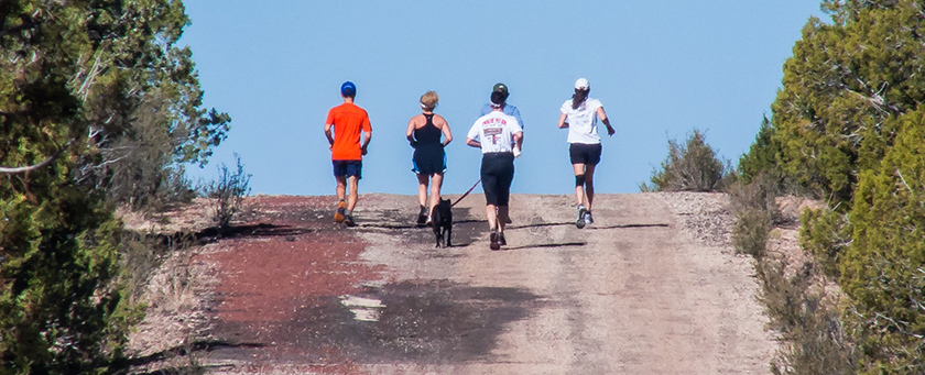
Sedona Runs
- Aerie-Cockscomb Loop (GPX; HTML)
This loop starts at the Fay Canyon Trailhead parking lot. It briefly follows the Cockscomb Trail to the southeast before turning southwestward (right) on the Aerie Trail. The Aerie Trail ascends the northwest face of Doe Mountain then circles the mountain. West of Doe Mountain is a parking lot with multiple trailheads. The Aerie Trail ends here and the Cockscomb begins. Follow the Cockscomb Trail as it winds counterclockwise around Doe Mountain and then back to the parking lot. Distance: 5.7 miles - Brins Mesa Loop (GPX; HTML)
This challenging loop starts at the trailhead at the end of Jordan Road in Uptown Sedona. The trail heads westward and climbs the first significant hill as it ascends Cibola Pass. The trail connects with the Jordan Trail as it heads westward past the Devils Kitchen and the Sacred Pools, then turns northward eventually intersecting the Soldiers Pass Trail. Thus begins a long and challenging climb to the top of the pass. At the intersection with the Brins Mesa Trail, turn to the right to cross Brins Mesa, location of a major wildfire just a few years ago. The final leg of the run is a long downhill back to the trailhead. Distance: 5.2 miles. - Baldwin-Highline-Templeton Loop (GPX; HTML)
This loop climbs up and over one of the prominent sandstone ridges visible from Village of Oak Creek and the views from the top are expansive. The trail head is at the parking area near the end of Verde School Road. Begin by following the Baldwin Trail to the left which will bring you down to Oak Creek. There is an intersection at 0.5 miles; continue straight ahead onto Templeton Trail and pass by the area known as Buddha Beach. Shortly after leaving the Beach the trail begins to climb through a series of switchbacks to the upper sandstone benches. Here you will pass below the impressive Cathedral Rock while running on some magnificent sandstone. At 2.9 miles, take the Slim Shady Trail—a narrow trail with lots of character. At 4.1 miles, turn right on Highline and continue the climb. The views from this trail are great but pay attention to the trail. It's narrow. At 5.6 miles, you've reached the high point. Begin the descent and follow the paint marks on the slickrock. Highline intersects Baldwin at 7.2 miles; take a left and follow the trail back to your starting point. Distance: about 8.5 miles. - Chimney Rock-Thunder Mountain-Teacup Loop (GPX; HTML)
A challenging run despite it's relatively short distance. It starts by circling to the west of Chimney Rock and climbing to the saddle then descends to the intersection with the Thunder Mountain trail. Continuing to the east it rolls across numerous sandy and rocky washes before it begins to climb again to the Teacup Trail. A fun descent begins here and then the trail contours along sandstone layers and ledges before it ends at the Soldiers Pass jeep trail. Return the same way or take some of the many trails that parallel the main track.
Distance: 6.2 miles - Court House Butte Loop (GPX; HTML)
The Court House Butte loop starts from the Bell Rock Trail parking area—a very busy and crowded trailhead. You quickly leave this trail and begin the loop around the Court House Butte using the Big Park Loops. The loop is a generally rolling trail with numerous ups and downs but no continuous climbs. Distance: 4.4 miles. - Chuck Wagon-Gunslinger Loop (GPX; HTML)
This loop uses a set of trails that have been recently incorporated into the Forest Service network although some have been around for a while. Start at the new trailhead and parking area on Vultee Arch Road. Pick up the trail from the northwest corner and move across a broad area of slick rock. Follow this for ~1.2 miles to the intersection of the Mescal Trail and then bear to the right. The trail winds up, down, and around many small hills and gullies and uses sandstone benches and stream beds as well. At ~3.4 miles is another trail sign directing you to the left. In a short distance this will cross Dry Creek and then begin a series of switchbacks up onto the ridge. Once the elevation is gained you will follow Dry Creek for a short distance; the trail then turns west and at 4.9 miles brings you to Long Canyon Road. Turn left; at 5.3 miles is a parking lot and the Mescal Trail goes left. At 5.5 miles, the Mescal Trail intersects Chuckwagon. Turn right and head back the way you came. (Note: The section of trail formerly known as Gunslinger is now a part of Chuck Wagon.) Distance: about 6.7 miles.
Option: Start at the Long Canyon Road parking area and take the Mescal-Chuckwagon loop and leave off the section that goes to Vultee Arch Road. Distance: about 4.5 miles. - Hangover Loop (a/k/a Mitten Ridge/Bear Paw) (GPX; HTML)
This is an amazing trail and not to be missed! It starts from the large parking area on Schnebly Hill Road and follows the Munds Wagon Trail which roughly parallels the road. The trail forks after a few miles with the left fork to the Cow Pies—a very interesting feature in the sandstone. After passing the Cow Pies the trail becomes more challenging as it contours along some steep terrain, eventually topping out at the obvious saddle. From here, angle down and right then quickly left to continue on Hangover Trail. This will contour around the north side of the rock formation to the next obvious saddle. The trail drops across the saddle and back to Munds Wagon Trail. Distance: 8.2 miles. - Hog Wash/High on the Hog/Hog Heaven/Broken Arrow (GPX; HTML)
The trail starts at the parking area at the end of Morgan Road. Start up Broken Arrow Trail and pass the Trail register. At the trail sign located on the sandstone benches take a hard right and reverse direction to find Hog Wash. The trail slowly climbs as it winds around the north side of the rocks. At the next marked intersection, head uphill on High on the Hog. This section of trail is moderately steep in places as it climbs to the saddle. This is a great place to catch your breath and take in the views in all directions. The trail heads down onto sandstone benches and is generally well marked. At the next marked intersection head right and uphill on Hog Heaven and another short stretch of climbing. After connecting to Broken Arrow, continue uphill to Chicken Point or turn left and return to the trail head. Distance: 4.7 miles as a loop; 6.2 miles out-and-back. - Huckaby Trail(GPX; HTML)
The Huckaby Trail is an out-and-back route that winds around the western extension of Mitten Ridge and then drops down to Oak Creek. It starts from the trailhead parking lot on Schnebly Hill Road. A couple of different trails originate from this location and are well marked. The trail begins a quick descent into Bear Wallow Canyon then regains all of this elevation and more as it climbs on to a ridge. When you have reached the high point you glimpse your first view of Oak Creek below. The trail slowly descends to the creek bottom. The final section of this run is flat as it moves across the flood plain and riparian zone and running on the soft sand is an interesting change from the hard rock above. The turnaround is at the creek crossing. At low water, the creek can be easily crossed and you can continue and connect with additional trails. Distance: 5 miles. - Long Canyon(GPX; HTML)
A simple out-and-back trail with gentle climbs—although it does get a bit rocky and steeper towards the end. The best views come early before entering the canyon although some amazing vistas are possible if you go off trail on some of the faint side paths that climb onto the sandstone. Distance: about 7.5 miles. - Mescal Mountain Loop (GPX; HTML)
This is a a closed loop as it completely encircles Mescal Mountain. It starts from the Boynton Canyon Trailhead parking lot then goes north on Deadmans Pass Trail. This takes you on the northwest side of Mescal Mountain. At the intersection with the Long Canyon trail turn right (southeast) and follow it out almost to the paved road. Turn right again and run on a new connector trail that joins Long Canyon to Mescal. Follow this until you connect with the Mescal Mountain Trail. The trail slowly climbs up onto a wide bench and circles around the mountain on the southwest side. Another recent re-route of the trail takes you down through a series of switchbacks before reconnecting back onto Deadmans Pass Trail. Turn left and in about 1/2 mile you will be back at your starting point. Distance: 5.2 miles. - Munds Wagon Trail (GPX; HTML)
The Munds Wagon Trail roughly parallels the Schnebly Hill Road and even crosses the road a few times along the way. For the most part, though, the trail stays within or close to Bear Wallow Canyon, a shallow canyon with occasional steep walls. During the winter and the summer thunderstorm season there may be running water in the creek; otherwise it is usually dry. In the winter, the pools of water are often frozen after any prolonged period of cold temperatures making the trip along the creek a visual treat. As shown here, the trail is done as a loop using the single-track trail up to Merry Go Round Rock and following the dirt road back down. The road adds about 1/4 mile extra versus doing the trail out-and back. Distance: 6.7 miles. - Soldier Wash Loop (GPX; HTML)
The Soldier Wash Trails are tucked in between residential areas on its east and west sides, and Highway 89A to its south. Yet there is a feeling of isolation on much of the trail system. With the large number of trails in this small area you can run almost any distance you want by adding or omitting trails. The loop described here follows the outer loop.
Start at the parking area located at the end of Jordan Road in uptown Sedona. Head south on Jordan Trail and take the Javalina Trail (0.7 miles). This will begin a fast descent that will take you to Highway 89A (2.0 miles). This is the lowest point on the run. Turn right/west onto Grand Central. In about 0.2 mile, turn left and follow the recently re-aligned Crusty Trail. At 2.5 miles, turn right on Adobe Jack. You will be following this uphill for the next couple of miles. Along the way you will pass trail junctions for Coyote Trail, Power Line Plunge, and Grand Central. Continue until the trail ends at Jordan Trail (4.5 miles). A few steps north of you is the Devil's Kitchen sinkhole. Take a moment to stare down into the deep hole here. Turn right/east and follow Jordan Trail across slick rock then turn left at Cibolla Pass Trail (4.9 miles). Begin the steep climb up to the top of the pass. This is the highest point of the run. A short descent brings you back to the trail head. Total distance: 5.5 miles. - Turkey Creek Loop (GPX;HTML)
This is a trail that follows old roads and single track with two looped portions near the beginning and middle section. Most of the run is rolling terrain but the last mile is a steady climb up a series of switchbacks to the edge of House Mountain. From the high point you can gaze to the southwest into the ancient caldera of the long-extinct volcano. The trail starts at the small parking area along Verde School Road. Distance: 7.6 miles. - Wet Beaver Creek (GPX; HTML)
An out-and-back run that follows old roads and single track as it parallels the creek and works its way up the canyon. Along the way, take some time to notice the petroglyphs inscribed into the rocks along the side of the trail. The turnaround is at "The Crack," a popular swimming hole with a very deep pool and rock ledges. At an elevation of just below 4000 feet this is one of the warmer runs and the first to dry out in the winter. Distance: 7.0 miles. - Yavapai Vista Double Loop (GPX; HTML)
This run is a Figure 8 with a loop south and a loop north of the trailhead and parking area.
Start from the Yavapai Vista Scenic View area located on southbound SR 179. From the kiosk head up the Yavapai Vista Trail until it intersects with Slim Shady (0.2 miles) and turn left (south). Stop a moment to catch your breath and admire the view of Bell Rock. Follow Slim Shady to a signed intersection (0.6 miles) with Made In The Shade Trail. Turn right and begin a series of uphill switchbacks. At the top of the switchbacks the trail heads in a southerly direction with an airy exposure on your downhill side. Soon it begins a gradual descent and rejoins with Slim Shady (1.8 miles). Turn left (north) and begin another ascent that brings you back to the Made In The Shade intersection at 2.4 miles. You've now completed the south loop.
Continue north—and up—on Slim Shady past the Kaibab Trail and begin a long descent. The trail winds through several washes and slick rock areas and terminates at the intersection with Templeton Trail (3.9 miles). Turn right and begin another ascent. Turn right (4.5 miles) on the Hermit Trail and follow this back to the trail head completing the north loop. Total distance: 4.9 miles
Flagstaff runs
- Arizona Trail: Snowbowl–Bismarck Lake (GPX; HTML)
Is there a "Best" section of the Arizona Trail? If so, this might be it. This out-and-back trail has only minor elevation changes as it contours around the west flanks of Humpheys Peak. It flows through Ponderosa forests, Alpine meadows, and Aspen stands with a few switchbacks thrown in for good measure. The scenery is gorgeous. And the elevation will leave you gasping for air. But it's worth it. Drive up Snowbowl Road to Aspen Corner and park. Head down the old two-track road for 0.25 miles then turn right onto the Arizona Trail. Run as far as you want but the trail sign for Bismarck Lake at 3.5 miles is a good destination. Distance: 3.5 miles one way. - Arizona Trail: FR418–Bismarck Lake (GPX; HTML)
This is another contender for "Best" section of the Arizona Trail. As you head south the trail gently climbs through numerous switchback as it traverses stands of Ponderosa pine and aspen. In late September and early October the changing colors of the aspen makes this especially wonderful. At the junction with the Bismarck Lake trail (3.9 miles), head west for a short distance and then take a faint, unmarked trail to the lake. Circle around the lake on the west side and follow this trail in a northeasterly direction back to the Arizona Trail. Take US 180 north to FR 151 then head east. Bear left onto FR418. The trailhead is 3 miles from the highway. Distance: 8.0 miles round trip.
- Arizona Trail: Walnut Canyon (GPX; HTML)
Here is another great section of the Arizona Trail. The trailhead can be found on old Walnut Canyon Road southeast of Flagstaff. Within a few minutes of leaving the trailhead the trail drops down into a side canyon that provides an expansive view of the main canyon. But if you are running the trail you need to keep your eyes on the trail and not the view. This is a good reason to stop and take a good look—or a photograph—before resuming the run. One of the best features of this trail run is heading out to one of the many overlooks and peering into the canyon. Because this area was inhabited by the Sinagua there are many artifacts lying around and with sharp eyes pieces of pottery are easily spotted. Enjoy—but please leave them where you found them! This run is 8-miles out and back and has a lot of climbing—in both directions. The trail is well marked and can be quite busy at times with hikers, runners, mountain bikers, and equestrians. Share the trail and enjoy! Distance: About 8 miles. - Kelly Pocket (GPX; HTML)
Kelly Pocket is a challenging run down a small side canyon that feeds into the larger Kelly Canyon and, eventually, Pumphouse Wash. Look for a small pull out about 150 yards to the south of the intersection of FR237 and FR9498 (Kelly Canyon Road). The trail follows the canyon floor as it cuts through many sandstone layers and passes through a lush ponderosa pine forest. Farther down the canyon, deep shade allows both fir and spruce trees to grow alongside the pine forest. There are a number of log ramps used by mountain bikers and these can be amusing to run up and down. At about 2.9 miles is the confluence of Kelly Canyon and Pumphouse Wash coming in from the right. This location is about 500 feet lower than your starting point. Turn around here for an out-and-back run. Or turn right and follow Pumphouse Wash to FR237 and follow this forest road back to your starting point for a slightly longer route of about 6.1 miles. - Kendrick Peak (GPX; HTML)
Kendrick Peak is one of the peaks in the San Francisco volcanic field—but stands separated from the taller Kachina Peaks by a few miles. Its isolation gives outstanding views from all faces as it is climbed as well as from the summit. There are any number of Forest Roads that will get you to the base. Here is my favorite: From Highway 180, go west on FR 193, located at milepost 233. In about three miles turn right on FR171 at the "T" intersection. As you approach the trail head there will be a few signs to guide you the last bit. The trail wastes no time in climbing and, in fact, this opening section may be one of the steeper portions of the trail. As the trail climbs it encounters many switchbacks and as you traverse the south side of the mountain take some time to gaze off into the distance. The trail tops out on a saddle and there is a historic cabin here. Great effort was expended to save this cabin during the devastating Pumpkin Fire (started by lightning) in 2000. This makes a great spot to kick back for a few minutes, drink some water and have a snack while enjoying the view. Or, continue up the extra 1/4 mile to the lookout tower for a 360 degree view. About 8.2 miles roundtrip to the saddle; add 1/2 mile if you go to the tower. - Rogers Lake (GPX; HTML)
Two newer trails in the Flagstaff area are the Two Spot and Gold Digger trails located near Rogers Lake. Start by driving south on Woody Mountain Road and parking at the second (south) trailhead. The trail heads north across Rogers Lake—which is not actually a lake but a rich wetland. This 1-mile segment is a "Rails to Trails" conversion and is flat and straight. Stop for a moment to enjoy the wide-open views of the San Francisco Peaks. At the northern terminus the trail crosses Woody Mountain Road. This forested single-track segment will take you back to your starting point. Just before passing through the gate to the trailhead there will be a junction marker. Turn left and you are now heading up Gold Digger. Gold Digger starts with a long but easy climb through a Ponderosa pine and Gambel oak forest. At some of the higher points and meadows you will again have a view of the San Francisco Peaks to your north. Gold Digger returns you to the Spot Trail near its northern end. Turn left and repeat the section you did earlier. Total distance: 7.3 miles - Schultz Creek-Brookbank-Rocky Ridge Loop (GPX; HTML)
This is a challenging loop that takes you around some of the hills and peaks in Flagstaff. The Schultz Creek trail lies in a shadowed drainage and can be many degrees cooler than the surrounding area making it an ideal choice for the uphill section of the run. After about 3.7 miles you pass by a small gate. Turn to the right and head up the single-track Sunset Loop Trail for about 1/2 mile where the trail meets up with an old road. Continue up the road to the Dry Lakes and a large grassy meadow. In spring, the lake often has water but the rest of the year it will be dry. Veer to your left across the meadow and follow the trail that heads downhill and becomes Brookbank. Brookbank ends at Elden Lookout Road at 6.1 miles. Turn right and follow the road for about 1/4 mile then veer right onto Rocky Ridge Trail. This trail has good southern exposure and is one of the first trails to melt snow and dry out in the area. Follow this back to your starting point. About 9.2 miles. - Schultz Creek-Secret-QuasiMoto (GPX; HTML)
Training for a marathon or ultra? Then this long loop might be a good run. Start by climbing the Schultz Creek trail to the Sunset Trail trailhead parking lot. Look for the Flagstaff Loop Trail in the northeast corner of the parking area. Follow this across Schultz Pass road where it becomes better marked. The Arizona Trail crosses here. At a marked trail junction take the right fork. This will take you higher still to just below Friedlen Prairie Road. A marked trail on the left is SuperMoto and is a fairly rugged trail. Continue a very short distance beyond and the trail veers to the left and descends. Welcome to "QuasiMoto" which is actually a continuation of Secret Trail. Downhill you go until you reach the pipeline. Cross over and get onto RockyMoto—veering right at the fork. This brings you to FR 164B. Turn left and follow the road back to the Fort Valley Trails—which are well marked—and follow any one of the many options back to Schultz Creek and the parking lot. About 19 miles.
- Schultz Creek-Sunset-Brookbank (GPX; HTML)
There are endless possibilities when you start with Schultz Creek! The Schultz Creek trail lies in a shadowed drainage and can be many degrees cooler than the surrounding area making it an ideal choice for a warm day. After about 3.7 miles you pass by a small gate. Bear to the left and continue up the single track. There is often water running here long after all other streams have dried up. Another half mile brings you to the Sunset trailhead parking area. Continue up the Sunset Trail single track. The first mile is rolling terrain; the second mile is a long climb! At the ridge top catch your breath and enjoy the view of the San Francisco Peaks to your north. Head down and at the trail junction bear right onto Brookbank (also known as Upper Brookbank). Upper Brookbank meets Lower Brookbank at a signed junction. Turn right/uphill and find yourself in the Dry Lakes region. Numerous trails crisscross here. Generally bear to the right on the flats and then downhill on the old jeep road (Little Gnarly). Bear left at the next trail junction; this will take you back to Schultz and the gate. Turn left onto Schultz and return to your starting point. Distance: About 14 miles. - Schultz Creek-Arizona Trail (GPX; HTML)
Yet another possibility that uses the Schultz Creek Trail! The Schultz Creek trail lies in a shadowed drainage and can be many degrees cooler than the surrounding area making it an ideal choice for a warm day. After about 3.7 miles you pass by a small gate. Bear to the left and continue up the single track. There is often water running here long after all other streams have dried up. Another half mile brings you to the Sunset trailhead parking area. Look for the Flagstaff Loop Trail in the northeast corner of the parking area. Follow this across Schultz Pass road where it becomes better marked. After a short distance, the Arizona Trail will cross your path. Turn left and follow this for several miles. Many faint side trails criss cross the area but the Arizona Trail is well marked through these intersections. At about 8 miles, the Arizona Trail, while heading north, will cross an east-west trail that descends to your left/west. Take this trail (known both as Chimney Springs and Lower Moto) which is part of the Fort Valley Trail system. The names of these trails are undergoing changes and updates. Head downhill for about 1.5 miles and bear left at a marked intersection. This trail will generally follow the contours as it winds in and out of small side drainages, eventually bringing you back to the Schultz Creek Trail. Distance: about 11.1 miles. - Soulstice: Short Loop (GPX; HTML)
One of the best short loops in the area, the Soulstice Short Loop is part of the annual NATRA Soulstice race. The loop starts at the Sunset Trailhead, located on Schultz Pass Road. Start by heading out on the Sunset Trail. The first half mile is gentle terrain but the next mile and a half is a steady climb. By the time you reach the high point of Sunset Trail you will have gained over 800 feet in elevation. This is a good place to catch your breath and look around at the San Francisco Peaks to your north. Head downhill for a short distance and take the right at the trail intersection onto Upper Brookbank. You begin to climb again but the pitch is much less steep than earlier. Cross a saddle and you begin the fast downhill. Watch the rocks and switchbacks! At about the 4-mile point, an unmarked—but heavily used—bypass trail goes right. Take this and watch your footing as it gets very steep and rocky for a short section. This brings you to the Dry Lakes and a large grassy meadow. In spring, the lake often has water but the rest of the year it will be dry. Veer to the right and re-enter the trees on an old gnarly road. Near the bottom of the hill the route takes the single track to the left. Follow this delightful trail to the intersection with Schultz Creek Trail. Turn right/uphill and finish back at the trail head. Distance: 6.0 miles. - Space Loops (GPX; HTML)
The Flagstaff Ranger District has been building many new trails as part of the Mount Elden-Dry Lakes (MEDL) recreation plan. Some of my favorites are the stacked-loop trails on the west side of Mount Elden. These trails all have names with a space theme so this loop is called Space Loops.
Start at the gate where pavement turns to dirt on Schultz Pass Road and head north on Chimney Trail. In about 1/2 mile it will merge with Schultz Creek Trail (which can be used as an alternate start). At one mile turn right on Afterglow. This is where the climbing really begins. Turn left at the intersection with Big Bang. At around two miles turn right on Spacewalk Trail. This is a more gentle climb to the high point of the loop at 2.5 miles. There are great views here of the peaks to the north. Continue on Spacewalk to Dipper and turn right. Continue heading downhill to the intersection with Apollo Trail at around four miles. Turn left on Apollo and right on Orbit. Stay on Orbit and it will bring you back to your start location. Distance: about 5.2 miles. - Sycamore Rim Loop (GPX; HTML)
This loop traverses some amazing terrain including canyon rims, natural springs and waterholes, and historical ruins. There are many access points to the loop: this one is located south of the intersection of Garland Prairie Road and Thomas Road where a small parking area with trail signs can be found. From the parking lot, head in a westerly direction for a short distance. This is a connector to the Sycamore Rim Trail. At the trail sign, turn left and begin a slow descent along the rim of the headwaters area of Sycamore Canyon. It's a rocky trail and requires some attention. The shallow canyon on your left quickly widens and deepens. As you run along the rim, the expansive vista of Sycamore Canyon is worth stopping to enjoy. At about 3 1/2 miles, there is a trail junction and sign. Turn left and find yourself at Sycamore Canyon Vista. Reverse direction here back to the trail sign. At this point, you can go right and return the way you came or head straight (north) to make a loop. This short section of trail soon merges with FR 56. At about 6 miles, a small parking lot with a trail sign is on the right. Turn here to pick up the Sycamore Trail once again. Cross the stream and head into the woods where a few historical sites (lumber camp, mining camp) can be found along with informational signs. At mile 7.2 you return to the short spur trail you started on. Go left and find yourself back at the trailhead in a few more minutes. Distance: 7.5 miles. - War Dog (GPX; HTML)
War Dog is a group run held every year on the first Sunday of October. For more details on this run see the NATRA pages. This is a long run with substantial elevation gain but, ultimately, a worthwhile endeavor. The run follows the old Weatherford Road (now a trail in a Wilderness Area) from the Schultz Pass Trailhead parking area to Doyle Saddle. Along the way will be countless switchbacks, rocky sections, tree fall, and spectacular views. The route is straightforward as it follows the old road with only one variation: at an unmarked fork the trail to the right follows Weatherford Canyon through some amazing stands of aspen, then rejoins the main trail at the trail register. At the saddle enjoy the views of the Inner Basin. Distance: about 13 miles with 3000 feet of vertical.