Desert mountain biking: The Black Canyon Trail

Not too far from the high altitudes and colder temperatures of Flagstaff lies the northern edge of the Sonoran Desert. A short drive of just 90 minutes will place you in the desert with Saguaro and other cacti. Here one can enjoy the winter months as the temperatures are much warmer than those found in northern Arizona and dry days vastly outnumber wet days.
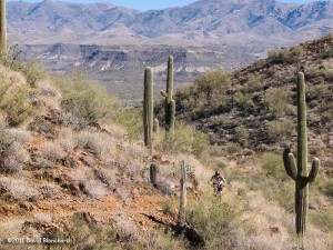
Desert riding on the Black Canyon Trail.

We had been planning on a mountain bike ride on theĀ Black Canyon TrailĀ once the desert temperatures cooled. With light winds, mild temperatures, and clear skies expected this week it was time to visit the BCT. Since this trail is approximately 78 miles long we had to choose which section we would ride. We selected theĀ Black Canyon City trailheadĀ and rode the Horseshoe Bend segment, the Skyline segment, and portions of the Cheapshot segment before running out of time and returning the way we came.

This is desert riding and cactus will reach out and puncture your tires if you aren’t careful. Apparently, I was not careful but at least I didn’t notice I was losing air until the ride was over. Upon inspection of the tube I found half a dozen punctures. Ouch!

Gazing down at the Agua Fria River from the Black Canyon Trail.

The descent down to the Agua Fria River is one of the highlights of this segment and the river and canyon are quite spectacular. Luckily there was only a very light flow of water in the river. After winter storms there could be substantial water flowing through here making the crossing difficult. But not today.
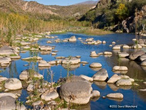
Horseshoe Bend section of the Agua Fria River.

By and large, the tread on this section of BCT is smooth and is beginner difficulty. On the other hand, there is substantial exposure where a fall could be painful resulting in an overall rating of intermediate for these sections. Riding along with the edge only a foot or two away from your wheel gives one strong motivation to ride a careful line.
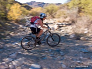
Dry wash crossing on the Cheapshot section of the Black Canyon Trail.

I suppose we could have ridden harder and faster and covered more territory in the time that we had. On the other hand, it’s more the journey than the destination so we took our time to enjoy the beautiful hills, pleasant weather, and very high quality mountain bike track.
Iridium Flares and NOSS satellite pairs

With storm systems and cold fronts moving across the region last night the opportunity to do any sky watching seemed remote. And, yet, for a brief period, clear skies revealed the stars, moon, and satellites above northern Arizona.

First up was the X-37B at ~1805 MST. I watched — but did not photograph — this USAF spacecraft. I wish that I had because for a few seconds after it had passed maximum altitude it flared brightly – possibly rivalling Jupiter in brightness.

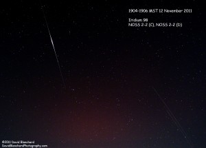
Iridium 98 satellite flaring along with the NOSS 2-2 (C) and NOSS 2-2 (D) satellite pair.

Next up was an Iridium 98 flare that was forecast to brighten to magnitude -6.5. This was easily captured by the camera but I was also able to capture two additional satellites travelling close together. A bit of investigation revealed that these were likely NOSS 2-2 (C) and NOSS 2-2 (D). NOSS is the Naval Ocean Surveillance System and these spacecraft travel in pairs and triplets.

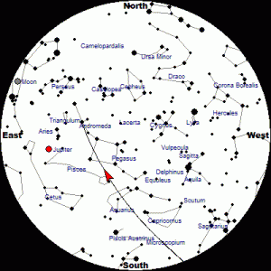
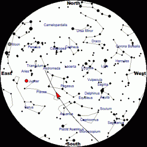
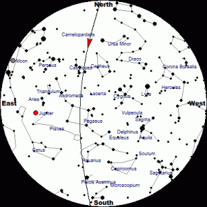
I often use the information available at the Heavens-Above web site for satellite tracks and times. Below are the tracks for the Iridium98, NOSS 2-2(C), and NOSS 2-2(D) spacecraft.

Track of Iridium 98 for 12 November 2011.
Track of NOSS 2-2(C) for 12 November 2011.
Track of NOSS 2-2(D) for 12 November 2011.

There are hundreds of active satellites and thousands of objects (live satellites, dead satellites, and pieces of space debris) orbiting the earth. So it’s pretty easy to look up and see one of these moving across the sky. But it also makes it difficult to photograph the stars, planets, and other celestial bodies without getting a satellite track across the image.

Another Space Station in the Sky

We all know about the International Space Station (ISS). Many people have watched as it flies overhead as a brilliant point of light moving across the sky.

But now it is no longer the only space station in the sky. On 29 September 2011 China launched its own space station known as Tiangong (“Heavenly Palace”). It’s not as bright as the ISS and thus less noticeable to most observers.

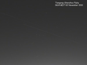
Tiangong and Shenzou spacecraft moving across the pre-dawn sky.

Then, on 01 November 2011, China launched the Shenzhou-8, an unmanned spacecraft designed to dock with Tiangong. And early on the morning of 02 November 2011, both spacecraft passed overhead cutting through the constellation Orion. Just a few hours later, Shenzou-8 successfully docked with Tiangong.

The dual spacecraft flyby is reminiscent of the ISS-Shuttle flybys.