With autumn winding down and winter just around the corner in northern Arizona, it was our last chance to attempt a Rim-to-Rim-to-Rim (R2R2R) hike across the Grand Canyon. Several years ago we tried the R2R2R but strong winds drove us back as we neared the North Rim. Although we were only about 3-1/2 miles from the finish, it was the prudent thing to do. Later that year, we tried again but a problem with my iliotibial band turned us around after only a few miles and we settled for a shorter hike.
Jump forward a few years and the knee issues have gone into remission. With fine weather expected and the moon just a few days past full it was time to try again.
We left the South Rim on the South Kaibab Trail (elevation 7260′) at midnight with a temperature in the low 40’s and 20–30 mph winds. Hats, gloves, and vests/parkas were required for this initial descent. At times, the wind was so fierce that we wondered if we should continue. By the time we had descended to Cedar Ridge (6060′) the wind had diminished enough to allow us to shed some of the excess gear.
With the bright moon high overhead and headlamps we were able to easily travel downhill. Traveling in the dark with a bright moon and no other hikers around is an amazing experience. It’s so quiet! We traveled quickly and arrived at the Colorado River (2480′) at 3:30 a.m. Temperatures were in the low 60’s and we took a long food and water break at Phantom Ranch before starting up the North Kaibab Trail through Bright Angel Canyon.

A short distance up stream from Phantom Ranch is “The Box.” Traveling through The Box can be the hottest part of the hike with its high and close walls of granite but it was still dark and pleasantly cool as we traversed this section of Bright Angel Canyon. The last time we were here, spring snow melt had resulted in so much water rushing down the creek that boulders were constantly moving, grinding, and crashing into each other underwater resulting in a raucous cacophony of sound. Not tonight; the gentle flow of water resulted in a delightful sound that was mesmerizing in the dark.

We arrived at Cottonwood campground (4080′), about 8 miles from Phantom Ranch, shortly after sunrise. We learned that the water had already been shut off for the season which meant there might not be any drinking water available uphill from here. Luckily, water was still running at the Roaring Springs Pumphouse Residence (~5200′) and we refilled here.

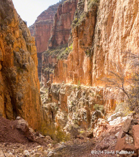
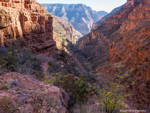
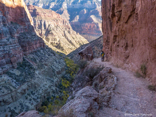
From Phantom Ranch to Roaring Springs Residence the North Kaibab Trail is a gentle uphill climb. The trail leaves Bright Angel Canyon just past the Residence and ascends Roaring Springs Canyon which is a much steeper section of trail. The trail is narrow and perched on a nearly vertical wall with steep drops to the side. It can be very intimidating.

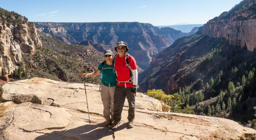
The trail crosses the narrow canyon at Supai Bridge and begins a series of steep switchbacks to the top. Along the way, you pass through Supai Tunnel (6800′). Not surprisingly, the water here had been turned off for the season. We arrived at the North Rim (8240′) at 12:15 p.m., where we had a leisurely lunch. Already very tired from the long climb, we now had to reverse and do it in the opposite direction.

As we descended Roaring Springs Canyon we stopped often to take photographs as the light was much better in the afternoon than it had been in the morning. The trees in the bottom of the canyon were still showing autumn colors and the narrowness of the trail as it hugged the canyon cliff was much more impressive. We stopped again at the Residence to refill our water bottles, drink, eat, and rest.

Darkness descended upon us down canyon from Cottonwood Campground and, once again, we traversed The Box in the cool darkness, arriving at Phantom Ranch at 8 p.m. Many campers were hanging around waiting for the cantina to re-open so they could visit the bar. I was definitely interested in a beer but thought better of it. Instead, I lay down on the picnic bench to rest and, not too surprisingly, fell asleep, awakening around 9 p.m.

After drinking lots of water, consuming as many calories as we could, and filling our water bottles, we departed Phantom Ranch around 9:30 p.m. and began the long and steep climb back up South Kaibab Trail. Clouds during the evening prevented us from getting any useful moon light so we were on headlamp lighting only. Once again, winds became strong and gusty as we ascended and we donned the warmer clothing.
Finally, at 3:15 a.m., we arrived at the South Rim. It had taken us 27 hours and my goal had been 24 hours. Although I was slightly disappointed at how slow we had traveled I was very happy that my third attempt at R2R2R had been successful. Total: 42 miles and 10,540 feet of ascent.