Fog and Atmospheric Optics

Fog with a Glory, Brocken spectre, and two segments of a fogbow.

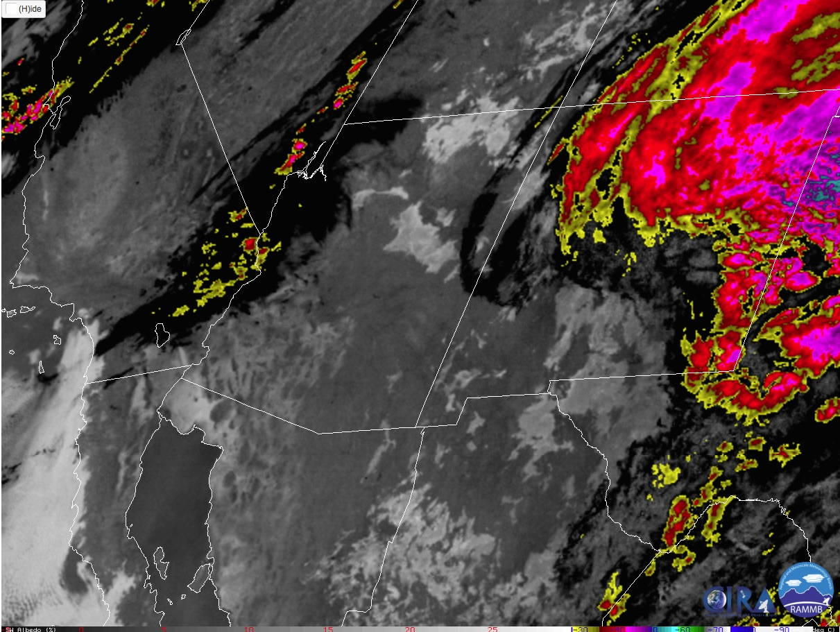
In the wake of a departing low pressure system I expected that there might be areas of dense fog in the morning. I awoke well before sunrise to look at satellite images to see if fog was developing. And, yes, there were some hints that fog was present. Good!

GOES-16 IR satellite image from ~5 a.m. showing large areas of fog across northern Arizona.

I left the house around 6 a.m. and headed east on Lake Mary Road. A few miles outside of town I ran into fog. Visibility dropped quickly to around 1/4 mile. Drive carefully!

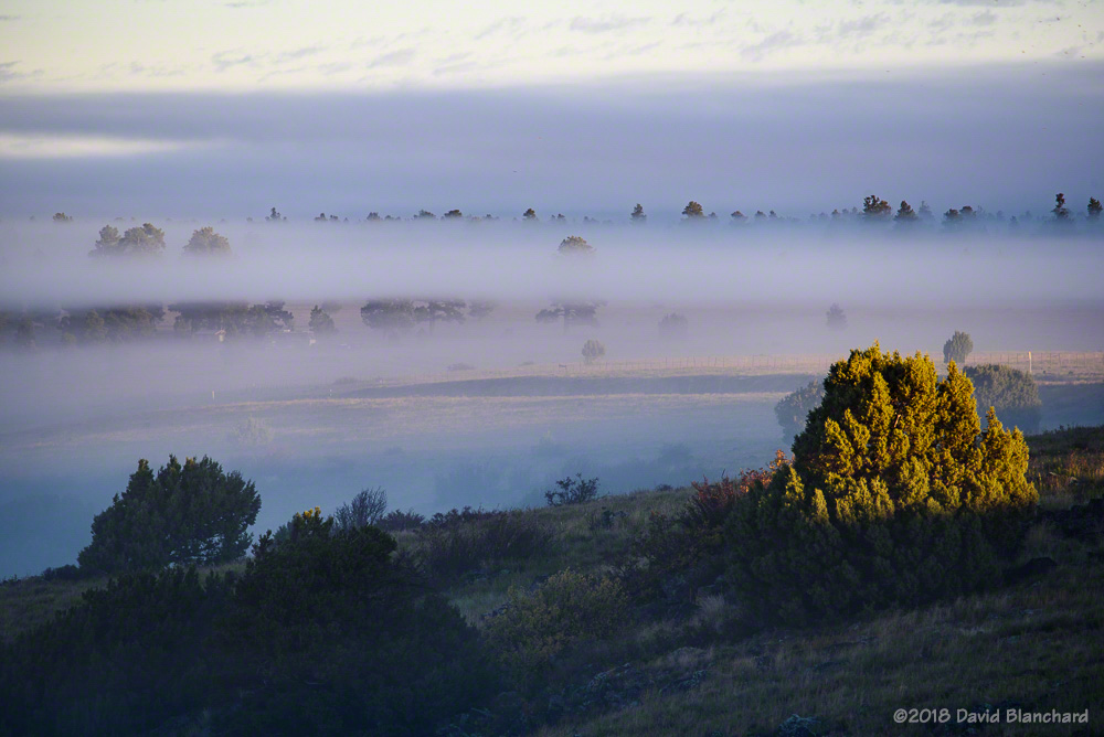
My destination was the Mormon Lake Overlook. I had some success last winter at this site with a similar fog situation. As I approached the overlook the fog lifted becoming a low cloud deck above me. Hmmmm….not quite what I wanted. Ahead, I could see the edge of the cloud/fog. As I made the final approach to the overlook the road gained a bit of elevation and, suddenly, I was above the cloud/fog deck. Wonderful.

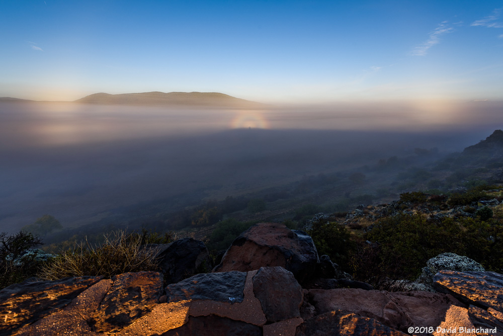
The sun had not yet risen but it was light enough to see that there was a shallow layer of fog covering the Mormon Lake basin. Moments later the sun began to rise through the dense fog.

Sunrise through the fog.
Layers of fog at sunrise.

With the sunrise a Glory and Brocken spectre became visible. Moments later, two short segments of a fog bow appeared. Also visible is a shadow of the overlook.

Fog with a Glory, Brocken spectre, and two segments of a fogbow.
Fog begins to dissipate across the Mormon Lake basin.

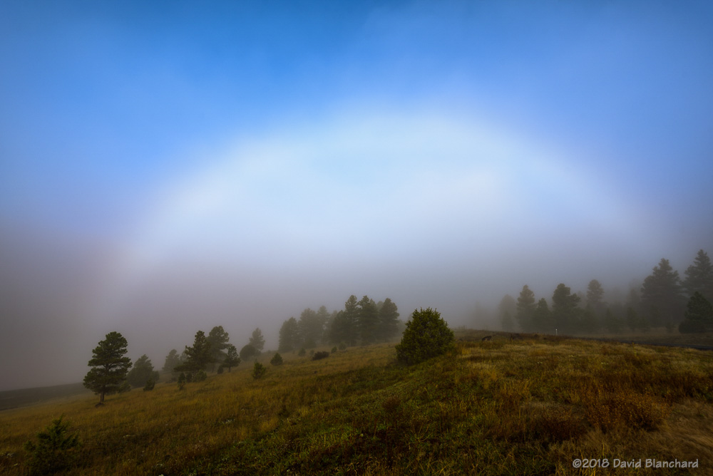
As the fog began to dissipate over Mormon Lake, I headed towards Anderson Mesa Station (home to several telescopes) because it is high enough to be above the fog. But first, along the way, the road dropped down into the fog and I saw this fog bow.

Fogbow near Lake Mary.

Finally, atop Anderson Mesa I once again was above the fog and able to photograph a Glory—this time projected onto trees with autumn colors.

Another glory and Brocken spectre projected onto fall foliage.

Finally, here is a time-lapse of the fog over Mormon Lake that includes the Glory and the right-hand side of the fog bow.

Edit: Replaced GOES-16 visibile image with IR image.

Severe Thunderstorms Near Two Guns

By late morning it was evident that convection was going to be interesting. Updrafts were quite vigorous and there was pileus atop many updrafts.

I thought about photographing storms but got sidetracked. Then I heard the first Severe Thunderstorm Warning on NOAA Weather Radio. Less than an hour later a Tornado Warning was issued.

I looked at the radar data for the warned storm but was unable to see a clearly defined mesocyclone or tornado vortex signature (TVS). As it turns out, this was a non-supercell tornado (NST), sometimes called a landspout—and landspouts are often difficult to detect by radar.

This warning finally got my attention. A short while later, I headed out the door to see if any other storms would be as interesting as this one. I drove east towards some existing convection near and north of Winslow—stopping frequently to take photographs.

New convection forming to the WNW of Two Guns, Arizona. (1651 MST 21 October 2018. )

New storms then began to form back to the west and I set my sights on these. By this time, I had moved back west to the Two Guns exit on Interstate 40. Two Guns is now a ghost town and there are several old and interesting buildings in the area. I set up so that I could photograph both the old buildings and the storm. That worked out well.

Strong thunderstorm N of Two Guns, AZ. (1707 MST 21 October 2018)

Then it was time to move to the north side of I-40 so I could get some photos without any buildings in the way. You know—just in case a tornado formed.

Supercell thunderstorm north of Two Guns, AZ. (1714 MST 21 October 2018)

No tornadoes were observed although for a brief period the visual appearance and radar depiction suggested that the storm was developing supercell characteristics and had some rotation.

As the storm moves to the ENE light from the setting sun illuminates the foreground. (1725 MST 21 October 2018)
Sunset colors illuminate the storm as it moves to the ENE. (1729 MST 21 October 2018)
Sunset colors. (1733 MST 21 October 2018)
Cumulus convection takes on pastel colors as the sun sets. (1742 MST 21 October 2018)

I shot both still images and video. Unfortunately, the dynamic range from the brilliantly lit updraft to the dark shadowy areas elsewhere was too much for the video and portions of the updraft were overexposed.


Still, the video shows some interesting evolution. Thirty minutes (1711–1741 MST) of raw video was compressed into ~18 seconds.