A potent weather system moved across Arizona on Tuesday, October 5, 2021, and produced a variety of weather including tornadoes, large hail, heavy rain, and flooding. This system was well forecasted and the various models did a very good job depicting the possibilities.
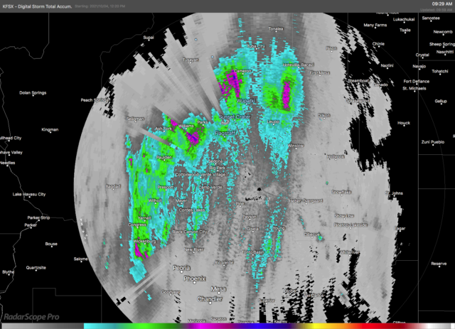
Areas of moderate rain moved across Arizona in the pre-dawn hours with many locations receiving more and one inch of rain by sunrise.
There had been some expectations that the severe weather would commence before sunrise owing to the favorable vertical wind profiles. Both the low-level shear and deep-layer shear supported organized thunderstorms with the possibilities of rotating supercells and even tornadoes. That scenario did not manifest probably because the widespread overnight rain cooled the boundary layer enough to inhibit strong thunderstorm development.
The forecast models also suggested a second period of severe weather was possible in the afternoon as temperatures warmed and buoyant instability increased across the area.
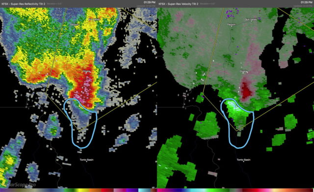
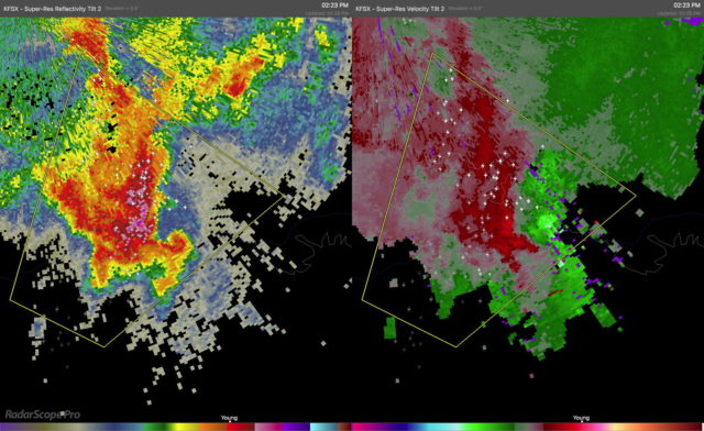
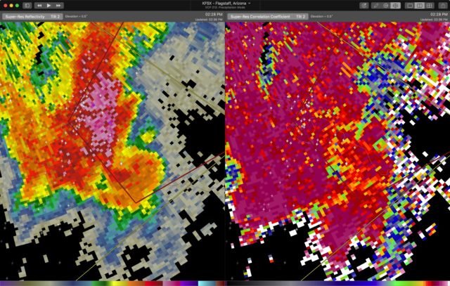
Strong thunderstorms developed across the desert regions of central and southern Arizona in the afternoon. These moved quickly to the northeast and into the higher terrain of the Mogollon Rim and Tonto Rim. At least two of these thunderstorms began to acquire supercellular characteristics and began to show rotation signatures in the Dopper radar data. By mid afternoon, one storm had developed a well-defined hook echo and velocity couplet. This storm was already producing strong winds and hail and a Severe Thunderstorm Warning (SVR) was already in effect. As the rotation rapidly intensified, the SVR was replaced with a Tornado Warning (TOR). Polarimetric Dopper radar data indicated low values of Correlation Coefficient (CC). This often accompanies tornadic debris lofted into the air. This was clearly a dangerous storm and the TOR was justified.
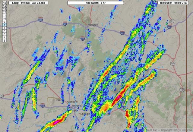
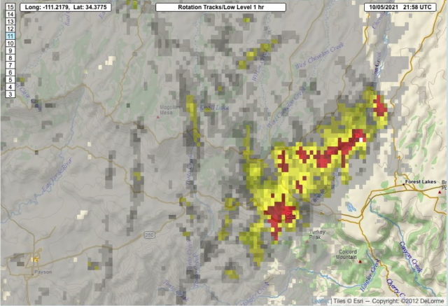
Eventually, the rotation weakened but the storm was still producing large hail as it moved northeastwards. Other storms also produced large hail. The Multiple Radar Multiple Sensors (MRMS) data shows these long swaths of large hail across portions of Arizona.
Forecasters from the National Weather Service offices in Arizona did a great job of anticipating this severe weather event and issuing timely warnings.