A recent hike in the Superstition Mountains east of Phoenix resulted in these two interesting images.
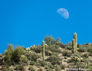
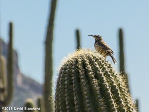
There are no pictures from the day before — I forgot to load a battery into the camera. It happens.
A recent hike in the Superstition Mountains east of Phoenix resulted in these two interesting images.


There are no pictures from the day before — I forgot to load a battery into the camera. It happens.
It’s been cold around these parts lately. How cold? Well, we’ve seen -24ºF in Bellemont, -19ºF in Tusayan, and -9ºF in Flagstaff. These are all northern Arizona communities that are used to the cold — but not for this many days in a row. This is the coldest 5-day period in Flagstaff in over three decades.
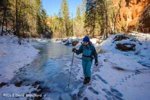
There are some benefits. With prolonged cold some of the streams in the canyons will freeze. With this in mind, we took a hike up West Fork Oak Creek. The trail was snow packed and icy. Wisely, we all had foot traction gear including instep crampons and microspikes.
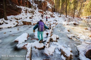
The trail crosses the creek numerous times and the first few crossings were tricky but doable. That is, the logs and/or stepping stones were ice covered but sure footing could be found using care and caution.

One of stream crossings, though, stymied us. For whatever reasons, the water and ice level had increased substantially in this location so that all the stepping stones were well under water and ice. And the flow of water had become concentrated along one side of the channel so that the ice was eroded. After studying it for awhile, we reluctantly agreed that the risk of crashing through the ice was too great. We turned back.
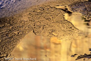
In previous years we had easily moved through this crossing and many others farther upstream including the “subway” passage. We had hoped to make it this far and, possibly, even farther upstream. It wasn’t to be.

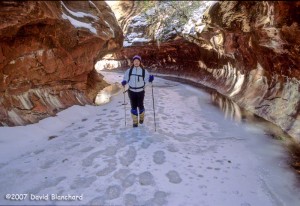
Still, it’s never a bad day when you are out hiking with no one else around except your friends in an environment not often experienced by most.
Edit: 01 Feb 2013 – fixed typos.
We’ve had several days of snow across northern Arizona with about 20 inches measured in Flagstaff — and lesser amounts in the lower elevations. Snow levels were low enough that Sedona recorded snow but little or no accumulation. That means that a few inches or more fell and accumulated in Oak Creek Canyon. When there is snow on the red rock the scenery can be amazing and worth photographing. Even if it’s cold outside.
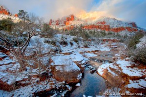
All things considered, it wasn’t too bad. Temperatures were in the mid-teens when I left Flagstaff and were in the mid-20s near Slide Rock State Park. This is much warmer than last year when I shot photographs at Slide Rock State Park.
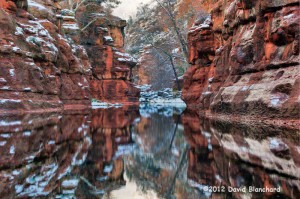
To add to the visual interest, there were clouds clinging to the upper walls of the canyon that caught the early morning sun.
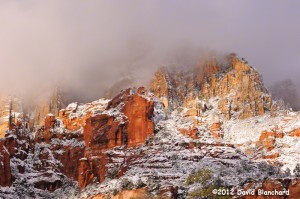
Because of the extreme dynamic range of light with dark shadows and brightly-lit snow I took multiple exposures and then experimented with HDR (high dynamic range) to tone map the results. Definitely a lot of fun but like many HDR images some of the results look a bit cartoonish. Nonetheless, presented here for your amusement.
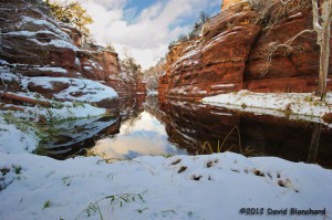
So, I’m glad I got up early and braved the cold. The photos were worth it. After I finished shooting, I headed to Indian Gardens Oak Creek Market for coffee and a bagel.
A few days ago we did a mountain bike ride in Sedona. Near the end of the day we travelled across a large area of red rock sandstone located on Llama Trail. Carved into the sandstone was a series of small pools — some of which contained water.

We were treated to this gathering of birds drinking from the pools. After they had their fill, they flew off to their next destination — and we finished our ride.

A few days ago we decided to spend the day wandering around the East Pocket area. This location overlooks the Red Rocks-Secret Mountain Wilderness on one side and Oak Creek Canyon on the other. It is a relatively flat area surrounded by steep cliffs and deep canyons. Back in the fall of 2005 we explored this area for the first time and decided that we needed to return to see more. Well, it took a few years…
To get to this location you drive south on FR231 — also known as Woody Mtn Road. From the end of the pavement it is about 28 miles to the East Pocket. The dirt road is pretty good for the first half — and not too bad over the second half.
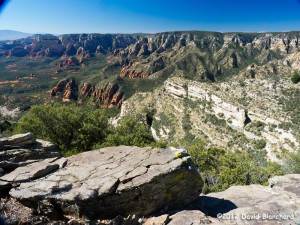
There are no trails on the East Pocket but there are old, abandoned forest roads that are disappearing into the forest. We set off towards the south to see if we could reach the southern point and then find a way across the canyons and climb back to the flats farther south. For an idea of what the terrain looks like, follow this link to Google Maps.
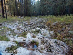

On the way home, we stopped at the bridge that crosses the extreme upper reaches of the West Fork of Oak Creek Canyon. At this point, there is no water and it consists of a rock strewn stream bed in a mountain forest of pine, spruce, and fir. There is a cautionary sign informing hikers of the difficult hiking to be found while heading downstream. We did this canyon from the upper end to the lower end about 10 years ago. It was a very challenging, but ultimately rewarding, 13-hour hike (and swim).