Monsoon thunderstorms and lightning over the Grand Canyon in Arizona

The North American Monsoon was going strong in late August and I decided to take a day trip up to the south rim of the Grand Canyon. My goal was to photograph lightning — both during the daytime and in the twilight hours — over and in the canyon.

I wasn’t disappointed. There were only a few thunderstorms around and that makes for better chances since there are fewer intervening storms and there is a better chance of catching some of the sky.

The first two images are of fairly weak thunderstorms producing only a few flashes as they traversed the canyon from south to north.

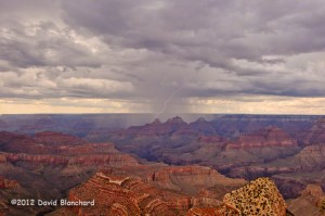
Early afternoon lightning over the Grand Canyon.
Afternoon lightning over the Grand Canyon from Grandview Point.

Later in the evening there was thunderstorm activity over the Kaibab Plateau and the north rim. This image captures the small thunderstorm as well as the stars overhead and the lights of the North Rim buildings.

Evening lightning over the Grand Canyon from Grandview Point.

The last image was taken as the storms ended leaving only a thin layer of clouds with the stars shining brightly and the inner canyon illuminated by the light of the full moon.
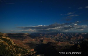
Full moon light shining down into Grand Canyon.

A few notes of interest. While taking lightning photos using my lightning trigger, a group of four photographers showed up at the same viewpoint — all with the same lightning trigger. And later, during the twilight hours, another group of lightning photographers arrived at the same viewpoint. Turns out these were folks from News9.com (an Oklahoma City television station). It’s not clear to me how lightning over the Grand Canyon is part of the news team coverage for Oklahoma City.
Buckskin Gulch sans water and mud

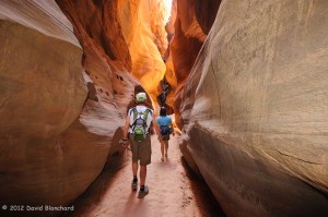
Three of us recently did a day hike in Buckskin Gulch. This is a well-known slot canyon on the Utah side of the Utah/Arizona border. The canyon is about 13 miles long making it one of the longest slot canyons in the southwest — and possibly the world.

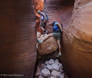
A climbing move is required to bypass this boulder in Wire Pass -- a tributary of Buckskin Gulch. The pile of boulders at the bottom helps.
A climbing move is required to bypass this boulder in Wire Pass — a tributary of Buckskin Gulch. The pile of boulders at the bottom helps.

In normal years rainfall during the summer, fall, and winter leaves ankle- to knee-deep pools of cold water in the canyon. Hiking through here under these conditions is tricky since the pools are often scoured by the rushing water which may result in one side being deep and the other shallow as the sand or rocks build up. With muddy water it is impossible to see under the surface of the water and a walking pole is used to probe carefully before placing each step. A mis-step can result in going from knee-deep water to chest-deep water in one quick step!

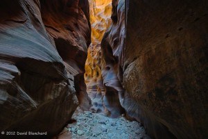
Dry and sandy narrows through Buckskin Gulch.

Some years, however, the fall and winter months are dry and the canyon floor is dry in the spring. That was the case this year. After a wet fall, a dry winter and spring followed and this allowed the canyon floor to be water free — at least in the first few miles that we traveled.

Reflected light illuminates a far wall deep within Buckskin Gulch.

The first time we did this hike (2004) it was dry and we mistakenly assumed this was normal. Returning to hike in 2005, 2006, and 2007, we were greeted each time with water. So it was a pleasant surprise to return after a few years absence and find it dry.

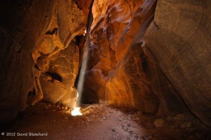
A narrow beam of light penetrates deep into the narrows of Buckskin Gulch and gently illuminates the side walls of the canyon.

What was less pleasant was seeing how visitors to this amazing place have left graffiti along the canyon walls. There was no graffiti the first three times we visited and only one defacement the last time. This time there was graffiti in many locations in the first few miles of the canyon. It is truly saddening that people would do such a thing in a beautiful place.

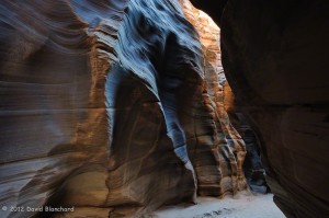
Exquisitely textured walls found within Buckskin Gulch.

Still, we had a great time walking a few miles down canyon, eating our lunch in the cool and quiet narrows of the slot, and enjoying our brief visit to this remarkable place.

Hiking over land and through water in Wet Beaver Creek

Wet Beaver Creek is a popular destination for hikers — especially in the hotter months. Along the stream are many trees providing shade and cooler temperatures. But the biggest draw is the swimming hole locally known as “The Crack” located about three and one-half miles upstream from the trail head. On a hot and sunny weekend there might be a few dozen visitors swimming and relaxing by the stream. Even on a cold weekday you might find visitors because even though it is too cold to swim it is still magnificent to see. (Well, maybe not too cold. I’ve seen trail runners jump in during the winter!)

One of the many narrows in Wet Beaver Creek. The shallow water deepens and turns into a swim to get beyond the far wall.

But go beyond The Crack and the crowds thin out quickly. There is no trail other than a faint footpath that wanders from one bank to the other. There are sections that require wading in the water. And then there are the required swims (“aqua-hiking”) in which the canyon sides close in and the water deepens.

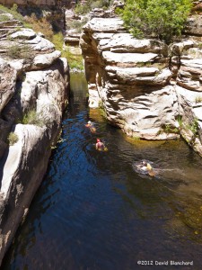
Another set of narrows and deep water in Wet Beaver Creek requiring a swim. But the water is warm and the day is hot -- so no complaints!
Another set of narrows and deep water in Wet Beaver Creek requiring a swim. But the water is warm and the day is hot — so no complaints!


These are best done in the hottest months otherwise the hypothermia factor must be considered. Finally, these are not easy miles so it takes far longer to travel than one might anticipate.

Spring snowfall at Slide Rock State Park in Oak Creek Canyon

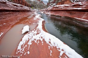
A late season storm brought snow to the high country of Flagstaff where almost a foot of snow fell over the weekend. But snow also occurred in the lower elevations including Oak Creek Canyon. Here was a final opportunity of the season to photograph new-fallen snow on the red rocks of Slide Rock State Park.

New snow on the red rocks of Slide Rock State Park in Oak Creek Canyon.

Unlike my previous snow photo shoot here back in early December temperatures were considerably warmer. (On that cold morning it was below zero in Flagstaff and only in the upper teens at Slide Rock State Park.) In fact, the temperatures remained above freezing overnight in this part of Oak Creek Canyon. This meant that the snow had been melting all night long leaving only patches on the ground. On the other hand, the relative warmth also meant that the rocks were only wet rather that covered in ice as in that previous session. So this made walking around substantially safer.

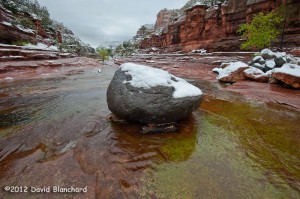
Snow covered boulder sits in Oak Creek in Slide Rock State Park.

Low clouds hung over northern Arizona that morning and the light was dull and flat as a result. Consequently the photographs don’t have the *pop* they might otherwise have if there was sunrise light reflecting off the high cliffs above the creek. Still, the juxtaposition of snow on the red rock is always worth a chance.

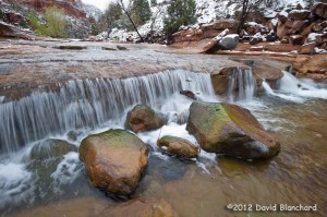
Boulders in Oak Creek in Slide Rock State Park.

Afterwards, a trip to the Indian Gardens Oak Creek Market was in order. Having a hot cup of coffee after a chilly morning of shooting is always welcome. And their bakery items are pretty good, too.

Grand Staircase-Escalante National Monument in Winter

With the winter holidays presenting a few days off from work we decided to do a bit of close-to-home travel. Our destination was Page, Arizona, and from there we could visit some photographically-interesting sites as well as do some canyon hiking.

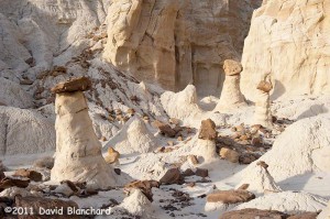
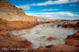
We arrived mid afternoon and headed for the Toadstools (also known as the Paria Rimrocks or the Rimrock Hoodoos), an otherworldly site that is part of the Grand Staircase-Escalante National Monument.

Located between Page, Arizona, and Kanab, Utah, it is easy to miss as there is only a small roadside sign and dirt parking lot as you travel on US Route 89. The trail is a short and easy hike of less than a mile.

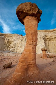
Rimrock Hoodoos ("Toadstools") in the Grand Staircase-Escalante National Monument.
Rimrock Hoodoos (“Toadstools”) in the Grand Staircase-Escalante National Monument.

From the interpretive sign at the start of the trail: “What is a Toadstool? A toadstool is a spire-like feature with a boulder perched atop a pedestal rock, like a mushroom, or ‘toadstool’. It forms when softer rock erodes away, leaving a column sheltered from the wind and water.”

Such a mundane description for what are amazing pieces of natural rock art.

Rimrock Hoodoos ("Toadstools") in the Grand Staircase-Escalante National Monument.
Rimrock Hoodoos (“Toadstools”) in the Grand Staircase-Escalante National Monument.

With afternoon light beginning to fade the colors were amazing. The downside was that it’s late December and even in the desert southwest it can get pretty chilly in the late afternoon. Finally, the sun set and the sky darkened ending an enjoyable afternoon of exploration and photography.

Late afternoon lighting across the Toadstools region.

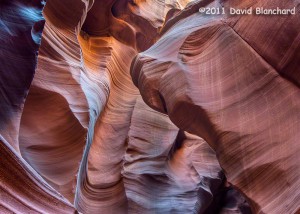
The next day was spent at the better known Antelope Canyon — a part of the Navajo Nation Parks.

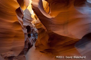
Lower Antelope Canyon, Navajo Nation Parks, near Page, Arizona. (HDR image).

We’ve been here a few times over the years but never get tired of viewing the fantastic sculpturing of the soft sandstone within the confines of this slot canyon.

Lower Antelope Canyon, Navajo Nation Parks, near Page, Arizona.

There are two distinct areas to visit: Upper Antelope Canyon and Lower Antelope Canyon. The upper canyon is much easier to walk as it has a smooth and generally flat sandy floor and is wide enough for people to move around. It is the recommended choice for those with limited hiking abilities or those that are uncomfortable in confined spaces. Lower Antelope Canyon requires moving through exceptionally narrow confines and climbing up and down steep ladders.

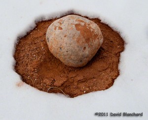
Snow melt pattern around a boulder in Catstair Canyon, Utah.

Lastly, we traveled back west towards Houserock Valley and did a short hike in Catstair Canyon. If you look carefully you will find some ancient petroglyphs on the sandstone walls of this short canyon. Far more interesting to us, however, was the snow melt pattern around this volleyball-sized boulder.