Grand Staircase-Escalante National Monument in Winter

With the winter holidays presenting a few days off from work we decided to do a bit of close-to-home travel. Our destination was Page, Arizona, and from there we could visit some photographically-interesting sites as well as do some canyon hiking.

We arrived mid afternoon and headed for the Toadstools (also known as the Paria Rimrocks or the Rimrock Hoodoos), an otherworldly site that is part of the Grand Staircase-Escalante National Monument.

Located between Page, Arizona, and Kanab, Utah, it is easy to miss as there is only a small roadside sign and dirt parking lot as you travel on US Route 89. The trail is a short and easy hike of less than a mile.
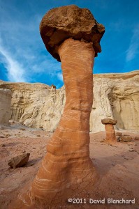
Rimrock Hoodoos ("Toadstools") in the Grand Staircase-Escalante National Monument.
Rimrock Hoodoos (“Toadstools”) in the Grand Staircase-Escalante National Monument.

From the interpretive sign at the start of the trail: “What is a Toadstool? A toadstool is a spire-like feature with a boulder perched atop a pedestal rock, like a mushroom, or ‘toadstool’. It forms when softer rock erodes away, leaving a column sheltered from the wind and water.”

Such a mundane description for what are amazing pieces of natural rock art.
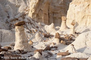
Rimrock Hoodoos ("Toadstools") in the Grand Staircase-Escalante National Monument.
Rimrock Hoodoos (“Toadstools”) in the Grand Staircase-Escalante National Monument.

With afternoon light beginning to fade the colors were amazing. The downside was that it’s late December and even in the desert southwest it can get pretty chilly in the late afternoon. Finally, the sun set and the sky darkened ending an enjoyable afternoon of exploration and photography.
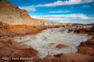
Late afternoon lighting across the Toadstools region.

The next day was spent at the better known Antelope Canyon — a part of the Navajo Nation Parks.
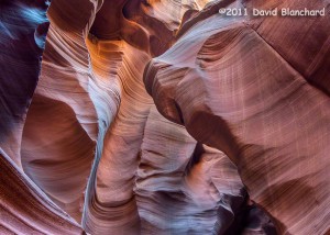
Lower Antelope Canyon, Navajo Nation Parks, near Page, Arizona. (HDR image).

We’ve been here a few times over the years but never get tired of viewing the fantastic sculpturing of the soft sandstone within the confines of this slot canyon.
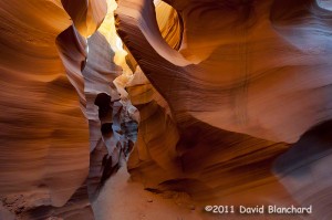
Lower Antelope Canyon, Navajo Nation Parks, near Page, Arizona.

There are two distinct areas to visit: Upper Antelope Canyon and Lower Antelope Canyon. The upper canyon is much easier to walk as it has a smooth and generally flat sandy floor and is wide enough for people to move around. It is the recommended choice for those with limited hiking abilities or those that are uncomfortable in confined spaces. Lower Antelope Canyon requires moving through exceptionally narrow confines and climbing up and down steep ladders.
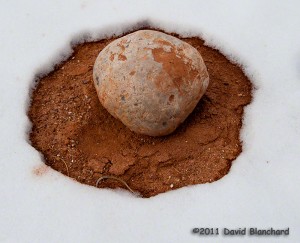
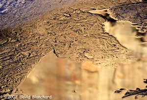
Snow melt pattern around a boulder in Catstair Canyon, Utah.

Lastly, we traveled back west towards Houserock Valley and did a short hike in Catstair Canyon. If you look carefully you will find some ancient petroglyphs on the sandstone walls of this short canyon. Far more interesting to us, however, was the snow melt pattern around this volleyball-sized boulder.
A Winter Visit to West Fork Oak Creek Canyon

Winter has settled in across northern Arizona with snow covering the ground and ice in the canyons. This is a beautiful time of the year for photography if you do not mind being cold while finding that special location.

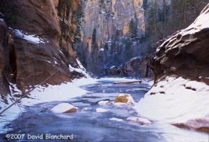
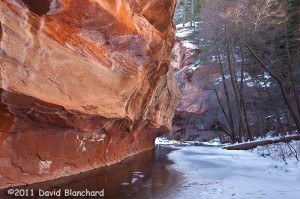
Bare trees...rock walls...and ice covered streams in West Fork Oak Creek.
Bare trees…rock walls…and ice covered streams in West Fork Oak Creek.

We hiked up the West Fork of Oak Creek Canyon on a well-traveled but snow-packed and icy trail. Some sort of boot traction (e.g., YakTrax, Kahtoola) would have been useful but with care and an easy pace we were able to move about without any difficulties. The water level in the creek was about normal making for fairly easy stream crossings. And there are quite a few.

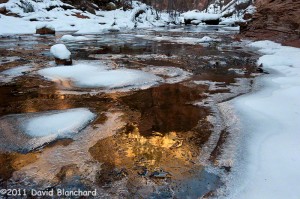
Reflections of canyon walls in West Fork Oak Creek.

The afternoon sun bouncing off the high canyon walls and then reflected in the water created the right setup for photographs and all that was needed was some interesting ice to complement the scene. We found plenty.

Canyon wall reflections and delicate ice in West Fork Oak Creek.

This is a moderately high-walled canyon and very little direct sun shines down on the canyon floor so that it remains quite chilly even in the afternoon. As long as we kept moving we stayed warm. Stop to take a picture — and get cold.

Deep shadows in the narrows of West Fork Oak Creek.

But it was worth it.

Night hiking in the Grand Canyon

We recently took a “day” hike in the Grand Canyon — except that much of the hike was in the dark. We left Flagstaff around midnight and arrived at the South Kaibab Trailhead at 1:30 a.m. and began our descent in the dark.

The moon was already past 3rd quarter and had not yet risen. But the skies were exceptionally clear and the stars were brilliant. There was almost enough light from the stars to hike down. Almost, but not quite.

So we did the safe thing and used our headlamps to light the trail.

Normally, the South Kaibab Trail is quite busy with hikers. The constant low hum of people talking to each other mixes with the normal daytime sounds of birds and of aircraft flying high overhead (or, sometimes, not so high overhead).

But there was none of that. Just the gentle sighing of the wind and even that began to diminish as we descended from the rim.

The Orionids meteor shower was nearing its peak (still a day away) but we saw plenty of meteor action during the pre-dawn hours. There would be extended lulls followed by a brief flurry of streaks across the sky. We spent so much time looking up that we made only slow progress going down.

At Tip Off Point, we turned onto the Tonto Trail and slowly made our way westward as the first hints of twilight began to appear in the eastern sky. With first light, I began to shoot some photographs of the cliffs of both the South and North Rims and of the side canyons.

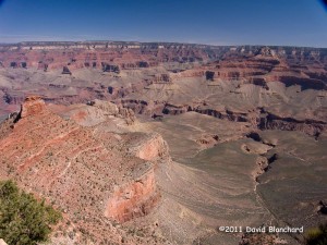
Early morning light on the South Rim of the Grand Canyon.

As we reached the Bright Angel Trail near Indian Garden, the sun had risen and people were out and about on the trail heading both up from Phantom Ranch and down from the Rim. The low hum of many conversations permeated the air and the heavenly silence we had experienced over the past few hours came to an end.

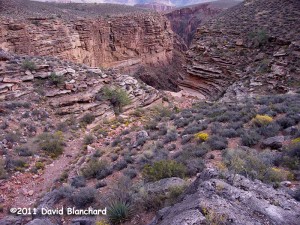
Pipe Spring Canyon - a side canyon of Grand Canyon.
Pipe Spring Canyon – a side canyon of Grand Canyon.

After a short jaunt out to Tonto Point — where we once again had silence — we finished our “day” hike by ascending the Bright Angel Trail.

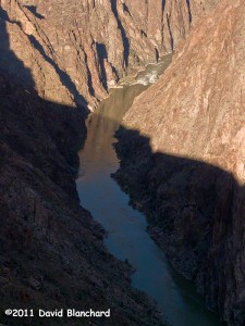
The Inner Gorge of Grand Canyon as seen from Tonto Point.

Autumn in the High Country of Northern Arizona

It’s that special time of year in northern Arizona. The thunderstorms and cloudy days of the summer rainy season are history and have been replaced with day after day of perfect weather. Warm days. Cool nights. Cloudless skies. Light winds.

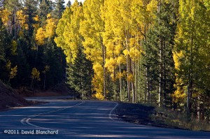
Fall colors near Aspen Corner on Snowbowl Road.

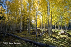
And, of course, the leaves are changing colors.

The view along the road is spectacular.

It’s mid-October and the colors have hit their peak at the higher elevations of the Kachina Peaks. Lower down, the colors are quickly approaching their peak. But it won’t last long. All it takes is one windy day or another hard freeze and it will be over for this year.

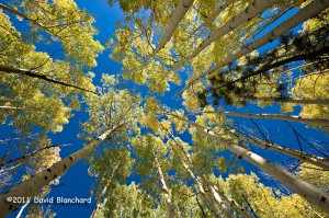
Everyone has an aspen image that looks like this!.You should have one, too!

I took some time early this morning wandering around the aspen along Snowbowl Road and found some groves in full color. Interestingly, a few groves were still green and a few others were already done. But most were hitting that perfect peak.

Hiking the Grand Canyon: Rim to Rim* to Rim

I have always wanted to hike the Rim-to-Rim-to-Rim traverse of the Grand Canyon. That is, start at one Rim, hike down to the Colorado River, hike up to the opposite Rim, then reverse back to the beginning.

From the South Kaibab Trail the North Rim is a long ways away...
From the South Kaibab Trail the North Rim is a long ways away…

I’ve done a single traverse before from the North Rim to the South Rim but never the R2R2R as it’s called. On the other hand, my significant other has done it a couple of times and keeps asking me to join her. So last week we set out to walk (WALK, not RUN!) the R2R2R of the Grand Canyon. We started mid morning on the South Rim and descended the South Kaibab Trail. Being in no hurry, we took a comfortable pace so that we could actually enjoy the hike and scenery. The weather was pleasant: clear skies, breezy, a bit cool at the top and a bit warm at the bottom.

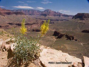
There were many flowers in bloom along the trail. This is "Prince's Plume."
There were many flowers in bloom along the trail. This is “Prince’s Plume.”

After a refreshing stop at Phantom Ranch where we had lunch and drank plenty of fluids we began the hike up the North Kaibab Trail to the North Rim. The last of the spring snowmelt was rushing down Bright Angel Creek and the roar of the water was loud enough to make conversation difficult. Crossing the stream would have been foolish but there is no need: all crossings have well- built bridges.

Still a long way to go to reach the Colorado River.

By the time we reached Cottonwood campground it was time to eat again and we had dinner as the sun slipped below the high walls of Bright Angel Canyon. The wind, which normally diminishes in the evening, became stronger. First it was annoying, then it became strong enough to blow dirt. Finally, as we were a mile or so above Roaring Springs, the wind nearly blew me off my feet. The sun had already set and it was quite dark as we climbed this part of the trail. It’s narrow with substantial cliffs on the side. The thought of being blown off my feet and… well, you know… was unnerving. So, with only about 3 1/2 miles to go, we decided to err on the side of safety and we turned back.

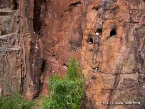
Rock art in Bright Angel Canyon. Hikers had placed these small stones in the canyon wall.

We walked in the dark until about midnight and then took a nap on a queen-sized flat rock. Never thought I could fall asleep on a rock but it was easy. I awoke to stare at the stars and listen to the thundering of the water in Bright Angel Creek. What a magnificent place to be! Just the two of us — and whatever wild creatures may have been watching us.

We walked back to Phantom Ranch and the Colorado River and then began the difficult climb back up South Kaibab Trail. About halfway up we had a magnificent sunrise. Not too much later we saw some long-distance runners heading downhill towards us. We chatted for a minute and gave them some information on trail conditions. And then they were off.

If we had done this a day earlier, we would have seen two women running R2R2R in an attempt to beat the “Fastest Known Time” for women on this trail. And they succeeded!

And just a few days later the record was broken again!

I’m happy to walk the R2R2R. Running not required.