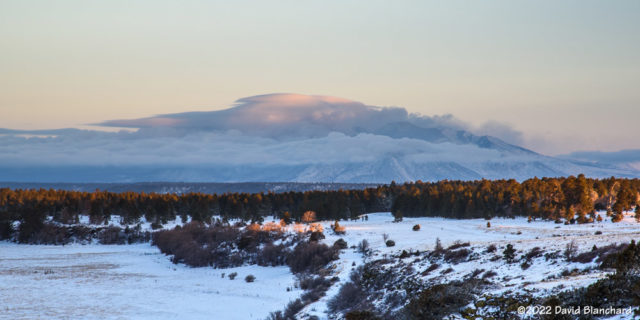
Monsoon Storms–July 2022

As noted in a previous post we had an early start to the North American Monsoon which brought thunderstorms and rain to northern Arizona in the second half of June. This was most welcome as it had been a very dry spring. Then we went into a down period for the first third of July with very little activity. That was completely reversed as we entered a period of very strong monsoon activity which brought frequent heavy rains and flash flooding.

So the first part of July had few targets. The remainder of July had above normal amounts of total precipitable water and very high surface dewpoints which produced an environment with mostly cloudy skies and very low cloud bases. None of this is particularly conducive to photographing storms with beautiful light (i.e., golden hour, blue hour). Nonetheless, if you head out often enough you will get some good photographs.

A cluster of late afternoon storms that lingered into twilight produced some beautiful lightning over the San Francisco Volcanic Field.
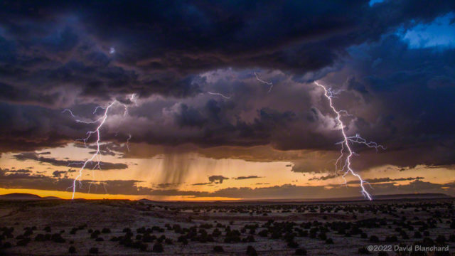
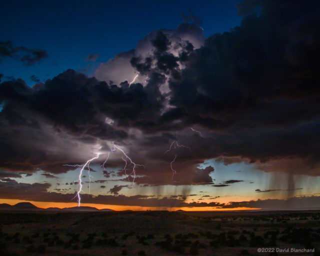
An isolated thunderstorm produced lightning at sunset over the San Francisco Volcanic Field.

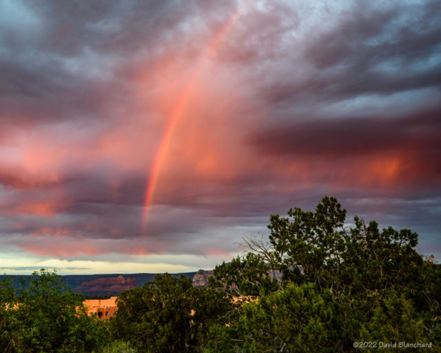
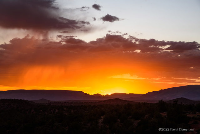
This day in Sedona produced very little lightning but did get a nice sunset and a partial rainbow.
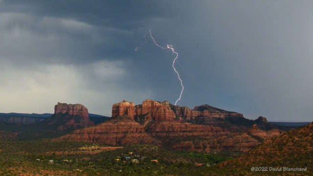
Lightning beyond Cathedral Rock in Sedona, Arizona.
A brilliant and colorful sunset in Sedona, Arizona.
As the sun set, a partial rainbow formed.

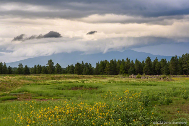
Convection often starts early over the elevated terrain of the San Francisco Peaks. These storms eventually produced flash flooding over recent wildfire burn scars.
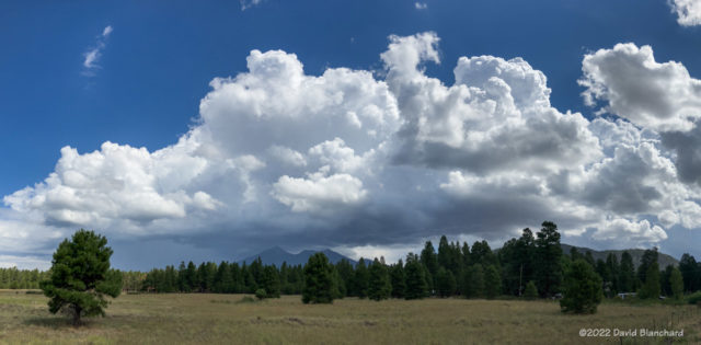
Convection starts early over the peaks.

Convective towers mix with laminar wave clouds over the San Francisco Peaks. Shot from Marshall Lake–now just a dry grassland.
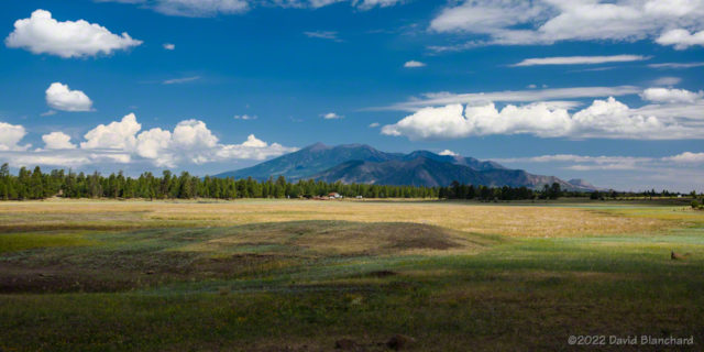
Morning convection and wave clouds over the San Francisco Peaks.
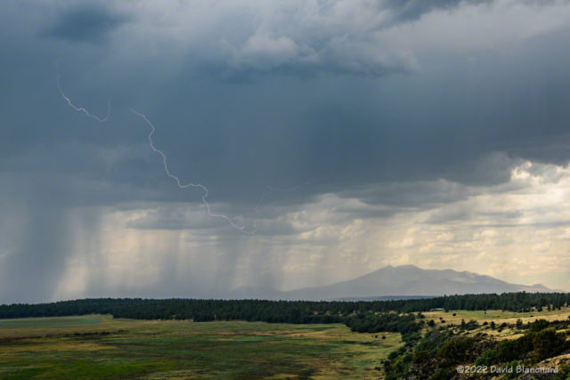
A cloud-to-cloud lightning flash over Mormon Lake, Arizona.

Sometimes you don’t have to travel any farther than your back porch to see lightning.
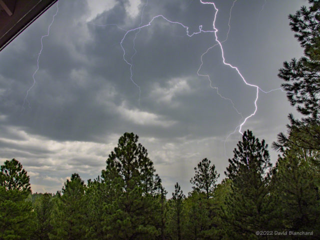
Lightning from my back porch.

After several days of heavy rain and high dewpoints fog would form in the shallow basins. But getting photos of fog at sunrise in July means a very early start!
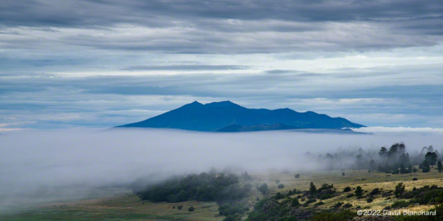
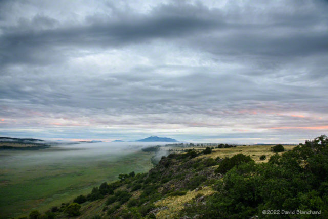
Morning fog with the San Francisco Peaks in the distance.
An example of what happens with too much moisture: overcast skies and low cloud bases.
Sunset panoramic image from Flagstaff.

Maybe August will be better. The photo above is a sunset panorama (10 images stitched together) taken on the first day of August.

 

Sunset panorama

Sunset panorama over Flagstaff.

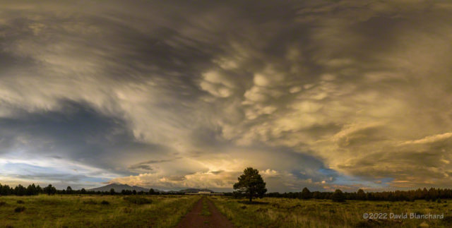
Yesterday (01 August) had only scattered thunderstorm activity for much of the day. However, radar indicated a weak convergence boundary near Flagstaff so there was a chance of late afternoon storms developing close by. And so it did happen.

A strong storm was located east of Flagstaff just before and after sunset. As the sun dropped to the horizon the underside of the storm and anvil cloud was lit with golden hour light. This is a panorama of that view. It was taken with a ultra-wide-angle lens in portrait mode with ten individual images that were stitched together.

Beautiful!

tau Herculids Meteor Shower

There were plenty of caveats associated with the tau Herculids meteor shower. It could be a full-blown meteor storm or it could be a total bust. But there was a third possibility; not a meteor storm but a shower, or maybe a drizzle.

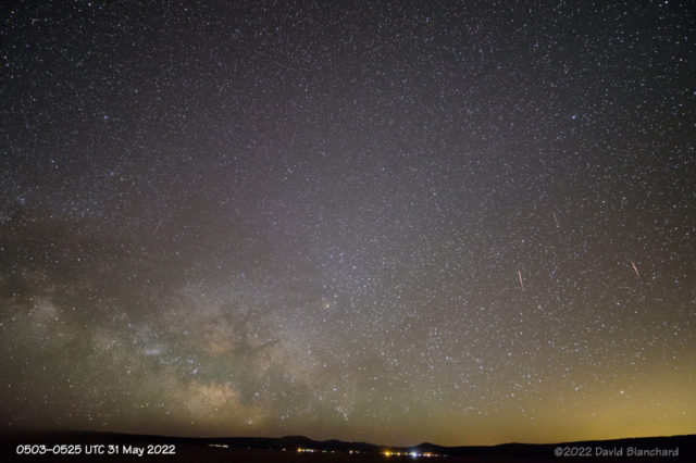
View of the Milky Way and several tau Herculids meteors.
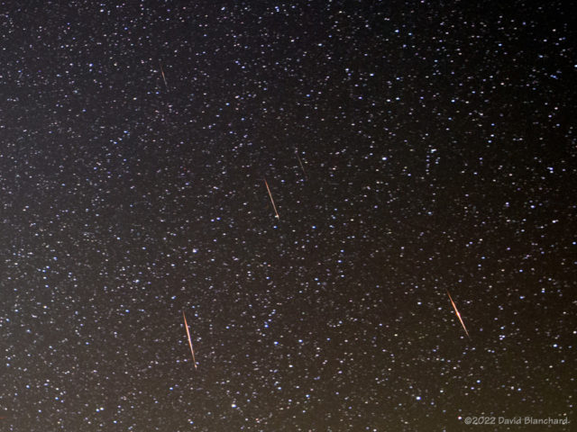
Cropped view of the three brightest tau Herculids meteors.

Of course I was hoping for the storm but was quite happy with the shower. I had a few ideas of how to shoot this but ended up going with the Keep It Simple concept. I ended up at a viewpoint on the west side of Mormon Lake and aimed the camera at the rising Milky Way.

A review of my images showed that I captured three very bright meteors and another six that were fairly dim. The first image is a composite of those images and shows the entire field of view from the ultra-wide 17mm lens. It has a field of view of 93° x 70°.

The next image is a tight crop of the three brightest meteors that also shows two dim meteors.

Time-lapse video of the three brightest tau Herculids meteors and some persistent smoke trails.

Finally, there is a time-lapse video of the three brightest showing the persistent smoke trails from two meteors.

It was a fun evening.

Edit: Fixed error in the field of view values.

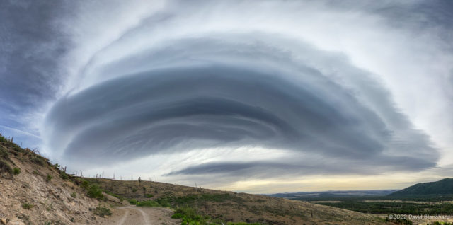
Wave Cloud over the San Francisco Peaks

We had an interesting wave cloud over and downwind of the San Francisco Peaks on Saturday. I first noticed it as I left the house driving to a trail run on Waterline Road in the San Francisco Peaks north of Flagstaff.

Wave cloud over the San Francisco Peaks, Arizona.

The view from the parking lot and trailhead was partially obscured by trees but I knew that sections of the Waterline Road had a wide-open view. And, so, I found a view that I really liked with the wave cloud, road, and distant cinder cones.

I shot this as a set of five vertical panoramas on my iPhone. I then imported these into Affinity Photo to create a horizontal panorama (a panorama of panoramas!).  Finally, I used some warp transformation in AP to fix the horizon (i.e.; make it straight instead of curved) and the corners.

Five vertical panorama images used to create the final image.

Oh, and the run was fun, too!

March Snow in northern Arizona

Another winter storm moved across northern Arizona on Friday and Saturday dropping several inches of snow. Clouds began to clear Sunday morning just before sunrise setting up the possibility of a great sunrise. Well—it was a great sunrise at my location but a small patch of low clouds blocked the sun from shining on the San Francisco Peaks.

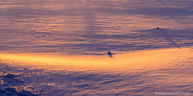
First light illuminates freshly-fallen snow.

Time to shoot photos of something else. Here is an image as the first sunlight hits the snow in front of me. The sun angle is so low that the slightest undulations in snow create long shadows.

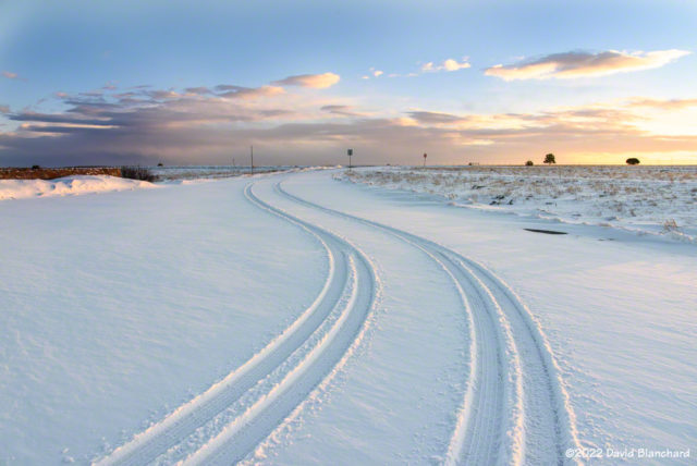
Tire tracks in the snow.

Tire tracks in snow are interesting, aren’t they? Taken just a few minutes later as a bit of cloudiness moved in front of the sun.

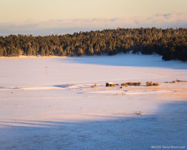
Old ranch buildings near Mormon Lake.

There are a couple of old buildings in the meadow near Mormon Lake and the sun and clouds provide a natural spotlight on the old ranch.

Clouds blow across the top of the San Francisco Peaks in the wake of a departing storm.

Here is an image of the San Francisco Peaks with just a bit of light striking the highest clouds.

Finally, a short time lapse video of the peaks and clouds. Note the sinking motion along the eastern edge of the peaks as well as the hydraulic jump farther downstream.