Snow in the Desert

Snow in the desert is amazing. Desert plants and red rocks are covered with snow and birds are just a bit bewildered by the whole experience.
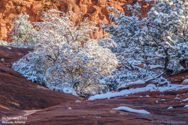
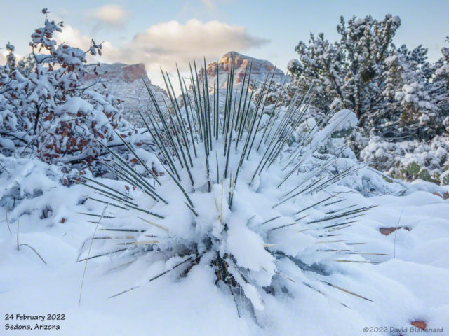
Red rocks and snow covered trees near Sedona.
Snow-covered desert plants near Sedona.

A very cold storm system moved across Arizona on Tuesday and Wednesday and snow levels fell well below 4000′ feet bringing snow to the higher deserts including Sedona. I was pretty certain I was going to make the trip to Sedona for sunrise on Thursday morning.

Around 3 a.m. the snow plows came through the neighborhood pushing up a 2 foot berm of ice and  snow that would need to be cleared before I could get out of the driveway. Classic—happens just about every time!

Once in Sedona I followed a trail that had not seen any human traffic since yesterday but there were coyote tracks. I never saw the critter and it was probably just as well.
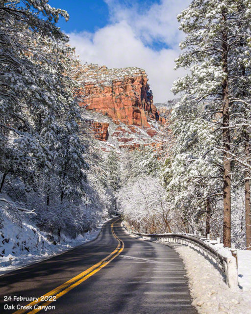
New snow covers red rock and trees in Oak Creek Canyon.

The snow in Sedona will be mostly gone within a day or two.
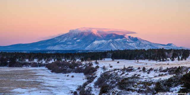
Cap Clouds over the San Francisco Peaks

A fast-moving storm system passed over northern Arizona on Wednesday. Snowfall amounts were generally 2–4 inches in the higher terrain of Coconino County and 2–6 inches in eastern Arizona. Clouds exited the region overnight leaving clear skies in the Flagstaff area. A check of satellite data suggested some clouds over the San Francisco Peaks so I headed out for some photos and video of the sunrise.

First light on the cap cloud atop the San Francisco Peaks (0712 MST 17 Feb 2022).
Sunlight illuminating both clouds and snow-covered peaks (0716 MST 17 Feb 2022).

There was a cap cloud over the peaks that was generated by strengthening northeasterly flow moving into the Inner Basin and rising over the summits. The cloud could be seen dissipating as it moved down the southwest flanks of the mountains.

Time-lapse video of the sunrise on the cap cloud atop the snow-covered San Francisco Peaks.

I shot video using a Sony RX10—but the battery gave out sooner than expected owing to the cold (+14 °F; –10 °C). Still, I was able to get about 24 minutes and then compressed this down to about 11 seconds.

Another storm seems likely next week.

Sunset Over the San Francisco Peaks

Bands of snow showers moving across the San Francisco Peaks. In its wake, sunlight illuminates both clouds and some of the snow still falling.

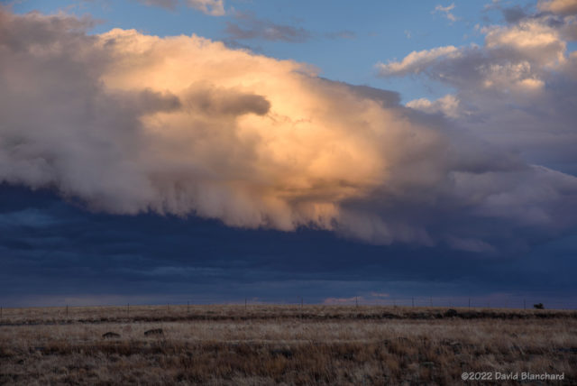
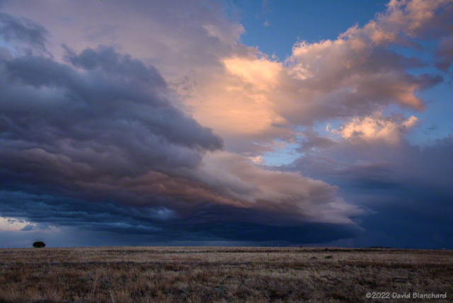
Tuesday afternoon brought the passage of a weak cold front across northern Arizona. It was mostly clear much of the day but by late afternoon clouds were increasing and spreading southward. Because there was a distinct west edge to the clouds it was likely that the setting sun would be able to illuminate the overhead clouds.

As the band of convective snow showers progressed southward it took on the characteristics of an outflow boundary and even developed a bit of a shelf cloud on the leading edge.

Convective cloud band with a small shelf cloud beginning to develop.
The setting sun illuminates the convective cloud band.

As the sun dropped lower in the western sky this cloud band briefly took on the colors of sunset.

Time lapse video showing the southward progression of the convective snow showers.

And, then, a few minutes later the light was gone.

Atmospheric River Over Arizona

We had a very wet period from late afternoon Thursday through early evening Friday (12/23-12/24) as an atmospheric river (AR) moved across the southwest and Arizona. From the Wikipedia site:

An atmospheric river (AR) is a narrow corridor or filament of concentrated moisture in the atmosphere. Other names for this phenomenon are tropical plume, tropical connection, moisture plume, water vapor surge, and cloud band.

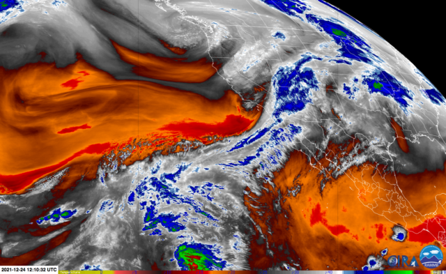
GOES-17 water vapor channel showing the moisture plume.

An approaching trough of low pressure was able to tap into tropical moisture and move it across the southwest into Arizona overnight. Interestingly, the moisture plume aloft initially moved above a drier layer of air. Precipitation falling into this drier air experienced strong wet bulbing and evaporative cooling which lowered snow levels to ~6500 feet—putting Flagstaff into the snow. As the plume continued, these cooling effects diminished and the snow turned into rain. So we had about 4-6″ of snow followed by day-long rain. What a mess.

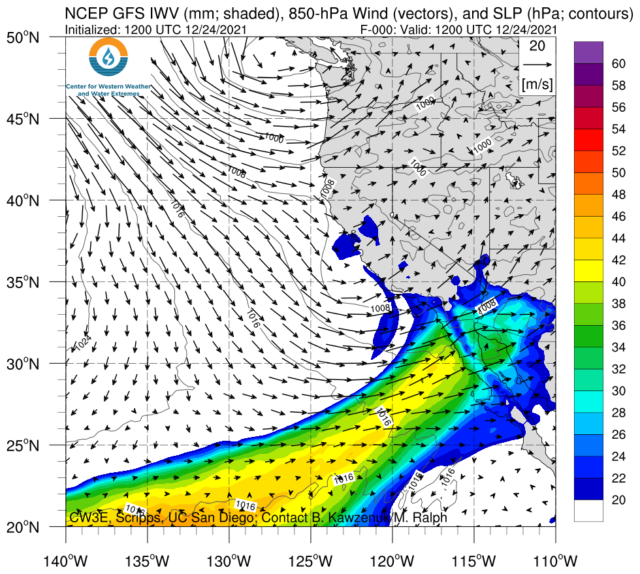
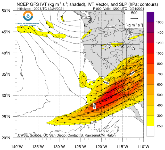
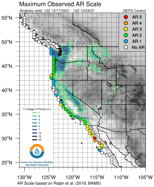
The Center for Western Weather and Water Extremes provides forecasts for ARs moving into the West. Below are some of the products valid at 5 A.M. Friday (12/24/2021) that clearly show the plume of moisture.

Integrated water vapor (iwv): Note how the moisture is depleted as it crosses the Mogollon Rim with very little moisture available across NE Arizona.
Integrated vertical transport (ivt)


Maximum observed AR scale.

It’s great to get all this moisture although it would have been much better if had been either all rain or all snow. Mixed precipitation is always a mess.

Comet C/2021 A1 (Leonard)—III

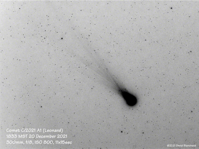
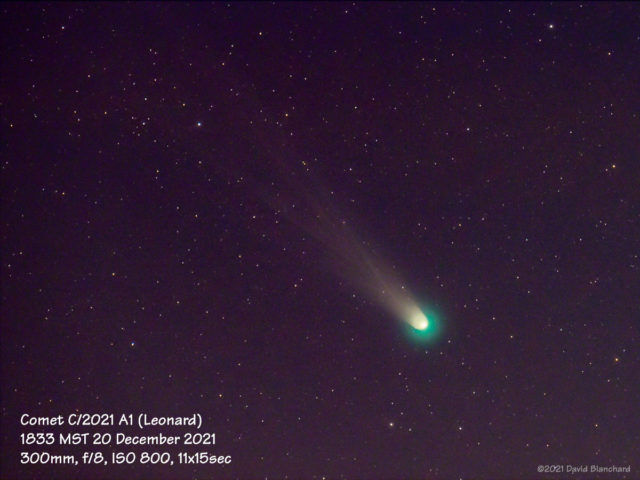
Comet C/2021 A1 (Leonard) remains a visually interesting object in the evening twilight. It is only visible for short time each evening between the time it gets dark enough to see it and when it gets too low on the horizon and is obscured by dust or clouds.

Comet C/2021 A1 (Leonard) at 1833 MST 20 December 2021. Image has been inverted to help show the fine structore of the tail.
Comet C/2021 A1 (Leonard) at 1833 MST 20 December 2021.

The comet has undergone a rapid brightening in the past few days. From Spaceweather.com:

The outburst might signal a fragmentation event in the comet’s core. This would come as no surprise. The comet is heading for its closest approach to the sun (0.61 AU) on Jan. 3rd. Increasing heat may be liberating new jets of gas and dust from the comet’s core—or worse, blowing away huge chunks of ice and rock.

There have been numerous magnificent images posted to the Spaceweather.com website:

In the southwest we are heading into an extended period of cloudy skies with rain and snow so it is unknown when I will get another chance to shoot photographs of the comet.