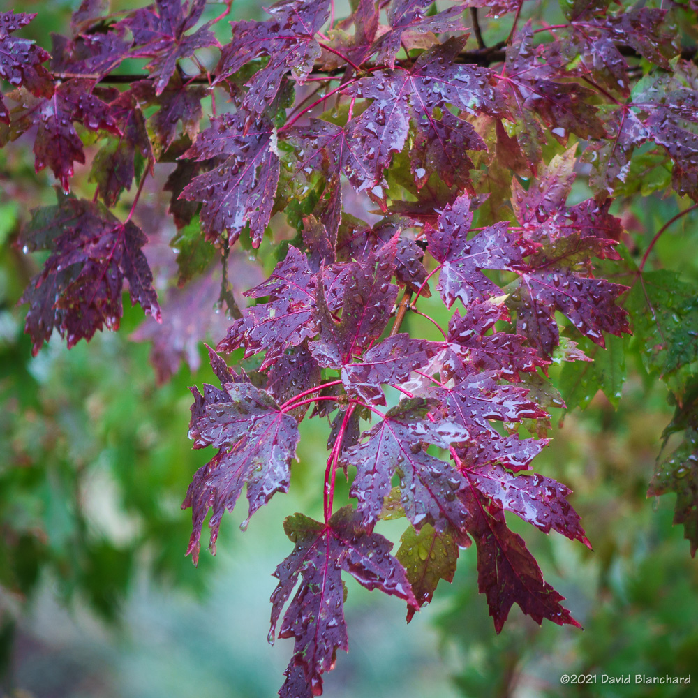
Last week we headed down to Sedona for a trail run. Because of a recent rain event followed by a very cold night there was frost on the ground and some of the vegetation. Especially wonderful was the spiky frost on many rocks and tree roots.
Spiky frost on a small rock.Frost on an exposed root.Frosted plants.
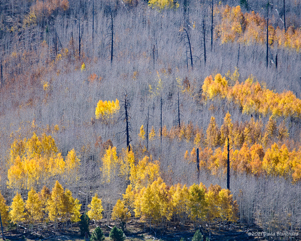
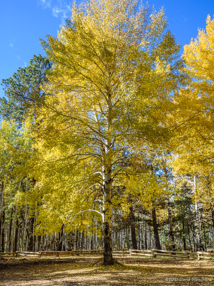
The changing color of aspen leaves has peaked in many locations — and just now peaking in others. It’s always interesting to see which areas go early and which hang on until later.
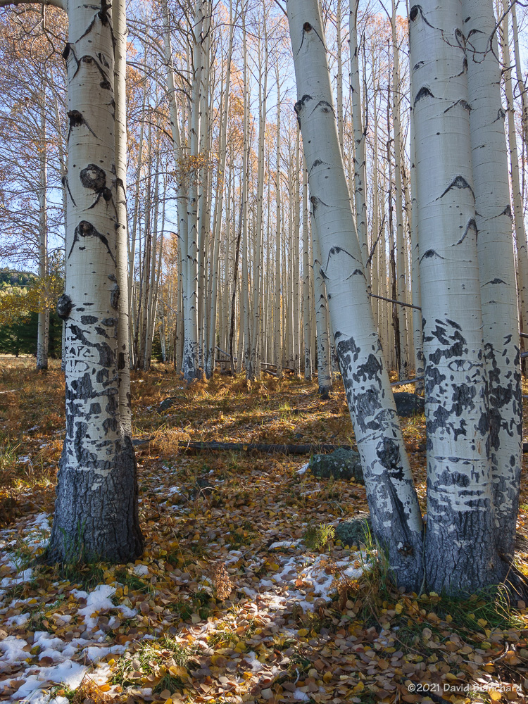
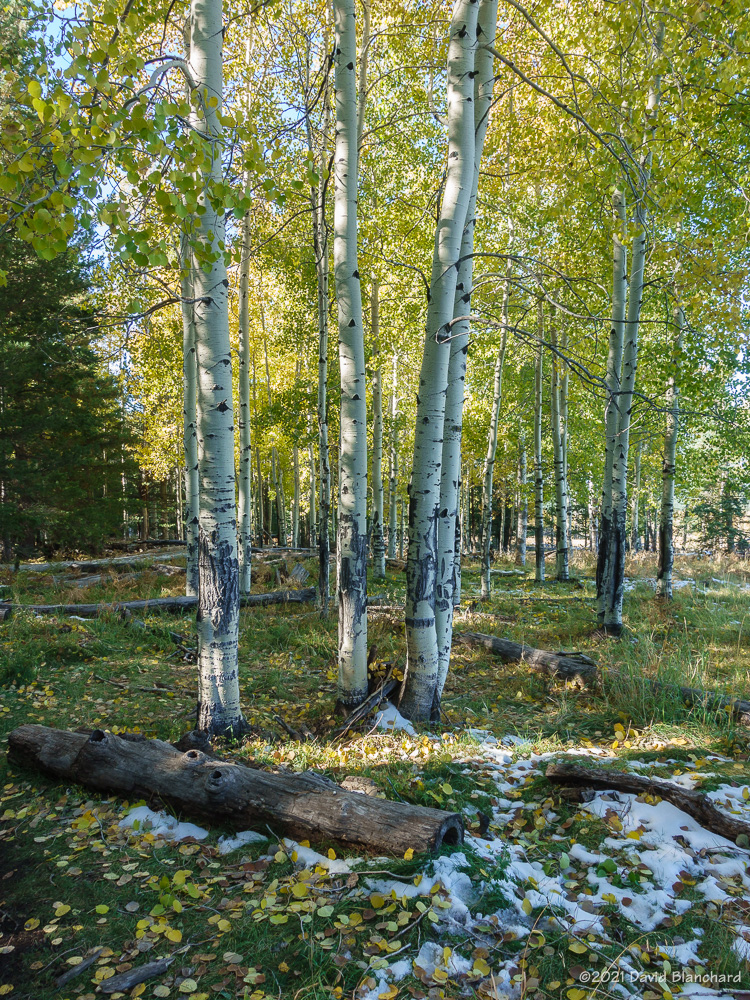
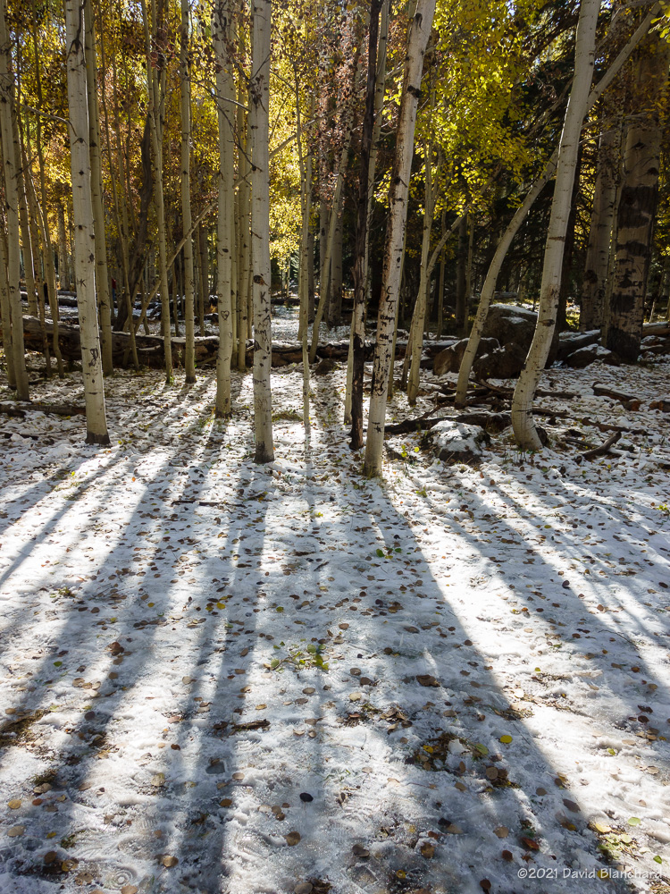
Here are some photos of aspen around northern Arizona this past week.
Going, going… (Hockderffer Hills near FR151.)Arizona Trail near Hart Prairie.Arizona Trail.Aspen trees with shadows.Aspen trees at Aspen Corner on Snowbowl Road. (Notice how many trees have been scarred from folks carving their initials in the bark.)Forest Road 151.A tunnel through the trees on FR 151.
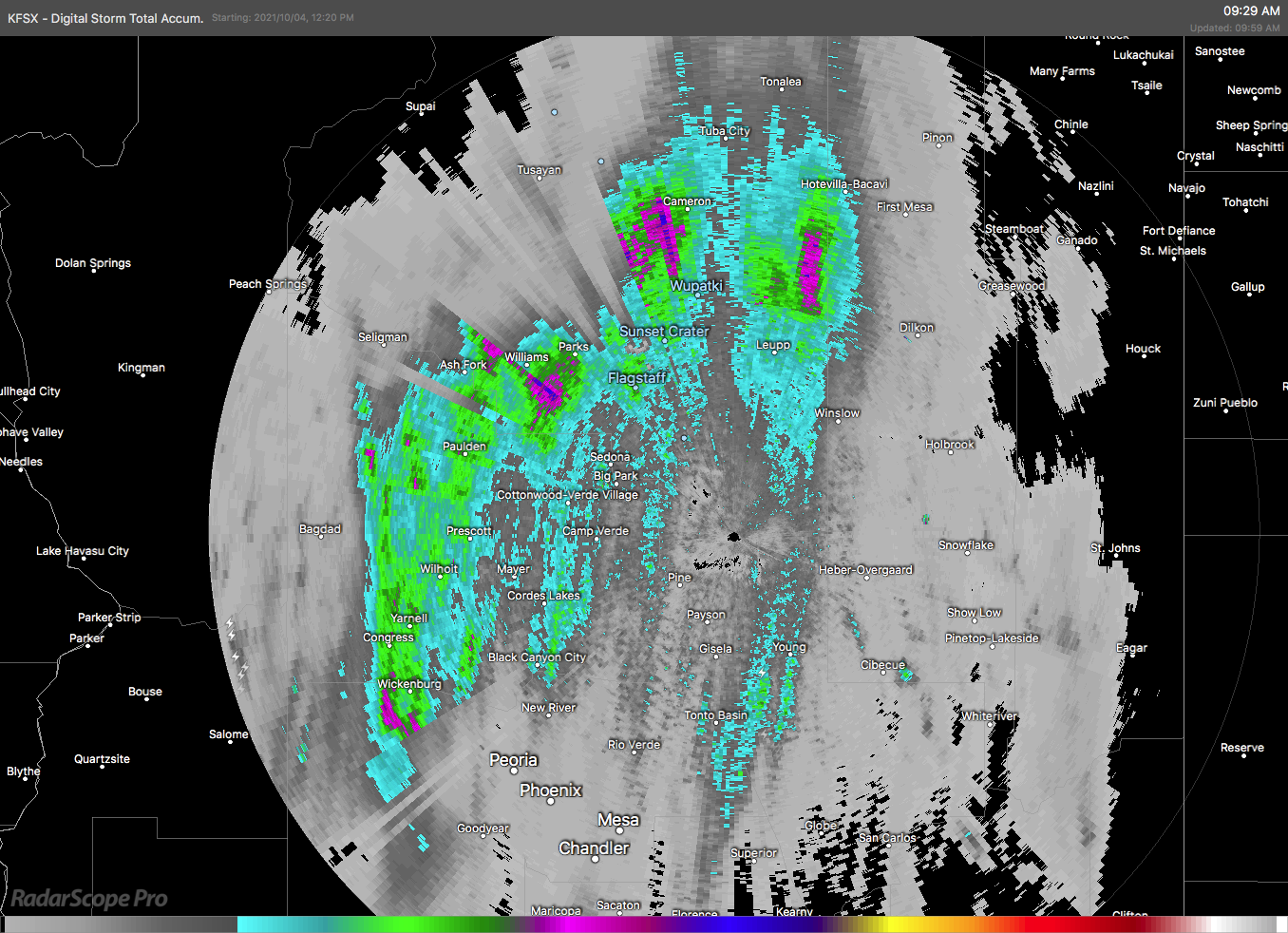
A potent weather system moved across Arizona on Tuesday, October 5, 2021, and produced a variety of weather including tornadoes, large hail, heavy rain, and flooding. This system was well forecasted and the various models did a very good job depicting the possibilities.
Radar-estimated rainfall amounts across Arizona on Tuesday morning.
Areas of moderate rain moved across Arizona in the pre-dawn hours with many locations receiving more and one inch of rain by sunrise.
There had been some expectations that the severe weather would commence before sunrise owing to the favorable vertical wind profiles. Both the low-level shear and deep-layer shear supported organized thunderstorms with the possibilities of rotating supercells and even tornadoes. That scenario did not manifest probably because the widespread overnight rain cooled the boundary layer enough to inhibit strong thunderstorm development.
The forecast models also suggested a second period of severe weather was possible in the afternoon as temperatures warmed and buoyant instability increased across the area.
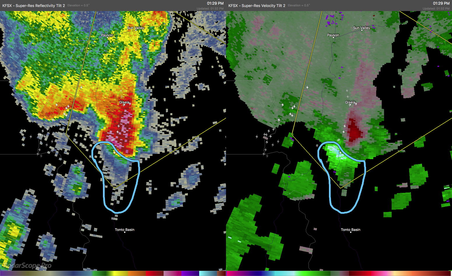
Severe thunderstorm with a Three-Body Scatter Signature (TBSS; also known as a “hail spike”).Severe thunderstorm with a hook echo (left) and strong velocity couplet (right). The box indicates that a Severe Thunderstorm Warning is in effect for this storm.Severe thunderstorm continues to show a hook echo (left); on the right is Correlation Coefficient where low values may indicate tornadic debris. The warning has been upgraded to a Tornado Warning.
Strong thunderstorms developed across the desert regions of central and southern Arizona in the afternoon. These moved quickly to the northeast and into the higher terrain of the Mogollon Rim and Tonto Rim. At least two of these thunderstorms began to acquire supercellular characteristics and began to show rotation signatures in the Dopper radar data. By mid afternoon, one storm had developed a well-defined hook echo and velocity couplet. This storm was already producing strong winds and hail and a Severe Thunderstorm Warning (SVR) was already in effect. As the rotation rapidly intensified, the SVR was replaced with a Tornado Warning (TOR). Polarimetric Dopper radar data indicated low values of Correlation Coefficient (CC). This often accompanies tornadic debris lofted into the air. This was clearly a dangerous storm and the TOR was justified.
Multi-Radar Multi-Sensor (MRMS) depiction of large hail swaths.MRMS rotation tracks associated with the tornado.
Eventually, the rotation weakened but the storm was still producing large hail as it moved northeastwards. Other storms also produced large hail. The Multiple Radar Multiple Sensors (MRMS) data shows these long swaths of large hail across portions of Arizona.
Forecasters from the National Weather Service offices in Arizona did a great job of anticipating this severe weather event and issuing timely warnings.
It is now September and we are in the so-called “transition season” as the North American Monsoon weakens and stronger baroclinic weather systems begin to traverse the southwestern states. From a paper presented at the 23rd Severe Local Storms Conference (2006):
Outbreaks of severe thunderstorms in northern Arizona are most likely to occur during the transition between the moist, tropical environment of the warm-season North American Monsoon regime and the first incursions of mid-latitude baroclinic systems in September. The presence of copious tropical moisture, combined with increased convective instability and deep-layer shear, is supportive of long-lived supercells which are responsible for most of the severe weather.
Supercells are more common during the transition season than other times of the year in northern Arizona. Tornadoes—especially long-lived, damaging tornadoes—are more likely to occur during this brief period. This is from a paper presented at the 24th Severe Local Storms Conference (2008):
The results show that more than half of the tornado days occurred during the approach of a closed low from the eastern Pacific with northern Arizona located in the warm sector of the northeast quadrant of the low. The closed lows produced environments with deep-layer shear and low-level shear comparable to the 3rd and 4th quartiles of tornadic environments discussed by Rasmussen and Blanchard (1998) while instability was small and was comparable to or less than their 1st quartile. These interesting results suggest that shear may be the more important factor and that instability need only be sufficient to initiate and maintain convection long enough for the shear to act upon the updrafts.
While tornadoes in northern Arizona are more likely to occur during the transition season they are still uncommon (a notable exception was the October 2010 outbreak) and several years may pass without any tornado events. Supercells, on the other hand, are more common and at least a few can be expected each year during the transition.
Below are composite means of 500-mb geopotential height, 700-mb v-wind component, and surface Lifted Index for the tornado events.
Composite 500-mb height field for the 19 tornado event days.Composite 700-mb v-component of the wind field.Composite surface-based Lifted Index field.
Will we have a closed-low, transition-season type of event this year?