Wave Cloud over the San Francisco Peaks

We had an interesting wave cloud over and downwind of the San Francisco Peaks on Saturday. I first noticed it as I left the house driving to a trail run on Waterline Road in the San Francisco Peaks north of Flagstaff.
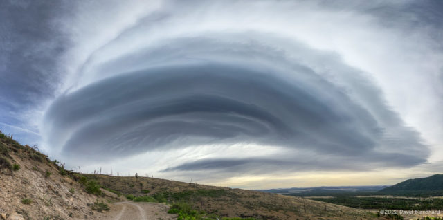
Wave cloud over the San Francisco Peaks, Arizona.

The view from the parking lot and trailhead was partially obscured by trees but I knew that sections of the Waterline Road had a wide-open view. And, so, I found a view that I really liked with the wave cloud, road, and distant cinder cones.

I shot this as a set of five vertical panoramas on my iPhone. I then imported these into Affinity Photo to create a horizontal panorama (a panorama of panoramas!). Ā Finally, I used some warp transformation in AP to fix the horizon (i.e.; make it straight instead of curved) and the corners.

Five vertical panorama images used to create the final image.

Oh, and the run was fun, too!

Running and Hiking in Sedona

Here are a few photographs taken on some recent hikes and trail runs in Sedona.

First was a hike across the top of Mescal Mountain. There are well-defined trails that go around the mountain but only faint tracks that go up and over the top. There are even a few spots that require some basic rock climbing moves—but nothing too difficult.

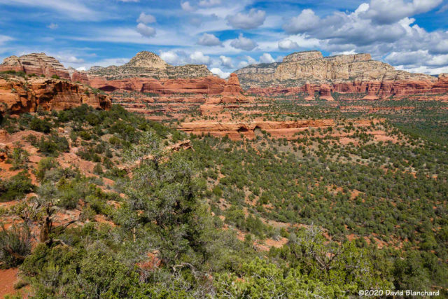
View from the top of Mescal Mountain towards Long Canyon.
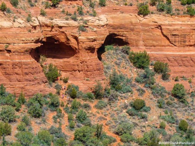
Zoomed in view of the northern ridge of Mescal Mountain with some caves.
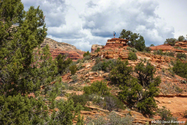
Hiker atop Mescal Mountain.

From the top of Mescal Mountain one can see across Long Canyon into the Red Rock-Secret Mountain wilderness area. One can also see two dark openings in the middle distance. The one on the left is the so-called “birthing cave.” Note in the second image the crowd of people entering and leaving the site.

Striations and channels in the rocks in Dry Creek.
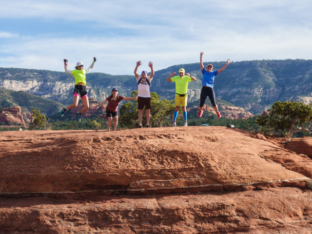
Jumping at the far point of the run.

A few days earlier a small group of trail runners had done “Earl’s Loop” trail run. You won’t find this on any modern maps but you might find it on some older maps. It does not see much traffic and the trail is faint in spots but it has some great views into the Red Rock-Secret Mountain wilderness area. And, of course, the obligatory group jump— with some jumping on the count of 2 instead of 3.

Edit: added another photo.

Spring Snow — 2018 edition

Spring snow. It seems to happen fairly often around here. We just had a May storm that dropped snow on the new crab apple blossoms. I’ve written similar blogs before in 2014 and 2015Ā and there have been other events in recent years.

The NWS recently posted a tweet that shows 54 years out of 118 (46%) have had snow in May. So—not rare at all. Quite pretty, in fact.

Here are a few images of the snow sitting on crab apple and forsythia blossoms plus the not-quite-blooming iris.

Snow and crab apple blossoms.
Snow and forsythia blossoms.
New snow on iris.
New snow on iris.

Most of the snow was gone by afternoon. The next morning we did a trail run up Schultz Creek Trail. It’s a shady location and there were still patches of snow. After many weeks of running on dry, dusty trails the damp trail that morning was fun.

Trail run on Schultz Creek Trail.

Water in the desert

It has been a wet autumn with precipitation amounts well above average for both the month and season. This has resulted in water flowing in some of the small seeps, springs, and streams in the Red Rock country of Arizona.

After a trail run earlier last week to view the water in the desert I returned a second time with photographic intentions. I was particularly interested in the tinajas located in a small side canyon. There had been running water—albeit a slow trickle—on that first trip and I was interested in capturing images of the water.

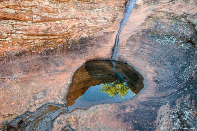
Brilliant blue skies above a series of small tinajas. The largest tinaja at the base of the pouroff is aboutĀ 2 metersĀ in diameter.

Although only a few days had passed between trips the flow of water had noticeably diminished; it will likely take another substantial rain event to bring the water levels back.

Sky and trees are reflected in the tinaja.

Even so, the tinaja was still full of clear water and made for an excellent subject with bright sunlight in the morning and soft shadows in the afternoon.

A water seep in the wall allows ferns to grow---and a small tree as well.
A water seep in the wall allows ferns to grow—and a small tree as well.

Farther up the side canyon was this wall with a water seep that allows a few ferns to take hold and grow. While this is fairly common, the tree growing out of the ferns is decidely less so.

An Evening on the Mountain

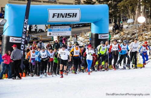
The 7th Annual Kahtoola Agassiz Uphill Race was held this weekend on the slopes on Humphreys Peak and within the boundaries of the Arizona Snowbowl. This is a winter race with runners using whatever sort of foot traction suits them. Some wear Kahtoola microspikes as minimalist equipment. Others use snowshoes. And some use skis—both downhill and telemark style. It’s an interesting contest as the runners can easily outpace the skiers on the way up—but skiers have the advantage on the downhill. Still, the fastest competitors were the runners.

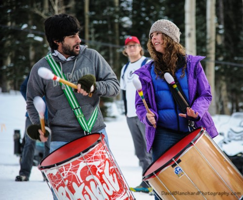
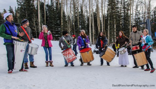
Providing the rhythmic drumming during the event was Flagstaff’s very own Sambatuque.

20140208_1653_DBP_6507 20140208_1654_DBP_6510 20140208_1700_DBP_6524 20140208_1700_DBP_6532 20140208_1807_DBP_6648 20140208_1808_DBP_6650