Get Your (Running) Kicks on Route 66

Always looking for new trail running routes, the Northern Arizona Trail Runners Association (NATRA) found themselves on a section of old Route 66 between Ash Fork and Williams, Arizona, on this sunny and warm spring morning. This section is also known as the Ash Fork Hill Bicycle Tour. (Map here.)

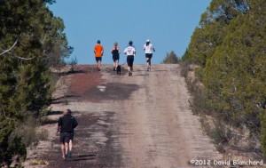
NATRA runners on Route 66: 1931 alignment near Ash Fork, Arizona.
NATRA runners cresting a hill top on Route 66.

Two parallel segments of Route 66 exist here: the original 1922 alignment (also known as the Old Trails Highway) and the 1931 alignment that replaced it. And, of course, the newest alignment is Interstate 40 just a few hundred meters away. The 1931 segment is composed of old and crumbling asphalt while the 1922 segment retains the original gravel road.
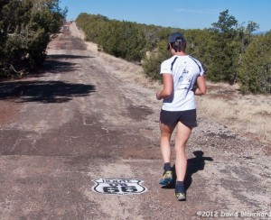
Route 66: 1931 alignment.

The group initially headed westward on the paved segment which has a net downhill and made the return trip on the uphill graveled segment. The soft gravel combined with the steady uphill climb made us pay for our earlier cruise on the downhill.
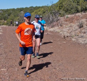
The 1922 alignment of Route 66 with the original gravel road bed.

A comparison of the retired segments and the current Interstate highway provides an interesting perspective on how American highways have evolved over the decades.
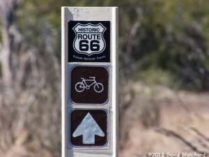
Kaibab Forest marker for Historic Route 66.

It’s fascinating to imagine cars driving on these old roads — where they came from and where they were going.
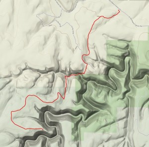
Trail running on the Arizona Trail near Walnut Canyon

The Arizona Trail is a National Scenic Trail from that traverses the state from Mexico to Utah. Currently 96% of the trail is complete. In the Flagstaff area are a couple of extraordinary sections of the trail — including the portion that runs along the rim of Walnut Canyon.

Within a few minutes of leaving the trailhead the trail drops down into a side canyon that provides an expansive view of the main canyon. But if you are running the trail you need to keep your eyes on the trail and not the view. This is a good reason to stop and take a good look — or a photograph — before resuming the run.

Arizona Trail along the edge of Walnut Canyon.

Portions of this trail have been re-routed recently. This includes the sections that drop down into and climb back out of the side canyon. The old sections were becoming eroded and difficult to maintain. The new sections have a more gradual slope and will shed water better so that the trail resists erosion.

One of the best features of this trail run is heading out to one of the many overlooks and peering into the canyon. Because this area was inhabited by the Sinagua there are many artifacts lying around and with sharp eyes pieces of pottery are easily spotted. Enjoy — but please leave them where you found them!

This run is 8-miles out and back and has a lot of climbing — in both directions. The trail is well marked and can be quite busy at times with hikers, runners, mountain bikers, and equestrians. Share the trail and enjoy!

Trail running in Sedona

Although we had a lot of snow in Flagstaff and northern Arizona in December, it’s been completely dry since then and the snow has slowly vanished. We’ve taken advantage of the dry weather and done a lot of trail running in Sedona. It’s always warmer there, of course, because of the lower elevations. But even there they received measurable snow in late December and, as a result, many of the trails are still muddy and some still have patchy snow in the deep shadows.

Still, it’s been a great chance to try out some new trails. We’ve been aware of the growing number of non-system trails (i.e., trails that are not part of the Forest Service network) and have been interested in trying some. The Forest Service has also recognized that some of these trails should be brought into the system.

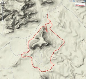
One of these is Aerie Trail which starts from the Boynton Canyon Trailhead and heads in a generally westerly direction, passes by the Fay Canyon Trailhead, then heads towards Doe Mountain. You can connect this trail with Cockscomb and make a nice loop. Although parts of the trail were exceptionally muddy, other sections were dry. These two trails can be combined into a short, ~6 mile loop.

Aerie-Cockscomb Loop

Another loop we’ve done a few times is the Munds Wagon–Cow Pies–Hangover Loop. This loop has some amazing views from the top of the saddle and some great running sections on the Hangover section. Keep your eyes open for mountain bikers!

Mitten Ridge--BearPaw--Hangover
Mitten Ridge–BearPaw–Hangover

So many trails … so little time!

______________________

Correction (10 March 2011): The USFS document referenced above does not include the Aerie Trail in their list of non-system trails.