Lightning across the landscape of northern Arizona

The North American Monsoon (NAM) is in full swing across the southwestern states and the daily showers and thunderstorms present many opportunities for dramatic lighting and lightning.

Earlier this week I traveled to the south rim of Grand Canyon National Park hoping to get some sunset images with storm clouds hanging over the canyon. Well, there certainly were clouds — and there wasn’t much of a sunset. The backup plan was to photograph lightning. On this count, the storms didn’t disappoint. There was a storm to the west and I was able to point the camera across the lines of cliffs and rock faces that were already falling into deep shadow in the late twilight. And off in the distance was a great flash of lightning.
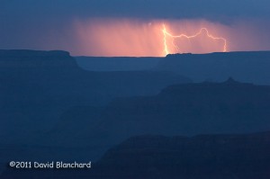
Lightning over the Grand Canyon.

A few days later I tried once again to capture twilight lightning — this time at Sunset Crater National Monument. A storm developed in early evening and moved to the northeast over the lower terrain of the Painted Desert in the Little Colorado River Valley.
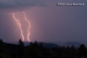
Lightning over the Painted Desert of northern Arizona.

In the foreground can be seen the Ponderosa Pine trees at the higher elevations in the Monument; in the middle distance are some of the many cinder cones that are a part of the San Francisco Volcanic Field; in the far distance are the lower elevations of the Painted Desert.
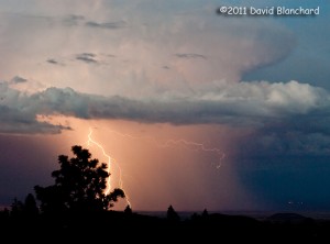
Lightning over the Painted Desert of northern Arizona.

With the typical NAM lasting through early September there should be plenty of opportunities for more dramatic lightning photographs.
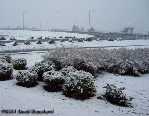
Springtime snow in northern Arizona

It’s been an interesting spring as the La Niña conditions of this past winter continue to abate. One of the characteristics of this diminishing pattern has been for low pressure systems to drop southeastward from the eastern Pacific and west coast and then across the southwestern states. Springtime low pressure systems routinely move across the southwest and bring strong winds to Arizona and these systems have been quite normal in that respect, that is, it’s been very windy.

But they have also brought the core of the low pressure system farther south than is typical and across Arizona. The result has been a combination of below normal temperatures and above normal rain along with snow in the higher elevations.

We had three days of snow last week — but only trace amounts fell across the area — and now we are having a real bona fide snow event. A few inches of snow have accumulated at elevations above 7000 feet.

Snowy scene in northern Arizona - in mid May.
Snowy scene in northern Arizona – in mid May.

Will this be the final event of this winter-like spring? Or will we see snow again? The record books show that snow isn’t rare in May at these elevations — and snow in June has happened on a number of occasions, too.

We’re all looking forward to spring finally arriving before the calendar says summer.

Dance of the clouds

The weather across much of the country has been very dramatic the past few days with snow storms, ice storms, strong winds, and brutal cold. Across Arizona we experienced exceptionally cold weather as the Arctic air mass settled in across the area. Strong northeast winds at the surface and aloft helped to drive the cold air across the Rocky Mountain barrier and deep into the southwest.

The northeast winds also created some fantastic wave clouds over the San Francisco Peaks, located to the north of Flagstaff. Normally, strong southwest winds roll across the Peaks and the best wave clouds are located to the northeast but this wind reversal resulted in a reversal of the wave clouds as well.

Delicate wave clouds dance across the San Francisco Peaks.

Video here.

Even more interesting were the clouds that were forming just below the tops of the peaks. Strong winds from the northeast drove cold air into the Inner Basin on the east side then up and over the top of the peaks. As the air ascended thin wispy clouds would form. Just as quicky the air descended on the southwest slopes and the clouds evaporated.

The rapidly changing clouds and detailed structure were fascinating to watch. A time-lapse movie clearly shows this incredible dance of the clouds as it moves across the Peaks.