Hiking West Fork Oak Creek — From the Top

West Fork Oak Creek.

Most of the time when we hike West Fork Oak Creek we do it from the bottom up. Only once before have we done top-to-bottom and that was back in 1999. We were new to northern Arizona and had read Tyler Williams’ Canyoneering Arizona that this could be done in one very long, hard day. He was right about the long and hard. We have since referred to that epic day as our bootcamp hike.

The start of the hike on Woody Mountain Road.
West Fork Oak Creek. You have been warned of the difficulties that lie ahead.

The passage of time can dim the memories of how hard and unpleasant things were. So here we were in 2019, twenty years later, and we wanted to do this hike again but with some modifications. We were not planning on hiking the entire length of the canyon. Instead, we would simply head down canyon and turn around when we had enough.

The first few miles feature a dry wash filled with boulders, sand, and thick vegetation. There is no trail.

It didn’t take long to realize that even this would be a challenge. There is no maintained trail—and not even much of any hint of a trail at all. The vegetation was so thick we had to bushwhack our way through it. Remember that the Slide Fire in 2014 burned through this area (mostly low intensity) and this thick vegetation may be the result of the burn and regrowth. And there was lots of poison ivy. After the first few attempts to get around it we gave up and just plowed through it.

It took us about 2 1/2 hours to reach the first set of narrows about 3 miles down canyon. Just below the narrows is the confluence with Casner Cabin Draw—which ended up being our turnaround spot. We had some commitments that evening so we did not have unlimited time for exploration. Maybe that was a good thing!

The first narrows are encounted just upcanyon of the confluence with Casner Cabin Draw.
At the first narrows (2019).
At the first narrows (1999).

I had just been looking at some old photographs from that 1999 hike so I remembered a few locations and took new photographs in the same spots. The tree on the right has grown substantially in 20 years.

Navigating the boulders in the dry narrows.

We did not encounter any water in the stream bed until the narrows and even then it was a small pool only a few inches deep and a few feet wide.

Wading through the cold pools (1999).

I’ve also included a photo (a scanned Kodachrome slide) from that 1999 hike showing one of the “must swim” cold pools of water.

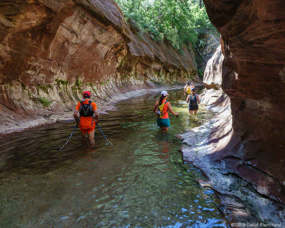
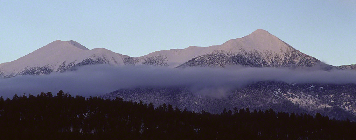
We enjoyed the quiet and solitude of the upper canyon.

Milky Way Closeup

Most of my Milky Way photographs are shot using a wide-angle (24 or 28 mm focal length), or ultra-wide-angle lens (16 mm focal length). These create an image that shows a large portion of the Milky Way. But sometimes it’s fun to zoom in a bit and focus (no pun intended) on a much smaller section of the sky.

Milky Way.
Milky Way.

A few days after the full Moon provided a great opportunity to do this. The Moon would not rise until about an hour after astronomical twilight ended and, more importantly, there were very clear skies.

I used a Nikon D750 body with a Nikon 85mm f/1.8 lens for this session. This is designed to be a portrait lens but I find it makes a pretty good astrophotography lens as well because of the excellent light-gathering f/1.8 aperture and the corner-to-corner sharpness resulting in nice round stars. At least, that is, when I get sharp focus and accurate tracking.

I shot 10 images of 120 seconds exposure time and used Long Exposure Noise Reduction (LENR). I was unable to use the 10th exposure because the sky was already getting brighter even though the Moon was still below the horizon. The result was 9×120 seconds or 18 minutes of light gathering.

I have several different applications (both Mac and Windows) for star stacking and alignment and chose to use Starry Sky Stacker this time with good results. Once I had the stack completed I used rnc-color-stretch for histogram stretching with final postprocessing done in Lightroom 6/Photoshop CS6.

Milky Way with annotations.

This is the final result. I think the colors might be a bit too saturated—but I don’t dislike the result. Artistic license invoked here.

A Summer Hike up West Fork Oak Creek

In early July we invited some friends to join us for a hike up West Fork Oak Creek. This is a hike we used to do almost every year until the Slide Fire in 2014 . We made a short trip up the canyon when it reopened and were pleased that the canyon had not burned but saddened by all the silt and ash that had clogged the deep pools.

West Fork Oak Creek—First Narrows

Earlier this year we did our first hike up the canyon in many years. Our main interest was to learn if the heavy rains of this past winter had successfully flushed out the silt and ash from the 2014 Slide Fire. As reported in a previous article here, the heavy rains had done a fine job of returning the canyon to its former pristine condition.

First time in West Fork!
Wading through the water in the first narrows in West Fork.
Above the first narrows in West Fork.
Water is channeled into this narrow and shallow slot in the canyon.
Enjoying a break in the cool shade above the narrows.

Now, with warm weather and sunny skies, it was time to hike as far up West Fork as time would permit. In the past, we have made it up and just beyond the “Camping Permitted” point which is around six miles up canyon. Years ago, we also did an end-to-end starting at Woody Mountain Road and hiking the entire length in a day. But since that “boot camp” day back in 1999, we have only hiked up from the bottom. This day was no different—except that we traveled farther up the canyon than any of our previous hikes. That’s a successful day. We spent about six hours hiking up and returned in about five hours.

Our friends were not able to commit as much time so they turned around after about 3.5 miles (i.e., after the “End of Trail” and just a bit beyond the first narrows).

Another narrows section.
Tree and sandstone wall.

The wildflowers were great. There were masses of Monkshood and Monkey Flowers—so I was motivated to get a photograph of both “monks*” in one shot. Nope. Apparently, they prefer slightly different conditions and while they would sometimes be close, they were never clustered together. Columbines were also in great abundance. And there were a few flowers we could not immediately identify but could certainly enjoy.

Monkshood wildflowers.
Columbines line the shore of West Fork Oak Creek.
Stream orchid.
Stream orchid.

About a mile or so above the “camping permitted” sign we began to encounter thickets of brush from one side of the canyon to the other. These made forward travel very difficult. They also brought back memories of how challenging this section was back when we did the entire canyon. And, with that in mind, we declared that location to be our turn-around point.

Deep pool with overhanging sandstone wave.
Reflection pool.
Reflection pool.
The crux move. If you slip, you swim.
Hiking through the narrows.
Cairn marking the trail.

What a fun (and tiring) day!

Milky Way and Wupatki National Monument — July 2019

A few nights ago I had an opportunity to photograph the Milky Way under exceptionally clear skies. I wanted to do two things: One was to replicate an image I shot a few years ago and the other was to get a Milky Way/landscape composite with a moonlit foreground.

I headed out to Wupatki National Monument (an International Dark Sky Park) and set up in a dark parking lot with a moonlit landscape. The Moon was still well above the horizon and I took several long exposure images to get a good foreground. After the Moon had set, I shot the Milky Way (using a star tracker to eliminate star trails). Back at home, I would then merge the two images. The result is the image below showing the Milky Way aligned above the distant San Franciso Peaks with mesas rising on either side of the shallow valley. What also shows up is the large amount of light pollution in Flagstaff. Flagstaff is the worlds First International Dark Sky City but it takes a lot of work to keep the skies dark. I fear we may be losing the battle.

The Milky Way stands above the San Francisco Peaks in northern Arizona.

After completing this set of images, I moved to my next location to take my final shot. This is a single, 30-second image at high ISO (ISO 3200) with the tripod carefully centered on the stripe down the middle of the road. Comparing this shot with the one taken a few years ago indicates that the older image was blessed (if that’s the right word) with airglow in the lower part of the image giving it a much more interesting character. The newer image lacks this airglow but does have a more interesting horizon.

Road to the Stars II.

And now the North American Monsoon has begun to ramp up across the southwest and clear skies will be a rarity for the next few months. Time to start photographing storms and lightning!

Two Moons

Here are two images that are about the Moon.

Moonrise behind Cathedral Rock.

The first image shows the full Moon rising behind Cathedral Rock. The day before Full Moon is a preferred time to shoot this type of image since the setting sun still throws a bit of light on the rock. Didn’t work this time as there were clouds in the west blocking the sun. Last month it was the other way around: clouds blocked the Moon but the Sun cast beautiful light on the rocks. Still, I like the way the Moon is framed between the pillars of Cathedral Rock.

First Quarter Moon illuminates Grand Canyon.

The second image does not show the Moon but rather the light it casts upon the Grand Canyon. The Sun had set and fading sunset colors were still visible low on the western horizon. The first-quarter Moon was throwing plenty of light into Grand Canyon and casting long shadows. This was a long exposure of 30 seconds (f/4, ISO 800, 50mm) so one of the trees in the foreground shows a bit of thrashing from the evening breezes at Timp Point on the west side of the Kaibab Plateau.