The Big Fog

Widespread, dense fog covered portions of northern Arizona for more than a week in early December. The fog appeared at Winslow, Arizona (KINW), during the evening of December 3 and finally dissipated on the afternoon of December 12. Similar conditions were experienced in Flagstaff, Arizona (KFLG), with fog appearing on the afternoon of December 4 and finally dissipating in the evening of December 10. For some locations, including Flagstaff, the fog was episodic with periods of dense fog interspersed with clear conditions. Farther to the northeast, including places such as Winslow and the Chinle Valley, the fog was more persistent.
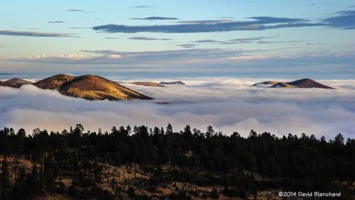
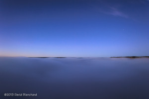
A sea of fog across northern Arizona at sunrise.

The fog was the result of a heavy rainfall event across northern Arizona December 2–4. Many locations received between 1 and 2 inches of rain. Following the rain, high pressure developed across the southwest and a strong thermal inversion developed. The inversion was finally removed when a trough moved across the region bringing strong southwest winds and steeper lapse rates.
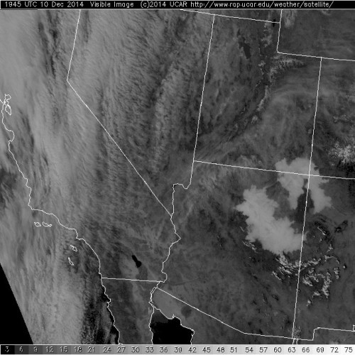
Visible satellite image showing extensive areas of fog across northern Arizona.

It should be noted that thermal inversions are not rare. Quite the contrary. An inversion commonly occurs at night and during the winter when the angle of the sun is very low in the sky. After last years fog event in the Grand Canyon, some in the media declared that thermal inversions are rare and that the inversion was the cause of the fog. Not really. Both then and now the moisture evaporated out of the soils but was trapped near the ground by the inversion. And, slowly but surely, the moisture content of the lowest few hundred meters of the atmosphere became saturated and fog developed.

Well—enough of the meteorological explanation. What did it look like?

When these shallow fog events occur it is possible to find hills and mountains that are above the inversion so that an observer can look down on the fog. This often results in some amazing photographic opportunities. Anticipating that the fog would occur, I was ready to travel to the Grand Canyon to capture images of the fog filling the canyon. Well, it didn’t quite fill the canyon—at least, not like last year. But there were still photographic opportunities.

I also found myself on the lower slopes of the San Francisco Peaks north of Flagstaff and was able to capture images and video of the fog streaming across the pass between the San Francisco Peaks and O’Leary Peak as well as the sea of fog across the Little Colorado River Valley.
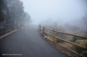
Fog in Northern Arizona

We woke up to a foggy morning in Flagstaff and a quick check of satellite data clearly showed widespread fog across northeastern Arizona but not across the remainder of the state. We quickly broke out of the fog and into sunny skies as we drove south of the Mogollon Rim for a trail run with our running group.

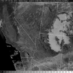
Visible satellite image showing widespread areas of fog across the west.

Intrigued by the fog, I traveled to the Grand Canyon in the late afternoon in hopes of getting some interesting photographs. At Yavapai Point on the South Rim there were few visitors. After all, who wants to see a canyon filled with fog! Visibility was on the order of a hundred meters or less and driving was an interesting challenge.

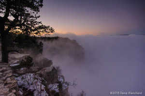
Fog at Yavapai Point, South Rim, Grand Canyon National Park.

Leaving Yavapai Point, I drove east on the Rim Drive to the first pullout. Moments later, the fog briefly cleared and I could see the North Rim above the top of the fog. Then, just as quickly, it filled back in. A short while later, this clearing repeated itself. This time I captured an image that shows a vast expanse of fog filling the canyon and the North Rim just barely peeking above the fog.

A break in the fog along the South Rim, Grand Canyon.

A sea of fog fills the Grand Canyon and the North Rim peeks above the fog.

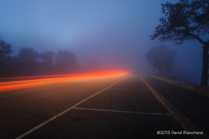
Then it was time for some fun. I set the camera to take long exposures and shot a photo every time a car drove by. The red streaks of the vehicle tail lights and the fog being illuminated by the lights created interesting images.

Vehicle tail lights illuminate the fog on the South Rim, Grand Canyon.

A foggy night in northern Arizona

It’s still the rainy season but this is silly. The amount of rain that has fallen in Bellemont, Arizona, in August is quickly approaching eight inches. Meanwhile, a few miles away at the Flagstaff airport, a more reasonable two and one-half inches has fallen this month. Most of that rain in Bellemont has fallen in the past few days. As a result, the ground is fairly saturated and there is plenty of standing water. This produces good conditions for nighttime fog in the area.

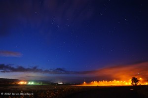
Fog during the pre-dawn morning hours.

The first image was taken well before sunrise with plenty of stars visible. More striking, however, is the patch of fog and low clouds on the right — nicely illuminated by the lights.

Early morning fog creeping down the hillside.

The next image was taken shortly after sunrise and shows the fog lurking on the hills above the flats of Bellemont. The trees poke out through the top and the light poles add some foreground texture to the image.