Grand Staircase-Escalante National Monument in Winter

With the winter holidays presenting a few days off from work we decided to do a bit of close-to-home travel. Our destination was Page, Arizona, and from there we could visit some photographically-interesting sites as well as do some canyon hiking.

We arrived mid afternoon and headed for the Toadstools (also known as the Paria Rimrocks or the Rimrock Hoodoos), an otherworldly site that is part of the Grand Staircase-Escalante National Monument.

Located between Page, Arizona, and Kanab, Utah, it is easy to miss as there is only a small roadside sign and dirt parking lot as you travel on US Route 89. The trail is a short and easy hike of less than a mile.
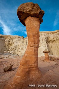
Rimrock Hoodoos ("Toadstools") in the Grand Staircase-Escalante National Monument.
Rimrock Hoodoos (“Toadstools”) in the Grand Staircase-Escalante National Monument.

From the interpretive sign at the start of the trail: “What is a Toadstool? A toadstool is a spire-like feature with a boulder perched atop a pedestal rock, like a mushroom, or ‘toadstool’. It forms when softer rock erodes away, leaving a column sheltered from the wind and water.”

Such a mundane description for what are amazing pieces of natural rock art.
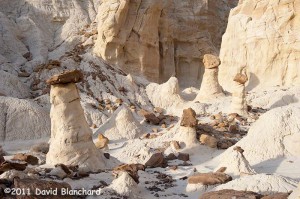
Rimrock Hoodoos ("Toadstools") in the Grand Staircase-Escalante National Monument.
Rimrock Hoodoos (“Toadstools”) in the Grand Staircase-Escalante National Monument.

With afternoon light beginning to fade the colors were amazing. The downside was that it’s late December and even in the desert southwest it can get pretty chilly in the late afternoon. Finally, the sun set and the sky darkened ending an enjoyable afternoon of exploration and photography.
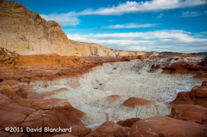
Late afternoon lighting across the Toadstools region.

The next day was spent at the better known Antelope Canyon — a part of the Navajo Nation Parks.
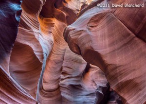
Lower Antelope Canyon, Navajo Nation Parks, near Page, Arizona. (HDR image).

We’ve been here a few times over the years but never get tired of viewing the fantastic sculpturing of the soft sandstone within the confines of this slot canyon.
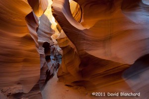
Lower Antelope Canyon, Navajo Nation Parks, near Page, Arizona.

There are two distinct areas to visit: Upper Antelope Canyon and Lower Antelope Canyon. The upper canyon is much easier to walk as it has a smooth and generally flat sandy floor and is wide enough for people to move around. It is the recommended choice for those with limited hiking abilities or those that are uncomfortable in confined spaces. Lower Antelope Canyon requires moving through exceptionally narrow confines and climbing up and down steep ladders.
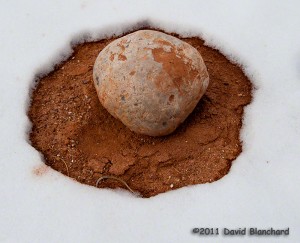
Snow melt pattern around a boulder in Catstair Canyon, Utah.

Lastly, we traveled back west towards Houserock Valley and did a short hike in Catstair Canyon. If you look carefully you will find some ancient petroglyphs on the sandstone walls of this short canyon. Far more interesting to us, however, was the snow melt pattern around this volleyball-sized boulder.
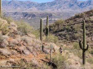
Desert mountain biking: The Black Canyon Trail

Not too far from the high altitudes and colder temperatures of Flagstaff lies the northern edge of the Sonoran Desert. A short drive of just 90 minutes will place you in the desert with Saguaro and other cacti. Here one can enjoy the winter months as the temperatures are much warmer than those found in northern Arizona and dry days vastly outnumber wet days.

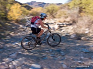
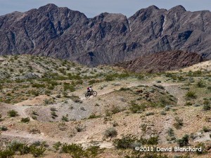
Desert riding on the Black Canyon Trail.

We had been planning on a mountain bike ride on theĀ Black Canyon TrailĀ once the desert temperatures cooled. With light winds, mild temperatures, and clear skies expected this week it was time to visit the BCT. Since this trail is approximately 78 miles long we had to choose which section we would ride. We selected theĀ Black Canyon City trailheadĀ and rode the Horseshoe Bend segment, the Skyline segment, and portions of the Cheapshot segment before running out of time and returning the way we came.

This is desert riding and cactus will reach out and puncture your tires if you aren’t careful. Apparently, I was not careful but at least I didn’t notice I was losing air until the ride was over. Upon inspection of the tube I found half a dozen punctures. Ouch!

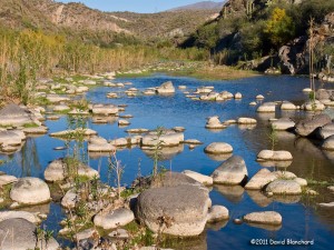
Gazing down at the Agua Fria River from the Black Canyon Trail.

The descent down to the Agua Fria River is one of the highlights of this segment and the river and canyon are quite spectacular. Luckily there was only a very light flow of water in the river. After winter storms there could be substantial water flowing through here making the crossing difficult. But not today.

Horseshoe Bend section of the Agua Fria River.

By and large, the tread on this section of BCT is smooth and is beginner difficulty. On the other hand, there is substantial exposure where a fall could be painful resulting in an overall rating of intermediate for these sections. Riding along with the edge only a foot or two away from your wheel gives one strong motivation to ride a careful line.

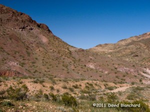
Dry wash crossing on the Cheapshot section of the Black Canyon Trail.

I suppose we could have ridden harder and faster and covered more territory in the time that we had. On the other hand, it’s more the journey than the destination so we took our time to enjoy the beautiful hills, pleasant weather, and very high quality mountain bike track.

Vermillion Cliffs National Monument: An otherworldly place

Massive cliffs. Deep slot canyons. Unimaginably contorted rock formations. Vivid colors. Otherworldly. Amazing. Beautiful.

All these and more describe — yet fail to describe — the Vermillion Cliffs National Monument and the Paria Plateau.

The VCNM was established in November 2000 by a Presidential proclamation from existing public lands already under the management of the Bureau of Land Management (BLM). At that time, the beauty of this place was known mostly to locals, ranchers, explorers, and a few photographers. Since then, however, it has become famous world wide. Years ago I was surprised to see a poster advertising a lecture and slide show with a picture from the VCNM posted to a kiosk in Europe. At that time, some of the best information on this place could be found on European web sites. Apparently, Americans hadn’t yet discovered it.

Deep within the confines of Buckskin Gulch, Vermillion Cliffs National Monument.

A friend worked for the BLM in this area some years ago and would tell me about these amazing places but was hesitant to give directions how to get there for fear that increased crowds would damage the area. He was right, of course, but in todays Internet world and digital cameras it’s become challenging to keep a “secret spot” secret.

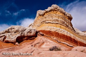
Lollipop Rock, White Pocket, Vermillion Cliffs National Monument.

Over the years we have visited Buckskin Gulch a couple of times traveling slowly down canyon while taking photographs but have yet to complete the entire trek to Paria Canyon. Perhaps if I travel without the camera I might make better time.

Sunset at White Pocket, Vermillion Cliffs National Monument.

We’ve also visited Coyote Buttes North and seen the Wave back in the day when permits were relatively easy to obtain. At least it was for us because a friend gave us his permits which he could not use. But we haven’t been to Coyote Buttes South yet.

Sunset and reflection at White Pocket, Vermillion Cliffs National Monument.

And, just recently, we finally made it to White Pocket. Travel to this location requires an adequate vehicle with appropriate driving skills. I have neither. So we chose to hire a guide and outfitter to take us there for the day. Sure, it cost a bit of money but it’s cheaper than getting stuck!

Deep and narrow: Buckskin Gulch, Vermillion Cliffs National Monument.

We encountered about a dozen other people there that day. I guess that’s a large crowd for this location. But the crowds are certain to increase with time and a permit system seems inevitable. Best to visit sooner — rather than later.

Springtime mountain biking at Bootleg Canyon

Although Bootleg Canyon Mountain Bike Park, located near Boulder City, Nevada, has been well-known and popular as a mountain biking area for a fairly long time I only recently learned of it. IMBA includes Bootleg Canyon as one of their Epics — rides that show what is possible for trail recreation on public lands.

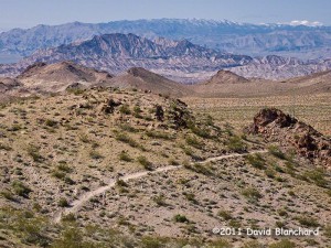
Mountain biking trails in Bootleg Canyon: Inner Caldera.

On a couple of cool spring days with clear blue skies and breezy winds we set out on some of the beginner and intermediate trails to learn a bit about this area. The cross-country trails are great fun with ups-and-downs, some tight twisty turns as well as flowing single track lines, and some fun technical sections.

Mountain biking trails in Bootleg Canyon: I.M.B.A.

The DH lines are far more challenging and, well, we didn’t try those. Not this time, at least. Perhaps another visit.

Mountain biking trails in Bootleg Canyon: West Leg.

It’s amazing to be riding these desert trails and then look off into the distance and be able to see the glitter of Las Vegas in one direction, Lake Mead in another, and the rugged mountains in yet another.

We’ll be back.

White Sands Reflected in Pools of Water

We recently took a trip to White Sands National Monument in New Mexico. The weather forecast that day called for increasing clouds and a chance of thunderstorms — some possibly severe — by late afternoon. Normally, this would be a deterrent to those wishing to visit this wonderful place but since I enjoy photographing thunderstorms and severe weather this was an opportunity not to be missed.

Rainbow over White Sands National Monument.

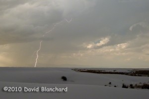
We arrived at WSNM in mid-afternoon and the clouds were beginning to fill the sky. We were soon rewarded with a rainbow stretching across the parabolic dunes on the edge of the dune fields. As that first storm moved away, other storms began to develop back to the west. I set up the camera to take lightning photographs and was rewarded with a couple of pretty good shots.

Late afternoon cloud-to-ground lightning over White Sands National Monument.

But the really wonderful part came the next morning. Those afternoon thunderstorms continued through the evening and into the night and produced about one and a half inches of rain across the sands. And in the bright blue sky of the following morning we found shallow lakes of up to a few inches deep scattered across the sands as a result of the heavy rainfall. The reflections of the sand dunes and other vegetation in these ephemeral lakes was simply delightful.

Reflections in the shallow lakes produced by heavy rainfall across White Sands National Monument.