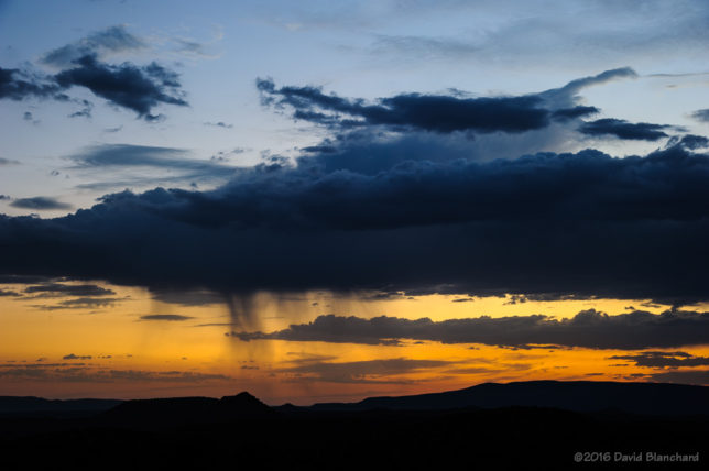
Lightning Across Northern Arizona — 2017

The North American Monsoon is now in full swing across the southwest and Arizona. This brings thundershowers almost every day to northern Arizona along with a chance to photograph lightning.

I have been photographing lightning for a long time with my earliest images using an old manual focus/exposure camera with film. Those were challenging because you had to guess at the exposure (although there were many fine articles online even then on camera settings). There was no way to do a quick check of the exposure to see if it was good. On the other hand, we usually shot in the evening or nighttime hours using long exposures of several seconds or more so you were usually pretty certain whether you had the shutter open at the right moment.

With digital, everything has changed. You can instantly check your image and see whether or not you captured the lightning. There are several lightning triggers on the market that will fire the shutter for you.

Here are some recent images taken in several different locations over the past few weeks.

Twilight lightning over the North Rim, Grand Canyon.

These were mainly in-cloud flashes so the best option was to leave the shutter open for 10-15 seconds. The longer exposure also allows some stars to appear in the image.
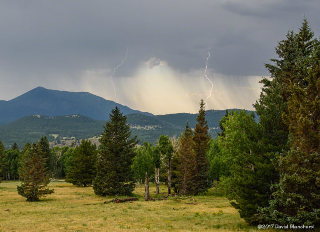
Lightning near Kendrick Peak in northern Arizona.
Early evening thunderstorms move into Flagstaff, Arizona.
Sunset lightning in Sedona, Arizona.


Just Another Day at the Grand Canyon

I found myself at Grand Canyon once again with hopes of interesting storms and lightning as well as sunset and astrophotography.

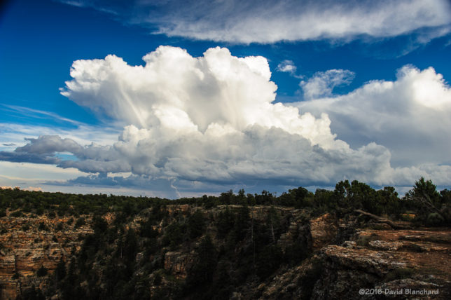
Cumulus towers developing south of Grand Canyon.

Late in the afternoon, these two cumulus towers south of Grand Canyon suggested that the next few hours could be interesting. Less than one-half hour later, the convection had become a Cumulonimbus with lightning. The storm was a fair distance away so that the lightning bolts were small—and in the wrong location. I had hoped to photograph a storm with lightning over the canyon but it was not to be.

Thunderstorms and lightning.

Continue reading →

Sedona Sunset Storms

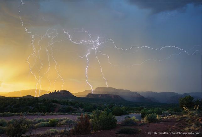
A few days ago I was in the right place at the right time and watched thunderstorms at sunset that were producing lightning strikes across the nearby cliffs and mountains. The sun was low and was producing warm sunset colors on the hills and rain—and lightning.

Sedona Sunset Storm.

This is a composite of several images taken over a period of six minutes.

Lightning and rainbows and storms. Oh, my!

The summer thunderstorm season got off to a slightly early start this year with moisture flowing northward into northern Arizona in late June. A more typical start would be the first or second week of July. However, you won’t get complaints from most folks about the early start as it signals the end of wildfire season.

Rainbow over Grand Canyon.

The highlight this early in the season is this rainbow seen from Yavapai Point on the South Rim of Grand Canyon National Park. The rainbow spans nearly 3/4 of a full circle and contains both primary and secondary bows. Rainbows typically are at least 50% hidden owing to the horizon. Only when the horizon is lower than the observer—e.g., from a mountaintop or over a canyon—will more than 50% be visible.

Continue reading →

A preview of the monsoon

The North American Monsoon (NAM) is slowly developing across northern Mexico but has not yet spread northward into Arizona. Nonetheless, some tropical moisture moved northward across the state and produced some showers and thunderstorms. In fact, one thunderstorm produced almost 1/2 inch of rain on the southwest side of Flagstaff (including my house!) and the temperature dropped more than 25°F resulting in pleasant conditions.

These storms produced a cool outflow boundary that pushed southward off the Mogollon Rim and into the lower elevations. These outflows can result in new thunderstorms forming over Sedona—one of my favorite places for photographing storms and lightning. And so I headed to Sedona.

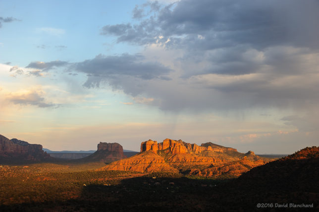
The outflow boundary was apparent as a line of shallow cumulus clouds roughly aligned east to west across the area. I selected a spot on Upper Red Rock Crossing Road to shoot towards Cathedral Rock and then waited for lightning.

Evening sunlight spreads across Cathedral Rock.

It was a long wait.

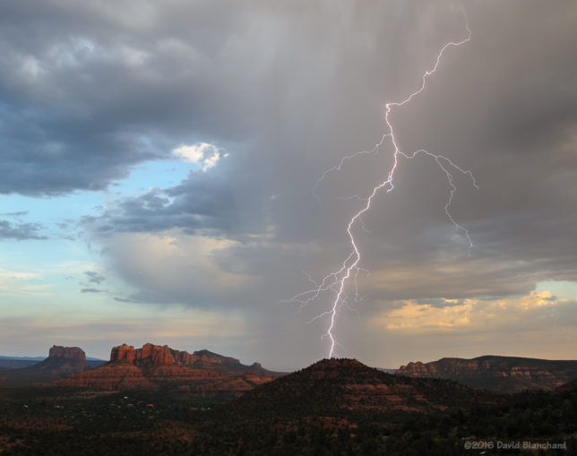
From first test photo to first lighting was a little over an hour. I’m patient but I almost gave up.Then, suddenly, a flash across the sky. Missed it—because I was zoomed in too tight. A moment later—another flash and this one I got. And that was it. No more flashes.

Lightning strikes behind Pyramid Peak.

Time to move to another location and shoot twilight colors. I often find myself at the defunct Sedona Cultural Park because it has wide open vistas to the west (at least for now). I arrived as the sun was setting and everyone else was leaving. But the so-called “Blue Hour” can be the best time. If you take long exposures, you can get some really nice colors. I particularly liked this cloud because of the thin streamers of precipitation falling with twilight colors in the background.

Thin streamers of precipitation fall as the twilight fades.

A day later and the moisture has moved out of the area resulting in more typical hot, dry days with clear blue skies. Boring.