Grand Staircase-Escalante National Monument in Winter

With the winter holidays presenting a few days off from work we decided to do a bit of close-to-home travel. Our destination was Page, Arizona, and from there we could visit some photographically-interesting sites as well as do some canyon hiking.

We arrived mid afternoon and headed for the Toadstools (also known as the Paria Rimrocks or the Rimrock Hoodoos), an otherworldly site that is part of the Grand Staircase-Escalante National Monument.

Located between Page, Arizona, and Kanab, Utah, it is easy to miss as there is only a small roadside sign and dirt parking lot as you travel on US Route 89. The trail is a short and easy hike of less than a mile.
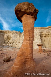
Rimrock Hoodoos ("Toadstools") in the Grand Staircase-Escalante National Monument.
Rimrock Hoodoos (“Toadstools”) in the Grand Staircase-Escalante National Monument.

From the interpretive sign at the start of the trail: “What is a Toadstool? A toadstool is a spire-like feature with a boulder perched atop a pedestal rock, like a mushroom, or ‘toadstool’. It forms when softer rock erodes away, leaving a column sheltered from the wind and water.”

Such a mundane description for what are amazing pieces of natural rock art.
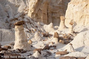
Rimrock Hoodoos ("Toadstools") in the Grand Staircase-Escalante National Monument.
Rimrock Hoodoos (“Toadstools”) in the Grand Staircase-Escalante National Monument.

With afternoon light beginning to fade the colors were amazing. The downside was that it’s late December and even in the desert southwest it can get pretty chilly in the late afternoon. Finally, the sun set and the sky darkened ending an enjoyable afternoon of exploration and photography.
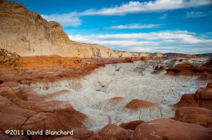
Late afternoon lighting across the Toadstools region.

The next day was spent at the better known Antelope Canyon — a part of the Navajo Nation Parks.
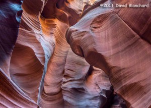
Lower Antelope Canyon, Navajo Nation Parks, near Page, Arizona. (HDR image).

We’ve been here a few times over the years but never get tired of viewing the fantastic sculpturing of the soft sandstone within the confines of this slot canyon.
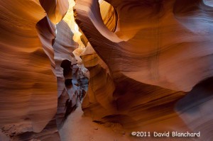
Lower Antelope Canyon, Navajo Nation Parks, near Page, Arizona.

There are two distinct areas to visit: Upper Antelope Canyon and Lower Antelope Canyon. The upper canyon is much easier to walk as it has a smooth and generally flat sandy floor and is wide enough for people to move around. It is the recommended choice for those with limited hiking abilities or those that are uncomfortable in confined spaces. Lower Antelope Canyon requires moving through exceptionally narrow confines and climbing up and down steep ladders.
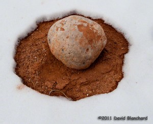
Snow melt pattern around a boulder in Catstair Canyon, Utah.

Lastly, we traveled back west towards Houserock Valley and did a short hike in Catstair Canyon. If you look carefully you will find some ancient petroglyphs on the sandstone walls of this short canyon. Far more interesting to us, however, was the snow melt pattern around this volleyball-sized boulder.

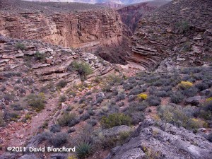
Night hiking in the Grand Canyon

We recently took a “day” hike in the Grand Canyon — except that much of the hike was in the dark. We left Flagstaff around midnight and arrived at the South Kaibab Trailhead at 1:30 a.m. and began our descent in the dark.

The moon was already past 3rd quarter and had not yet risen. But the skies were exceptionally clear and the stars were brilliant. There was almost enough light from the stars to hike down. Almost, but not quite.

So we did the safe thing and used our headlamps to light the trail.

Normally, the South Kaibab Trail is quite busy with hikers. The constant low hum of people talking to each other mixes with the normal daytime sounds of birds and of aircraft flying high overhead (or, sometimes, not so high overhead).

But there was none of that. Just the gentle sighing of the wind and even that began to diminish as we descended from the rim.

The Orionids meteor shower was nearing its peak (still a day away) but we saw plenty of meteor action during the pre-dawn hours. There would be extended lulls followed by a brief flurry of streaks across the sky. We spent so much time looking up that we made only slow progress going down.

At Tip Off Point, we turned onto the Tonto Trail and slowly made our way westward as the first hints of twilight began to appear in the eastern sky. With first light, I began to shoot some photographs of the cliffs of both the South and North Rims and of the side canyons.

Early morning light on the South Rim of the Grand Canyon.

As we reached the Bright Angel Trail near Indian Garden, the sun had risen and people were out and about on the trail heading both up from Phantom Ranch and down from the Rim. The low hum of many conversations permeated the air and the heavenly silence we had experienced over the past few hours came to an end.

Pipe Spring Canyon - a side canyon of Grand Canyon.
Pipe Spring Canyon – a side canyon of Grand Canyon.

After a short jaunt out to Tonto Point — where we once again had silence — we finished our “day” hike by ascending the Bright Angel Trail.

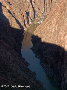
The Inner Gorge of Grand Canyon as seen from Tonto Point.

Lightning and Mammatus: The beauty of thunderstorms

The North American Monsoon is bringing thunderstorms to the southwest United States including northern Arizona. You would think that with almost daily thunderstorms it would be easy to shoot great images of lightning and thunderstorms. Well, not always…

One of the characteristics of the rainy season in the higher elevations of northern Arizona is that as the storms develop in the late morning or early afternoon it quickly becomes overcast so that it is difficult to see the individual storms. It is equally difficult to photograph lightning because it is often raining over large areas obscuring the view of the lightning.

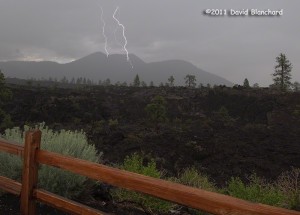
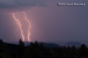
Lightning in Sunset Crater National Monument.

So I was particularly pleased when we had two days in a row in which I was able to photograph lightning and actually see the thunderstorms. The lightning was photographed in Sunset Crater National MonumentĀ overlooking the Bonito Lava Flow; the mountain that it is striking is O’Leary Peak. There is a fire lookout station at the summit of the peak and I’m certain they get their fair share of close bolts.

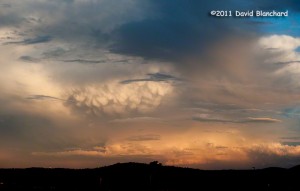
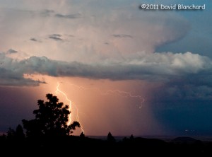
Sunset colors on an Arizona thunderstorm.

The following day proved equally photogenic. This thunderstorm was photographed in late afternoon and is quite dramatic with mammatus clouds visible from the anvil region of the storm.

If only everyday was as photogenic as these two.

Lightning across the landscape of northern Arizona

The North American Monsoon (NAM) is in full swing across the southwestern states and the daily showers and thunderstorms present many opportunities for dramatic lighting and lightning.

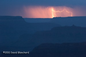
Earlier this week I traveled to the south rim of Grand Canyon National Park hoping to get some sunset images with storm clouds hanging over the canyon. Well, there certainly were clouds — and there wasn’t much of a sunset. The backup plan was to photograph lightning. On this count, the storms didn’t disappoint. There was a storm to the west and I was able to point the camera across the lines of cliffs and rock faces that were already falling into deep shadow in the late twilight. And off in the distance was a great flash of lightning.

Lightning over the Grand Canyon.

A few days later I tried once again to capture twilight lightning — this time at Sunset Crater National Monument. A storm developed in early evening and moved to the northeast over the lower terrain of the Painted Desert in the Little Colorado River Valley.

Lightning over the Painted Desert of northern Arizona.

In the foreground can be seen the Ponderosa Pine trees at the higher elevations in the Monument; in the middle distance are some of the many cinder cones that are a part of theĀ San Francisco Volcanic Field; in the far distance are the lower elevations of the Painted Desert.

Lightning over the Painted Desert of northern Arizona.

With the typical NAM lasting through early September there should be plenty of opportunities for more dramatic lightning photographs.

Vermillion Cliffs National Monument: An otherworldly place

Massive cliffs. Deep slot canyons. Unimaginably contorted rock formations. Vivid colors. Otherworldly. Amazing. Beautiful.

All these and more describe — yet fail to describe — the Vermillion Cliffs National Monument and the Paria Plateau.

The VCNM was established in November 2000 by a Presidential proclamation from existing public lands already under the management of the Bureau of Land Management (BLM). At that time, the beauty of this place was known mostly to locals, ranchers, explorers, and a few photographers. Since then, however, it has become famous world wide. Years ago I was surprised to see a poster advertising a lecture and slide show with a picture from the VCNM posted to a kiosk in Europe. At that time, some of the best information on this place could be found on European web sites. Apparently, Americans hadn’t yet discovered it.

Deep within the confines of Buckskin Gulch, Vermillion Cliffs National Monument.

A friend worked for the BLM in this area some years ago and would tell me about these amazing places but was hesitant to give directions how to get there for fear that increased crowds would damage the area. He was right, of course, but in todays Internet world and digital cameras it’s become challenging to keep a “secret spot” secret.

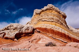
Lollipop Rock, White Pocket, Vermillion Cliffs National Monument.

Over the years we have visited Buckskin Gulch a couple of times traveling slowly down canyon while taking photographs but have yet to complete the entire trek to Paria Canyon. Perhaps if I travel without the camera I might make better time.

Sunset at White Pocket, Vermillion Cliffs National Monument.

We’ve also visited Coyote Buttes North and seen the Wave back in the day when permits were relatively easy to obtain. At least it was for us because a friend gave us his permits which he could not use. But we haven’t been to Coyote Buttes South yet.

Sunset and reflection at White Pocket, Vermillion Cliffs National Monument.

And, just recently, we finally made it to White Pocket. Travel to this location requires an adequate vehicle with appropriate driving skills. I have neither. So we chose to hire a guide and outfitter to take us there for the day. Sure, it cost a bit of money but it’s cheaper than getting stuck!

Deep and narrow: Buckskin Gulch, Vermillion Cliffs National Monument.

We encountered about a dozen other people there that day. I guess that’s a large crowd for this location. But the crowds are certain to increase with time and a permit system seems inevitable. Best to visit sooner — rather than later.