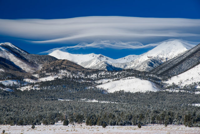
A New Cloud Type is Proposed

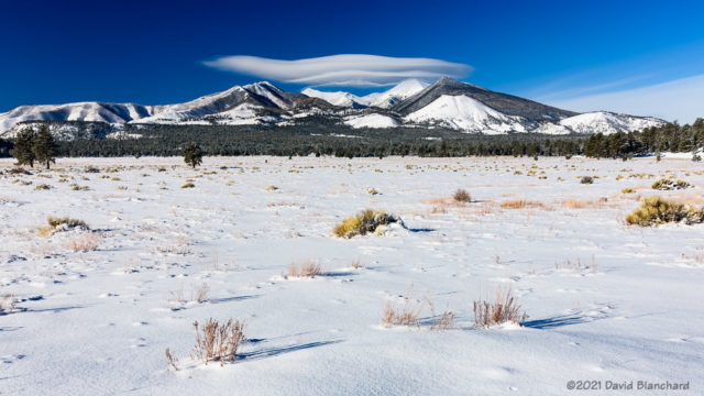
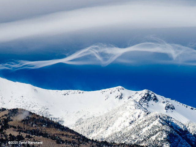
Turbulent wave clouds over the San Francisco Peaks (Jan 2021).

You would think that we have seen all the types of clouds—and named them—that can be seen. But the International Cloud Atlas added one new type (asperitas) in 2017 and is now may be asked to consider adding another—Supercilium. From the Royal Meteorological Society’s Weather journal:

‘Supercilium’ are short-lived cloud features, which appear in turbulent airflow over, and to the immediate lee of, steep mountain peaks during periods of strong mountain summit level winds.

I have seen and photographed this type of cloud several times over the years. My most recent photographs in January 2021 were posted to a weather discussion group in which several folks proposed some hypotheses on the nature and formation of these clouds. We did not reach a consensus or conclusion.
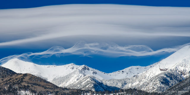
Same as above but zoomed in on the feathery tendrils.
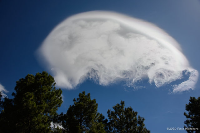
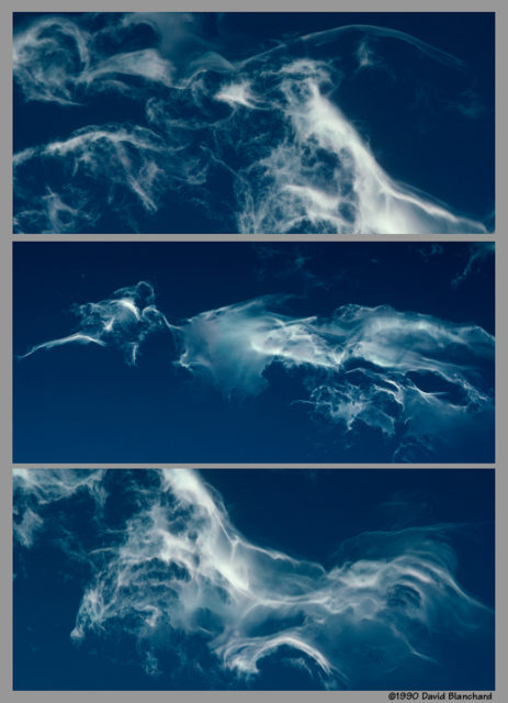
Another example seen over the Rocky Mountains (1990).

The Weather article proposes a name and description:

Proposed classification description
Supercilium: Short-lived, broken thin wisps of cloud, irregularly distributed, appearing to tumble and break in a turbulent way in airflow over, and to the immediate lee of, steep mountain peaks during periods of strong mountain summit level winds. Applies mainly to Altocumulus and Stratocumulus, possibly Cirrocumulus, sometimes coincident with the Duplicatus variety.

Nice to see that there will be a specific name applied to these very interesting clouds.

Edit: Fixed link to Weather journal.
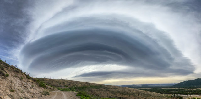
 

Wave Cloud over the San Francisco Peaks

We had an interesting wave cloud over and downwind of the San Francisco Peaks on Saturday. I first noticed it as I left the house driving to a trail run on Waterline Road in the San Francisco Peaks north of Flagstaff.

Wave cloud over the San Francisco Peaks, Arizona.

The view from the parking lot and trailhead was partially obscured by trees but I knew that sections of the Waterline Road had a wide-open view. And, so, I found a view that I really liked with the wave cloud, road, and distant cinder cones.

I shot this as a set of five vertical panoramas on my iPhone. I then imported these into Affinity Photo to create a horizontal panorama (a panorama of panoramas!).  Finally, I used some warp transformation in AP to fix the horizon (i.e.; make it straight instead of curved) and the corners.

Five vertical panorama images used to create the final image.

Oh, and the run was fun, too!

Wave Clouds over Sedona

Earlier in the day the clouds were more extensive over northern Arizona but by early afternoon the sky was mostly clear with only occasional wave clouds appearing. These wave clouds were not terrain locked (i.e., remaining in place) but were moving quickly with the strong winds aloft. It is likey that they were generated by the Black Hills in Yavapai County.

Wave clouds above MItten Ridge in Sedona.

The conversion of the original image to black and white helps to show the shape and textures of the cloud as well as the details of the cliffs and towers of Mitten Ridge.


Wave Clouds Over the San Francisco Peaks

A few weeks ago I captured these images of wave clouds over the San Francisco Peaks. At first, there was a “short stack” of lenticular clouds, specifically Altocumulus Standing Lenticularis (ACSL).

Wave clouds over the San Francisco Peaks.

I took several photographs looking toward the peaks from the Bonito Park area near the west entrance of Sunset Crater Volcano National Monument. I alternated between wide-angle shots showing the snow-covered flats and zoomed-in images of the stack of clouds. After a few minutes, I was ready to leave.

Wide-angle view of wave clouds over the San Francisco Peaks.
Zoomed-in crop showing structure of the wispy filaments with ACSL above.

But before I did leave, new clouds began to form beneath the stack of ACSL. These clouds were quite different and appeared as long, wispy filaments or rope-like clouds. Again, I took photographs ranging from wide-angle shots to zoomed-in shots. After about 8–10 minutes the delicate filaments began to take on more of an ACSL shape similar to the already-present ACSL above.

I was intrigued by the shapes of these clouds so I posted a comment with photographs to a weather discussion group with many atmospheric scientists far more aware of the dynamics and details of wave clouds than I. It turned into a fascinating discussion with links to journal articles, modeling studies and, inevitably, YouTube.

I do not think we reached a consensus on the dynamics and evolution of these cloud filaments but all agreed it was a worthwhile discussion.

Some Interesting Wave Clouds

For a few hours this morning (02 July 2020) the clouds were amazing. Laminar, wave-like clouds were visible across a portion of the sky and moving quickly to the north. Farther south, the sky remained clear. These clouds were apparently forming in a region of orographic uplift generated by the Mogollon Rim.

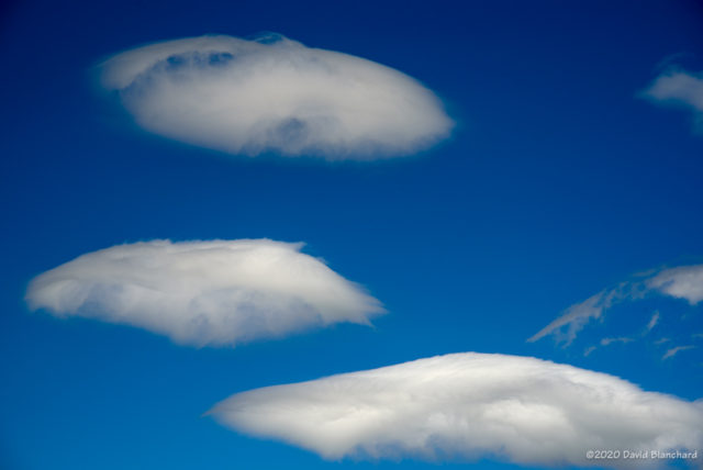
Wave clouds over Flagstaff.

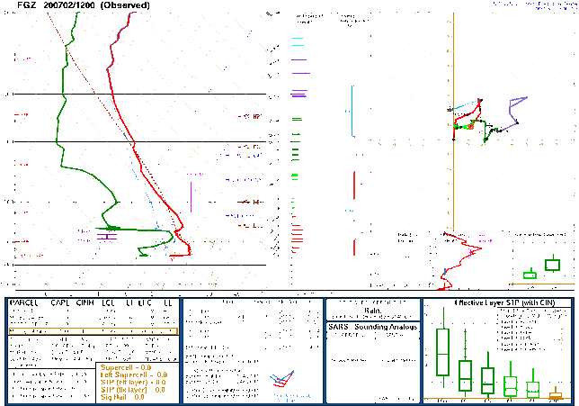
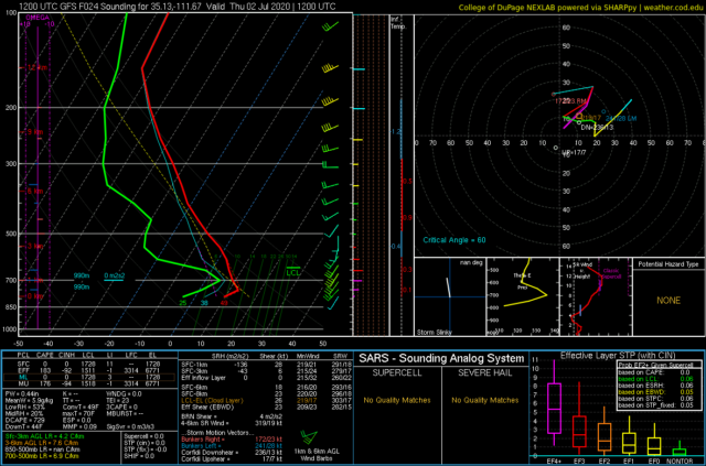
But these clouds weren’t actually a surprise. Yesterdays models were forecasting a thin layer of moisture around 700 mb with much drier conditions both above and below that level.

Observed sounding from KFGZ at 1200 UTC 02 July 2020
24-hour forecast sounding for KFLG for 1200 UTC 02 July 2020

The GFS did a good job of forecasting both the thin layer of moisture and the stronger winds embedded in that layer. But where did those stronger winds and moisture originate?

HYSPLIT backward trajectories.

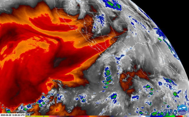
A look back using backward trajectories from the HYSPLIT model reveals some interesting origins. Higher-level air parcels originated over the northeast Pacific while low-level parcels originated over the eastern Pacific. The water vapor satellite images shows both of these source regions to be very dry.

Water vapor satellite image from 1200 UTC 29 June 2020.

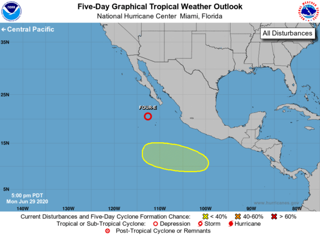
The moist layer had its origins along the Mexico coast. The water vapor image shows substantial moisture associated with Tropical Depression FOUR-E.

Tropical depression FOUR-E.

So the shallow mid-level moist layer had its origins in the remnants of a tropical disturbance. Very interesting!